Property Record
4601 Platt Rd, Ann Arbor, MI 48108
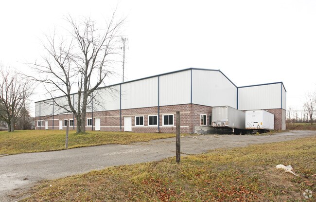


Property Detail
4601 Platt Rd
12-14-300-012
PI 14-6B-2D (004) COM AT SW COR SEC 14, TH N 01-05-40 W 2211.76 FT ALG C/L PLATT RD, TH N 88-20-40 E 398 FT FOR POB, TH N
Distributionwarehouseregional
WASHTENAW
II
Michigan
B and X Area of moderate flood hazard, usually the area between the limits of the 100-year and 500-year floods.
1.60 AC
2025
Washtenaw W of 23
2025
Detroit
415400
Ann Arbor, MI
11,655 SF
NEARBY LISTINGS FOR SALE OR LEASE
DEMOGRAPHICS near 4601 Platt Rd
1 mile
3 mile
5 mile
2025 Total Population
1,523
47,517
175,452
2030 Population
1,482
47,474
182,225
Pop Growth 2025-2030
(2.69%)
(0.09%)
+ 3.86%
Average Age
41
39
37
2025 Total Households
669
21,163
71,136
HH Growth 2025-2030
(2.39%)
(0.13%)
+ 4.03%
Median Household Inc
$53,309
$80,431
$76,083
Avg Household Size
2.30
2.20
2.20
2025 Avg HH Vehicles
2.00
2.00
2.00
Median Home Value
$277,272
$337,070
$389,555
Median Year Built
1975
1978
1981
Nearby Places
Map Layers
Map Styles
 Street
 Aerial
Layers
 Traffic
 Biking
Places
Listings with unknown addresses are not visible on the map
- Restaurants
- Banks
- Shops
- Fitness
- Groceries
PUBLIC TRANSPORTATION
COMMUTER RAIL
Drive
Walk
Distance
14 min
6.0 mi
AIRPORT
Detroit Metro Wayne County
Drive
Walk
Distance
Detroit Metro Wayne County
35 min
25.6 mi
SALE & LEASE HISTORY
LISTING DATE
SALE/LEASE

Sep 19, 2019
For Sale
Nearby Properties
Address
Land Use
TOTAL SIZE
Lot Size
Zoning
Address
Land Use
TOTAL SIZE
Lot Size
Zoning
407,374 SF
35.17 AC
C3
Address
Land Use
TOTAL SIZE
Lot Size
Zoning
Address
Land Use
TOTAL SIZE
Lot Size
Zoning
315,108 SF
6.57 AC
C1B
Address
Land Use
TOTAL SIZE
Lot Size
Zoning
36,000 SF
27.61 AC
BI
Address
Land Use
TOTAL SIZE
Lot Size
Zoning
112,994 SF
45.12 AC
IH
Address
Land Use
TOTAL SIZE
Lot Size
Zoning
140,039 SF
Address
Land Use
TOTAL SIZE
Lot Size
Zoning
37,500 SF
25.94 AC
BI
Address
Land Use
TOTAL SIZE
Lot Size
Zoning
253,702 SF
30.23 AC
Address
Land Use
TOTAL SIZE
Lot Size
Zoning
17,672 SF
33.37 AC
BI
Address
Land Use
TOTAL SIZE
Lot Size
Zoning
32,040 SF
22.33 AC
BI
Address
Land Use
TOTAL SIZE
Lot Size
Zoning
27,603 SF
35.42 AC
BI
Address
Land Use
TOTAL SIZE
Lot Size
Zoning
111,435 SF
21.38 AC
R4B
Address
Land Use
TOTAL SIZE
Lot Size
Zoning
119,631 SF
7.85 AC
PUD
Address
Land Use
TOTAL SIZE
Lot Size
Zoning
13,720 SF
37.87 AC
Address
Land Use
TOTAL SIZE
Lot Size
Zoning
283,290 SF
10.42 AC
O
Address
Land Use
TOTAL SIZE
Lot Size
Zoning
480 SF
23.64 AC
BI
Address
Land Use
TOTAL SIZE
Lot Size
Zoning
137,182 SF
11.83 AC
R4C
Address
Land Use
TOTAL SIZE
Lot Size
Zoning
317,872 SF
11.79 AC
M1
Address
Land Use
TOTAL SIZE
Lot Size
Zoning
94,157 SF
7.20 AC
C3
Address
Land Use
TOTAL SIZE
Lot Size
Zoning
27,306 SF
16.08 AC
BI
Address
Land Use
TOTAL SIZE
Lot Size
Zoning
18,148 SF
21.62 AC
BI
Address
Land Use
TOTAL SIZE
Lot Size
Zoning
13,224 SF
24.30 AC
BI
Address
Land Use
TOTAL SIZE
Lot Size
Zoning
167,294 SF
40.67 AC
Address
Land Use
TOTAL SIZE
Lot Size
Zoning
74,481 SF
3.40 AC
R5
Address
Land Use
TOTAL SIZE
Lot Size
Zoning
178,367 SF
10.70 AC
R5
Address
Land Use
TOTAL SIZE
Lot Size
Zoning
170,742 SF
6.73 AC
R4B
Address
Land Use
TOTAL SIZE
Lot Size
Zoning
159,947 SF
14.19 AC
Address
Land Use
TOTAL SIZE
Lot Size
Zoning
132,937 SF
13.92 AC
R4A
Address
Land Use
TOTAL SIZE
Lot Size
Zoning
216,900 SF
4.22 AC
O
Address
Land Use
TOTAL SIZE
Lot Size
Zoning
105,615 SF
26.31 AC
The World's #1 Commercial Real Estate Marketplace
Connect with us
© 2026 CoStar Group
The information above has been obtained from sources believed reliable. While we do not doubt its accuracy we have not verified it and make no guarantee, warranty or representation about it. It is your responsibility to independently confirm its accuracy and completeness. Any projections, opinions, assumptions, or estimates used are for example only and do not represent the current or future performance of the property. The value of this transaction to you depends on tax and other factors which should be evaluated by your tax, financial, and legal advisors. You and your advisors should conduct a careful, independent investigation of the property to determine to your satisfaction the suitability of the property for your needs.