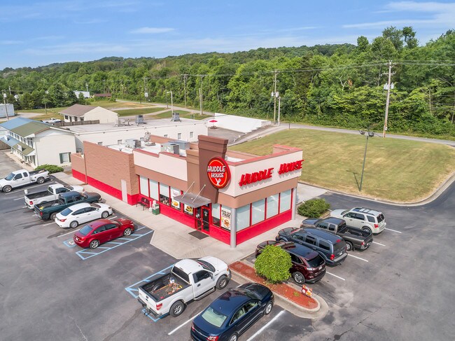
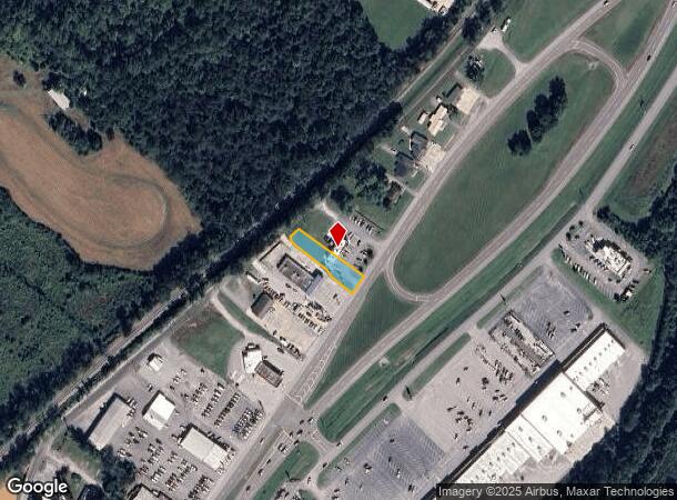
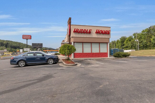
Property Record
4601 Rhea County Hwy, Dayton, TN 37321
NEARBY LISTINGS FOR SALE OR LEASE
Property Detail
4601 Rhea County Hwy
Dayton, TN
Abel Plan No 1
096F-A-010.00
DISTRICT: 4; SUBDIVISION: ABEL PLAN NO 1
Restaurantdrivein
Rhea
X
Tennessee
47007C0400C
4
0
0.27 AC
2025
Tennessee East Area
975401
Other Market Areas
1,875 SF
DEMOGRAPHICS near 4601 Rhea County Hwy
1 Mile
3 Mile
5 Mile
2024 Total Population
2,178
11,119
17,148
2029 Population
2,275
11,655
17,921
Pop Growth 2024-2029
+ 4.45%
+ 4.82%
+ 4.51%
Average Age
38
39
40
2024 Total Households
866
4,373
6,662
HH Growth 2024-2029
+ 4.50%
+ 4.78%
+ 4.44%
Median Household Inc
$48,066
$49,704
$49,133
Avg Household Size
2.50
2.50
2.50
2024 Avg HH Vehicles
2.00
2.00
2.00
Median Home Value
$134,061
$145,780
$147,805
Median Year Built
1979
1986
1987
Nearby Places
- Restaurants
- Banks
- Shops
- Fitness
- Groceries
PUBLIC TRANSPORTATION
AIRPORT
Lovell Field
DRIVE
WALK
Distance
Lovell Field
52 min
39.5 mi
SALE & LEASE HISTORY
LISTING DATE
SALE/LEASE

Jun 21, 2019
For Sale
Nearby Properties
Address
Land Use
TOTAL SIZE
Lot Size
Zoning
Address
Land Use
TOTAL SIZE
Lot Size
Zoning
68,614 SF
0.64 AC
Address
Land Use
TOTAL SIZE
Lot Size
Zoning
163,717 SF
28.16 AC
C2
Address
Land Use
TOTAL SIZE
Lot Size
Zoning
245,209 SF
10.48 AC
Address
Land Use
TOTAL SIZE
Lot Size
Zoning
95,360 SF
16.88 AC
Address
Land Use
TOTAL SIZE
Lot Size
Zoning
130,246 SF
20 AC
Address
Land Use
TOTAL SIZE
Lot Size
Zoning
133,192 SF
11.55 AC
Address
Land Use
TOTAL SIZE
Lot Size
Zoning
27,288 SF
1.80 AC
Address
Land Use
TOTAL SIZE
Lot Size
Zoning
1,718 SF
1.47 AC
Address
Land Use
TOTAL SIZE
Lot Size
Zoning
124,713 SF
15.53 AC
C2
Address
Land Use
TOTAL SIZE
Lot Size
Zoning
31,942 SF
2.55 AC
I2
Address
Land Use
TOTAL SIZE
Lot Size
Zoning
10,115 SF
4.85 AC
Address
Land Use
TOTAL SIZE
Lot Size
Zoning
107.89 AC
Address
Land Use
TOTAL SIZE
Lot Size
Zoning
39,965 SF
2.47 AC
Address
Land Use
TOTAL SIZE
Lot Size
Zoning
88,206 SF
11.69 AC
I2
Address
Land Use
TOTAL SIZE
Lot Size
Zoning
47,875 SF
3.87 AC
Address
Land Use
TOTAL SIZE
Lot Size
Zoning
31,181 SF
1.68 AC
Address
Land Use
TOTAL SIZE
Lot Size
Zoning
219,770 SF
39.92 AC
I2
Address
Land Use
TOTAL SIZE
Lot Size
Zoning
26,927 SF
0.70 AC
Address
Land Use
TOTAL SIZE
Lot Size
Zoning
48,656 SF
1.22 AC
Address
Land Use
TOTAL SIZE
Lot Size
Zoning
12,660 SF
1.51 AC
Address
Land Use
TOTAL SIZE
Lot Size
Zoning
3,264 SF
3.30 AC
Address
Land Use
TOTAL SIZE
Lot Size
Zoning
4.20 AC
R1
Address
Land Use
TOTAL SIZE
Lot Size
Zoning
8,766 SF
1.10 AC
Address
Land Use
TOTAL SIZE
Lot Size
Zoning
23,874 SF
0.74 AC
Address
Land Use
TOTAL SIZE
Lot Size
Zoning
9,768 SF
0.44 AC
Address
Land Use
TOTAL SIZE
Lot Size
Zoning
10,650 SF
4.87 AC
Address
Land Use
TOTAL SIZE
Lot Size
Zoning
18,849 SF
4.18 AC
Address
Land Use
TOTAL SIZE
Lot Size
Zoning
8,844 SF
9 AC
Address
Land Use
TOTAL SIZE
Lot Size
Zoning
88 AC
I1
Address
Land Use
TOTAL SIZE
Lot Size
Zoning
83.34 AC
The World's #1 Commercial Real Estate Marketplace
Connect with us
© 2025 CoStar Group
The information above has been obtained from sources believed reliable. While we do not doubt its accuracy we have not verified it and make no guarantee, warranty or representation about it. It is your responsibility to independently confirm its accuracy and completeness. Any projections, opinions, assumptions, or estimates used are for example only and do not represent the current or future performance of the property. The value of this transaction to you depends on tax and other factors which should be evaluated by your tax, financial, and legal advisors. You and your advisors should conduct a careful, independent investigation of the property to determine to your satisfaction the suitability of the property for your needs.