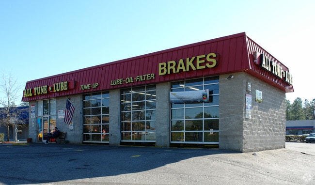
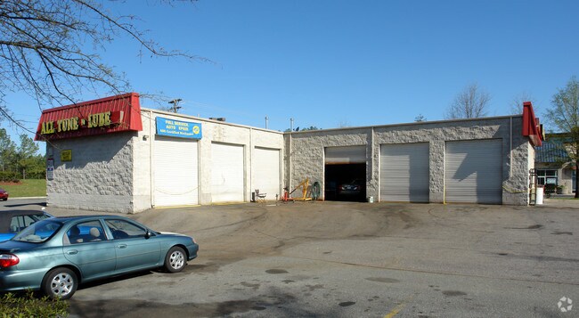
Property Record
4603 Nc Highway 55, Durham, NC 27713

Current Lease Availabilities
Property Detail
4603 Nc Highway 55
154188
AUTO MALL/OUTPARCEL:#01 DBA/MORGAN AUTO & TIRE PL:000122-000190
Autorepair
DURHAM
CC(D)
North Carolina
B and X Area of moderate flood hazard, usually the area between the limits of the 100-year and 500-year floods.
1
2025
0.70 AC
2025
Research Triangle
002036
Raleigh/Durham
3,441 SF
Durham-Chapel Hill, NC
NEARBY LISTINGS FOR SALE OR LEASE
DEMOGRAPHICS near 4603 Nc Highway 55
1 mile
3 mile
5 mile
2025 Total Population
4,466
47,937
140,963
2030 Population
4,679
50,576
150,239
Pop Growth 2025-2030
+ 4.77%
+ 5.51%
+ 6.58%
Average Age
35
38
38
2025 Total Households
2,327
21,561
59,861
HH Growth 2025-2030
+ 4.77%
+ 5.71%
+ 6.79%
Median Household Inc
$72,273
$97,031
$103,547
Avg Household Size
1.90
2.20
2.30
2025 Avg HH Vehicles
1.00
2.00
2.00
Median Home Value
$361,834
$426,340
$456,055
Median Year Built
1998
1998
2003
Nearby Places
Map Layers
Map Styles
 Street
 Aerial
Transit
 Traffic
 Biking
Places
Listings with unknown addresses are not visible on the map
- Restaurants
- Banks
- Shops
- Fitness
- Groceries
PUBLIC TRANSPORTATION
COMMUTER RAIL
Drive
Walk
Distance
14 min
7.8 mi
AIRPORT
Raleigh-Durham International
Drive
Walk
Distance
Raleigh-Durham International
14 min
8.2 mi
Nearby Properties
Address
Land Use
TOTAL SIZE
Lot Size
Zoning
Address
Land Use
TOTAL SIZE
Lot Size
Zoning
2,436,024 SF
SRP
Address
Land Use
TOTAL SIZE
Lot Size
Zoning
778,433 SF
90.38 AC
CC(D)
Address
Land Use
TOTAL SIZE
Lot Size
Zoning
875,384 SF
111.74 AC
SRP
Address
Land Use
TOTAL SIZE
Lot Size
Zoning
1,080,486 SF
61.68 AC
SRP
Address
Land Use
TOTAL SIZE
Lot Size
Zoning
677,504 SF
60.32 AC
SRP
Address
Land Use
TOTAL SIZE
Lot Size
Zoning
1,272,163 SF
117.61 AC
OI,SRP
Address
Land Use
TOTAL SIZE
Lot Size
Zoning
1,378,965 SF
183.46 AC
SRP
Address
Land Use
TOTAL SIZE
Lot Size
Zoning
868,283 SF
56.23 AC
SRP
Address
Land Use
TOTAL SIZE
Lot Size
Zoning
491,701 SF
124.48 AC
SRP
Address
Land Use
TOTAL SIZE
Lot Size
Zoning
507,119 SF
118.85 AC
SRP
Address
Land Use
TOTAL SIZE
Lot Size
Zoning
799,818 SF
84.58 AC
IL
Address
Land Use
TOTAL SIZE
Lot Size
Zoning
168,660 SF
15.49 AC
CG(D)
Address
Land Use
TOTAL SIZE
Lot Size
Zoning
444,254 SF
58.71 AC
SRP
Address
Land Use
TOTAL SIZE
Lot Size
Zoning
624,324 SF
81.65 AC
RA
Address
Land Use
TOTAL SIZE
Lot Size
Zoning
35.03 AC
RS-M(D)
Address
Land Use
TOTAL SIZE
Lot Size
Zoning
47,376 SF
11.86 AC
OI(D)
Address
Land Use
TOTAL SIZE
Lot Size
Zoning
319,275 SF
50.52 AC
SRP
Address
Land Use
TOTAL SIZE
Lot Size
Zoning
353,339 SF
25.95 AC
SRP
Address
Land Use
TOTAL SIZE
Lot Size
Zoning
2.82 AC
SRP-C
Address
Land Use
TOTAL SIZE
Lot Size
Zoning
23,889 SF
50.95 AC
OI
Address
Land Use
TOTAL SIZE
Lot Size
Zoning
7,080 SF
30.67 AC
OI,RS-M
Address
Land Use
TOTAL SIZE
Lot Size
Zoning
6,948 SF
21.22 AC
RS-M(D)
Address
Land Use
TOTAL SIZE
Lot Size
Zoning
529,439 SF
29.84 AC
IL
Address
Land Use
TOTAL SIZE
Lot Size
Zoning
10,143 SF
46.78 AC
PDR 5.940
Address
Land Use
TOTAL SIZE
Lot Size
Zoning
7,241 SF
25.34 AC
PDR 5.370
Address
Land Use
TOTAL SIZE
Lot Size
Zoning
300,042 SF
41.03 AC
SRP
Address
Land Use
TOTAL SIZE
Lot Size
Zoning
295,946 SF
15.35 AC
RMFM
Address
Land Use
TOTAL SIZE
Lot Size
Zoning
8,199 SF
28.28 AC
PDR 12.000
Address
Land Use
TOTAL SIZE
Lot Size
Zoning
555,485 SF
34.84 AC
SRP
Address
Land Use
TOTAL SIZE
Lot Size
Zoning
425,972 SF
41.46 AC
RA
The World's #1 Commercial Real Estate Marketplace
Connect with us
© 2026 CoStar Group
The information above has been obtained from sources believed reliable. While we do not doubt its accuracy we have not verified it and make no guarantee, warranty or representation about it. It is your responsibility to independently confirm its accuracy and completeness. Any projections, opinions, assumptions, or estimates used are for example only and do not represent the current or future performance of the property. The value of this transaction to you depends on tax and other factors which should be evaluated by your tax, financial, and legal advisors. You and your advisors should conduct a careful, independent investigation of the property to determine to your satisfaction the suitability of the property for your needs.