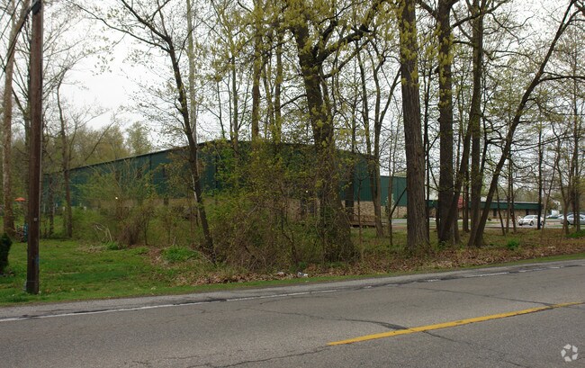
Property Record
4607 W Laskey Rd, Toledo, OH 43623


Property Detail
4607 W Laskey Rd
24-01621
6 9 13 NE 1/4 E 460 FT NW 1/4 EXC S 340.1 FT & W 460 FT E 92
Religious
Lucas
10-RS12
Ohio
B and X Area of moderate flood hazard, usually the area between the limits of the 100-year and 500-year floods.
20.16 AC
0
West/Sylvania
2025
Toledo
008303
Toledo, OH
76,588 SF
NEARBY LISTINGS FOR SALE OR LEASE
-
-
View all Toledo listings for sale on LoopNet.com
DEMOGRAPHICS near 4607 W Laskey Rd
1 mile
3 mile
5 mile
2025 Total Population
8,113
69,381
188,014
2030 Population
7,870
67,824
185,727
Pop Growth 2025-2030
(3.00%)
(2.24%)
(1.22%)
Average Age
43
42
40
2025 Total Households
3,463
30,553
80,076
HH Growth 2025-2030
(3.06%)
(2.25%)
(1.16%)
Median Household Inc
$78,130
$74,366
$67,316
Avg Household Size
2.30
2.20
2.20
2025 Avg HH Vehicles
2.00
2.00
2.00
Median Home Value
$203,268
$178,199
$175,635
Median Year Built
1966
1961
1964
Nearby Places
Map Layers
Map Styles
 Street
 Aerial
Layers
 Traffic
 Biking
Places
Listings with unknown addresses are not visible on the map
- Restaurants
- Banks
- Shops
- Fitness
- Groceries
PUBLIC TRANSPORTATION
COMMUTER RAIL
Toledo (Capitol Limited - Amtrak, Lake Shore Limited - Amtrak)
Drive
Walk
Distance
Toledo (Capitol Limited - Amtrak, Lake Shore Limited - Amtrak)
15 min
8.4 mi
AIRPORT
Eugene F Kranz Toledo Express
Drive
Walk
Distance
Eugene F Kranz Toledo Express
35 min
19.4 mi
Freight Ports
Port of Toledo
Drive
Walk
Distance
Port of Toledo
26 min
13.4 mi
Nearby Properties
Address
Land Use
TOTAL SIZE
Lot Size
Zoning
Address
Land Use
TOTAL SIZE
Lot Size
Zoning
607,717 SF
7.39 AC
31-R3
Address
Land Use
TOTAL SIZE
Lot Size
Zoning
253,662 SF
16.59 AC
10-MX
Address
Land Use
TOTAL SIZE
Lot Size
Zoning
460,266 SF
85.36 AC
31-R1
Address
Land Use
TOTAL SIZE
Lot Size
Zoning
15.79 AC
31-B4
Address
Land Use
TOTAL SIZE
Lot Size
Zoning
312,089 SF
6.34 AC
31-B5
Address
Land Use
TOTAL SIZE
Lot Size
Zoning
7.71 AC
10-CRSO
Address
Land Use
TOTAL SIZE
Lot Size
Zoning
12.52 AC
10-CRSO
Address
Land Use
TOTAL SIZE
Lot Size
Zoning
293,770 SF
13.95 AC
10-RS6
Address
Land Use
TOTAL SIZE
Lot Size
Zoning
260,875 SF
9.91 AC
20-R5
Address
Land Use
TOTAL SIZE
Lot Size
Zoning
166,837 SF
23.82 AC
10-MX
Address
Land Use
TOTAL SIZE
Lot Size
Zoning
208,092 SF
12.49 AC
10-CR
Address
Land Use
TOTAL SIZE
Lot Size
Zoning
87,071 SF
8.10 AC
10-CRSO
Address
Land Use
TOTAL SIZE
Lot Size
Zoning
141,643 SF
14.31 AC
10-RS9
Address
Land Use
TOTAL SIZE
Lot Size
Zoning
222,493 SF
29.88 AC
10-IC
Address
Land Use
TOTAL SIZE
Lot Size
Zoning
49,960 SF
8.33 AC
10-CO
Address
Land Use
TOTAL SIZE
Lot Size
Zoning
49,960 SF
8.33 AC
10-CO
Address
Land Use
TOTAL SIZE
Lot Size
Zoning
51,129 SF
460.05 AC
20-S1
Address
Land Use
TOTAL SIZE
Lot Size
Zoning
154,003 SF
14 AC
10-MX
Address
Land Use
TOTAL SIZE
Lot Size
Zoning
169,580 SF
8.98 AC
20-C2
Address
Land Use
TOTAL SIZE
Lot Size
Zoning
67,713 SF
10.24 AC
20-C2
Address
Land Use
TOTAL SIZE
Lot Size
Zoning
174,890 SF
19.86 AC
31-R3
Address
Land Use
TOTAL SIZE
Lot Size
Zoning
203,129 SF
10 AC
10-RS9
Address
Land Use
TOTAL SIZE
Lot Size
Zoning
157,086 SF
13.24 AC
10-CRSO
Address
Land Use
TOTAL SIZE
Lot Size
Zoning
52,429 SF
3.79 AC
10-CO
Address
Land Use
TOTAL SIZE
Lot Size
Zoning
161,884 SF
3.09 AC
10-RM36
Address
Land Use
TOTAL SIZE
Lot Size
Zoning
135,978 SF
14.01 AC
31-B2
Address
Land Use
TOTAL SIZE
Lot Size
Zoning
123,985 SF
9.74 AC
10-MX
Address
Land Use
TOTAL SIZE
Lot Size
Zoning
84,485 SF
8.41 AC
20-C2
Address
Land Use
TOTAL SIZE
Lot Size
Zoning
214,400 SF
13.07 AC
20-C2
Address
Land Use
TOTAL SIZE
Lot Size
Zoning
109,712 SF
10.64 AC
10-MX
The World's #1 Commercial Real Estate Marketplace
Connect with us
© 2026 CoStar Group
The information above has been obtained from sources believed reliable. While we do not doubt its accuracy we have not verified it and make no guarantee, warranty or representation about it. It is your responsibility to independently confirm its accuracy and completeness. Any projections, opinions, assumptions, or estimates used are for example only and do not represent the current or future performance of the property. The value of this transaction to you depends on tax and other factors which should be evaluated by your tax, financial, and legal advisors. You and your advisors should conduct a careful, independent investigation of the property to determine to your satisfaction the suitability of the property for your needs.