Property Record
4610 E Highway 4, Murphys, CA 95247
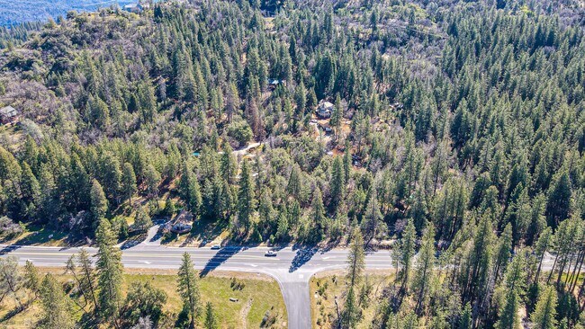

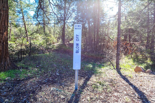
This Property Is For Sale
Property Detail
4610 E Highway 4
034-004-031-000
PCL D OF PCL MAP 1 63 IN 25 T4R14
Ranch
CALAVERAS
RR5
California
B and X Area of moderate flood hazard, usually the area between the limits of the 100-year and 500-year floods.
25
2025
22.34 AC
2025
Merced/Central
000501
Other Market Areas
NEARBY LISTINGS FOR SALE OR LEASE
-
-
View all Murphys listings for sale on LoopNet.com
DEMOGRAPHICS near 4610 E Highway 4
1 mile
3 mile
5 mile
2025 Total Population
779
1,806
5,506
2030 Population
763
1,765
5,450
Pop Growth 2025-2030
(2.05%)
(2.27%)
(1.02%)
Average Age
51
51
51
2025 Total Households
344
795
2,529
HH Growth 2025-2030
(2.33%)
(2.26%)
(0.95%)
Median Household Inc
$73,806
$74,256
$74,002
Avg Household Size
2.30
2.30
2.20
2025 Avg HH Vehicles
2.00
2.00
2.00
Median Home Value
$505,682
$512,175
$527,657
Median Year Built
1988
1988
1985
Nearby Places
Map Layers
Map Styles
 Street
 Aerial
Layers
 Traffic
 Biking
Places
Listings with unknown addresses are not visible on the map
- Restaurants
- Banks
- Shops
- Fitness
- Groceries
Nearby Properties
Address
Land Use
TOTAL SIZE
Lot Size
Zoning
Address
Land Use
TOTAL SIZE
Lot Size
Zoning
1,136 SF
40.45 AC
MTTORO40
Address
Land Use
TOTAL SIZE
Lot Size
Zoning
4,384 SF
17.06 AC
U
Address
Land Use
TOTAL SIZE
Lot Size
Zoning
148.56 AC
U
Address
Land Use
TOTAL SIZE
Lot Size
Zoning
4,017 SF
6.38 AC
U
Address
Land Use
TOTAL SIZE
Lot Size
Zoning
3,386 SF
39.52 AC
U
Address
Land Use
TOTAL SIZE
Lot Size
Zoning
2,650 SF
40.14 AC
U
Address
Land Use
TOTAL SIZE
Lot Size
Zoning
2,673 SF
120.15 AC
A120
Address
Land Use
TOTAL SIZE
Lot Size
Zoning
3,934 SF
40.41 AC
U
Address
Land Use
TOTAL SIZE
Lot Size
Zoning
82.19 AC
REC
Address
Land Use
TOTAL SIZE
Lot Size
Zoning
60.02 AC
A1
Address
Land Use
TOTAL SIZE
Lot Size
Zoning
4,546 SF
41.28 AC
U
Address
Land Use
TOTAL SIZE
Lot Size
Zoning
4,684 SF
40 AC
RR5
Address
Land Use
TOTAL SIZE
Lot Size
Zoning
4,825 SF
8.01 AC
RR3
Address
Land Use
TOTAL SIZE
Lot Size
Zoning
8,410 SF
1.19 AC
C2PD
Address
Land Use
TOTAL SIZE
Lot Size
Zoning
2,478 SF
68.66 AC
Address
Land Use
TOTAL SIZE
Lot Size
Zoning
4,140 SF
11.43 AC
RAX
Address
Land Use
TOTAL SIZE
Lot Size
Zoning
2,605 SF
40.40 AC
U
Address
Land Use
TOTAL SIZE
Lot Size
Zoning
2,636 SF
5.05 AC
RR
Address
Land Use
TOTAL SIZE
Lot Size
Zoning
5,050 SF
40.50 AC
TP
Address
Land Use
TOTAL SIZE
Lot Size
Zoning
2,576 SF
1.38 AC
C1PD
Address
Land Use
TOTAL SIZE
Lot Size
Zoning
23.74 AC
U
Address
Land Use
TOTAL SIZE
Lot Size
Zoning
2,353 SF
19.35 AC
U
Address
Land Use
TOTAL SIZE
Lot Size
Zoning
2,904 SF
9.66 AC
RRXRR5
Address
Land Use
TOTAL SIZE
Lot Size
Zoning
1,550 SF
13.07 AC
RRX
Address
Land Use
TOTAL SIZE
Lot Size
Zoning
4,650 SF
5.14 AC
RR3
Address
Land Use
TOTAL SIZE
Lot Size
Zoning
6,300 SF
1.33 AC
RC
Address
Land Use
TOTAL SIZE
Lot Size
Zoning
2,542 SF
10.23 AC
RR
Address
Land Use
TOTAL SIZE
Lot Size
Zoning
2,769 SF
4.85 AC
RR3
Address
Land Use
TOTAL SIZE
Lot Size
Zoning
22,358 SF
6.67 AC
M4PD
Address
Land Use
TOTAL SIZE
Lot Size
Zoning
2,377 SF
5.10 AC
RR5
The World's #1 Commercial Real Estate Marketplace
Connect with us
© 2026 CoStar Group
The information above has been obtained from sources believed reliable. While we do not doubt its accuracy we have not verified it and make no guarantee, warranty or representation about it. It is your responsibility to independently confirm its accuracy and completeness. Any projections, opinions, assumptions, or estimates used are for example only and do not represent the current or future performance of the property. The value of this transaction to you depends on tax and other factors which should be evaluated by your tax, financial, and legal advisors. You and your advisors should conduct a careful, independent investigation of the property to determine to your satisfaction the suitability of the property for your needs.