Property Record
4610 Long Prairie Rd, Flower Mound, TX 75028
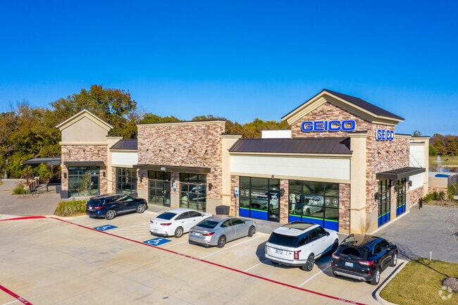

Property Detail
4610 Long Prairie Rd
Dallas-Fort Worth-Arlington, TX
WINDSOR RIDGE BLK A LOT 5
R748967
DENTON
Commercialnec
Texas
B and X Area of moderate flood hazard, usually the area between the limits of the 100-year and 500-year floods.
5
2024
4.36 AC
2025
Lewisville
021759
Dallas/Ft Worth
27,839 SF
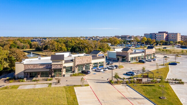
NEARBY LISTINGS FOR SALE OR LEASE
DEMOGRAPHICS near 4610 Long Prairie Rd
1 mile
3 mile
5 mile
2024 Total Population
13,787
104,952
194,614
2029 Population
16,614
125,473
233,202
Pop Growth 2024-2029
+ 20.50%
+ 19.55%
+ 19.83%
Average Age
40
40
39
2024 Total Households
5,308
36,282
67,812
HH Growth 2024-2029
+ 21.01%
+ 20.08%
+ 20.34%
Median Household Inc
$115,900
$126,934
$111,512
Avg Household Size
2.60
2.80
2.80
2024 Avg HH Vehicles
2.00
2.00
2.00
Median Home Value
$365,642
$386,163
$382,830
Median Year Built
1994
1994
1994
Nearby Places
Map Layers
Map Styles
 Street
 Aerial
Transit
 Traffic
 Biking
Places
Listings with unknown addresses are not visible on the map
- Restaurants
- Banks
- Shops
- Fitness
- Groceries
PUBLIC TRANSPORTATION
COMMUTER RAIL
Highland Village/Lewisville Lake Station (A-train - Denton County Transportation Authority)
Drive
Walk
Distance
Highland Village/Lewisville Lake Station (A-train - Denton County Transportation Authority)
12 min
5.9 mi
Old Town Station (A-train - Denton County Transportation Authority)
Drive
Walk
Distance
Old Town Station (A-train - Denton County Transportation Authority)
13 min
6.4 mi
AIRPORT
Dallas-Fort Worth International
Drive
Walk
Distance
Dallas-Fort Worth International
19 min
12.2 mi
Dallas Love Field
Drive
Walk
Distance
Dallas Love Field
38 min
25.6 mi
Freight Ports
Port of Shreveport
Drive
Walk
Distance
Port of Shreveport
244 min
223.9 mi
SALE & LEASE HISTORY
LISTING DATE
SALE/LEASE

Oct 25, 2019
For Lease
Feb 05, 2021
For Lease
Nearby Properties
Address
Land Use
TOTAL SIZE
Lot Size
Zoning
Address
Land Use
TOTAL SIZE
Lot Size
Zoning
478,148 SF
57.44 AC
Address
Land Use
TOTAL SIZE
Lot Size
Zoning
428,117 SF
67.02 AC
Address
Land Use
TOTAL SIZE
Lot Size
Zoning
334,685 SF
38.12 AC
Address
Land Use
TOTAL SIZE
Lot Size
Zoning
397,866 SF
43.19 AC
Address
Land Use
TOTAL SIZE
Lot Size
Zoning
309,498 SF
9.57 AC
Address
Land Use
TOTAL SIZE
Lot Size
Zoning
282,766 SF
9 AC
Address
Land Use
TOTAL SIZE
Lot Size
Zoning
231,043 SF
11.89 AC
Address
Land Use
TOTAL SIZE
Lot Size
Zoning
340,081 SF
18.06 AC
6
Address
Land Use
TOTAL SIZE
Lot Size
Zoning
295,098 SF
10.65 AC
Address
Land Use
TOTAL SIZE
Lot Size
Zoning
226,888 SF
5.62 AC
Address
Land Use
TOTAL SIZE
Lot Size
Zoning
302,183 SF
15.50 AC
7G
Address
Land Use
TOTAL SIZE
Lot Size
Zoning
262,035 SF
10.88 AC
Address
Land Use
TOTAL SIZE
Lot Size
Zoning
212,454 SF
13 AC
6B
Address
Land Use
TOTAL SIZE
Lot Size
Zoning
244,310 SF
6.24 AC
Address
Land Use
TOTAL SIZE
Lot Size
Zoning
199,049 SF
28.96 AC
Address
Land Use
TOTAL SIZE
Lot Size
Zoning
99,272 SF
16.60 AC
Address
Land Use
TOTAL SIZE
Lot Size
Zoning
241,095 SF
13.02 AC
Address
Land Use
TOTAL SIZE
Lot Size
Zoning
221,320 SF
12.79 AC
6B
Address
Land Use
TOTAL SIZE
Lot Size
Zoning
240,886 SF
6.65 AC
Address
Land Use
TOTAL SIZE
Lot Size
Zoning
208,268 SF
11.23 AC
6G
Address
Land Use
TOTAL SIZE
Lot Size
Zoning
154,756 SF
15.12 AC
7G
Address
Land Use
TOTAL SIZE
Lot Size
Zoning
148,458 SF
14.69 AC
Address
Land Use
TOTAL SIZE
Lot Size
Zoning
135,394 SF
14.48 AC
Address
Land Use
TOTAL SIZE
Lot Size
Zoning
179,120 SF
7.66 AC
6G
Address
Land Use
TOTAL SIZE
Lot Size
Zoning
168,897 SF
11.62 AC
7G
Address
Land Use
TOTAL SIZE
Lot Size
Zoning
145,758 SF
17.25 AC
Address
Land Use
TOTAL SIZE
Lot Size
Zoning
258,852 SF
12.66 AC
6A
Address
Land Use
TOTAL SIZE
Lot Size
Zoning
80,396 SF
8.72 AC
Address
Land Use
TOTAL SIZE
Lot Size
Zoning
169,188 SF
10.17 AC
Address
Land Use
TOTAL SIZE
Lot Size
Zoning
130,986 SF
7.32 AC
6A
The World's #1 Commercial Real Estate Marketplace
Connect with us
© 2026 CoStar Group
The information above has been obtained from sources believed reliable. While we do not doubt its accuracy we have not verified it and make no guarantee, warranty or representation about it. It is your responsibility to independently confirm its accuracy and completeness. Any projections, opinions, assumptions, or estimates used are for example only and do not represent the current or future performance of the property. The value of this transaction to you depends on tax and other factors which should be evaluated by your tax, financial, and legal advisors. You and your advisors should conduct a careful, independent investigation of the property to determine to your satisfaction the suitability of the property for your needs.