Property Record
4611 E 31St St S, Wichita, KS 67210
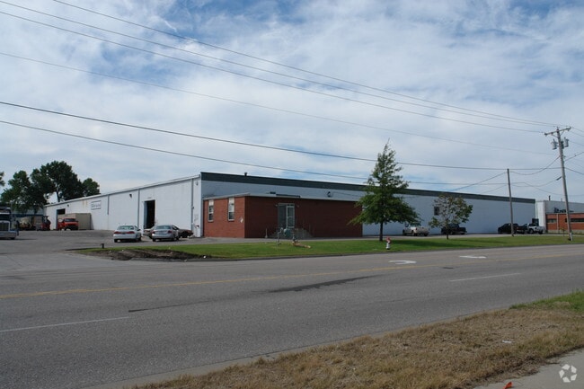

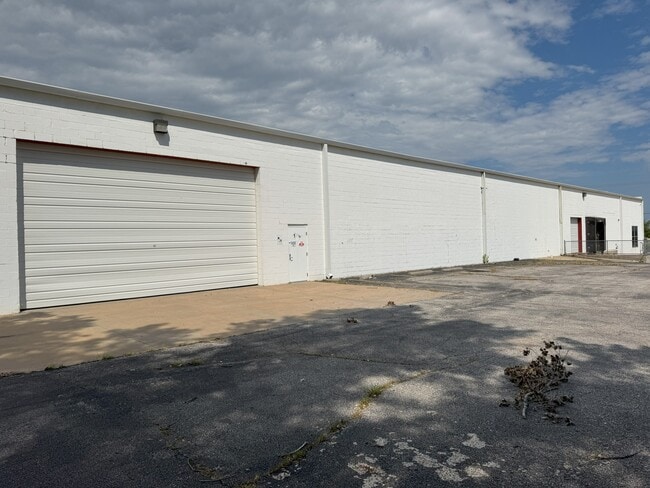
This Property Is For Sale
NEARBY LISTINGS FOR SALE OR LEASE
Property Detail
4611 E 31St St S
Wichita, KS
Caro Second Add
211-11-0-11-01-003.00
LOT 1 CARO SECOND ADD.
Warehouse
Sedgwick
X
Kansas
20173C0368G
1
2024
2.79 AC
2025
McConnell AFB/Southeast
006600
Wichita
46,827 SF
DEMOGRAPHICS near 4611 E 31St St S
1 Mile
3 Mile
5 Mile
2024 Total Population
5,194
67,171
178,828
2029 Population
5,412
69,258
183,434
Pop Growth 2024-2029
+ 4.20%
+ 3.11%
+ 2.58%
Average Age
33
36
37
2024 Total Households
1,931
26,615
72,675
HH Growth 2024-2029
+ 3.99%
+ 3.08%
+ 2.54%
Median Household Inc
$29,982
$41,921
$49,374
Avg Household Size
2.60
2.40
2.30
2024 Avg HH Vehicles
1.00
2.00
2.00
Median Home Value
$79,364
$84,870
$119,738
Median Year Built
1958
1961
1964
Nearby Places
Map Layers
Map Styles
 Street
 Aerial
- Restaurants
- Banks
- Shops
- Fitness
- Groceries
PUBLIC TRANSPORTATION
AIRPORT
Wichita Dwight D Eisenhower Ntl
DRIVE
WALK
Distance
Wichita Dwight D Eisenhower Ntl
20 min
11.8 mi
Nearby Properties
Address
Land Use
TOTAL SIZE
Lot Size
Zoning
Address
Land Use
TOTAL SIZE
Lot Size
Zoning
430,593 SF
11.89 AC
GO,LC
Address
Land Use
TOTAL SIZE
Lot Size
Zoning
237,087 SF
48.33 AC
B
Address
Land Use
TOTAL SIZE
Lot Size
Zoning
418.47 AC
AFB
Address
Land Use
TOTAL SIZE
Lot Size
Zoning
527,510 SF
50.27 AC
TF-3
Address
Land Use
TOTAL SIZE
Lot Size
Zoning
167,304 SF
6.19 AC
MF-29
Address
Land Use
TOTAL SIZE
Lot Size
Zoning
152,978 SF
7.86 AC
LI
Address
Land Use
TOTAL SIZE
Lot Size
Zoning
3,063,858 SF
57.81 AC
LI
Address
Land Use
TOTAL SIZE
Lot Size
Zoning
233,436 SF
20.38 AC
LI
Address
Land Use
TOTAL SIZE
Lot Size
Zoning
62,580 SF
7.83 AC
SF20
Address
Land Use
TOTAL SIZE
Lot Size
Zoning
67,145 SF
11.49 AC
LI
Address
Land Use
TOTAL SIZE
Lot Size
Zoning
106,159 SF
16.16 AC
SF-5
Address
Land Use
TOTAL SIZE
Lot Size
Zoning
71,568 SF
4.83 AC
TF-3
Address
Land Use
TOTAL SIZE
Lot Size
Zoning
98,077 SF
10.92 AC
SF-5
Address
Land Use
TOTAL SIZE
Lot Size
Zoning
119,245 SF
10.77 AC
MF29
Address
Land Use
TOTAL SIZE
Lot Size
Zoning
64,218 SF
5.76 AC
TF-3
Address
Land Use
TOTAL SIZE
Lot Size
Zoning
71,651 SF
5.82 AC
SF-5
Address
Land Use
TOTAL SIZE
Lot Size
Zoning
62,775 SF
4.73 AC
SF-5
Address
Land Use
TOTAL SIZE
Lot Size
Zoning
75,932 SF
5.46 AC
SF-5
Address
Land Use
TOTAL SIZE
Lot Size
Zoning
35,528 SF
7.15 AC
LC
Address
Land Use
TOTAL SIZE
Lot Size
Zoning
67,479 SF
0.74 AC
B
Address
Land Use
TOTAL SIZE
Lot Size
Zoning
71,165 SF
20.05 AC
SF-5
Address
Land Use
TOTAL SIZE
Lot Size
Zoning
63,353 SF
11.41 AC
SF-20
Address
Land Use
TOTAL SIZE
Lot Size
Zoning
59,964 SF
16.85 AC
LI,LC
Address
Land Use
TOTAL SIZE
Lot Size
Zoning
59,393 SF
3.34 AC
TF-3
Address
Land Use
TOTAL SIZE
Lot Size
Zoning
53,626 SF
8.03 AC
SF-5
Address
Land Use
TOTAL SIZE
Lot Size
Zoning
80,461 SF
8.93 AC
TF-3
Address
Land Use
TOTAL SIZE
Lot Size
Zoning
21,970 SF
5 AC
TF-3
Address
Land Use
TOTAL SIZE
Lot Size
Zoning
1,014,655 SF
24.68 AC
LI
The World's #1 Commercial Real Estate Marketplace
Connect with us
© 2026 CoStar Group
The information above has been obtained from sources believed reliable. While we do not doubt its accuracy we have not verified it and make no guarantee, warranty or representation about it. It is your responsibility to independently confirm its accuracy and completeness. Any projections, opinions, assumptions, or estimates used are for example only and do not represent the current or future performance of the property. The value of this transaction to you depends on tax and other factors which should be evaluated by your tax, financial, and legal advisors. You and your advisors should conduct a careful, independent investigation of the property to determine to your satisfaction the suitability of the property for your needs.