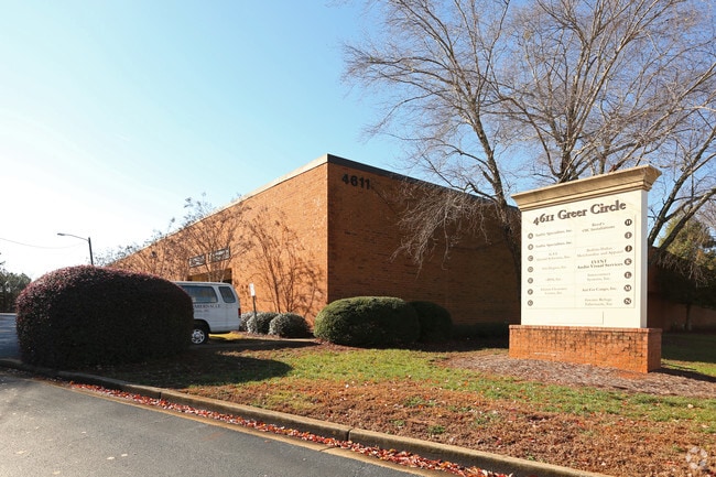
Property Record
4611 Greer Cir, Stone Mountain, GA 30083


Current Lease Availabilities
NEARBY LISTINGS FOR SALE OR LEASE
Property Detail
4611 Greer Cir
18-170-02-019
DeKalb
Warehouse
Georgia
X
19
13089C0079L
4.32 AC
2025
Stone Mountain
2025
Atlanta
021910
Atlanta-Sandy Springs-Roswell, GA
87,336 SF
DEMOGRAPHICS near 4611 Greer Cir
1 Mile
3 Mile
5 Mile
2024 Total Population
6,919
84,186
240,191
2029 Population
6,872
84,220
241,682
Pop Growth 2024-2029
(0.68%)
+ 0.04%
+ 0.62%
Average Age
36
37
38
2024 Total Households
2,652
31,485
88,008
HH Growth 2024-2029
(0.68%)
+ 0.04%
+ 0.53%
Median Household Inc
$41,152
$55,904
$62,411
Avg Household Size
2.50
2.60
2.60
2024 Avg HH Vehicles
1.00
2.00
2.00
Median Home Value
$207,302
$271,630
$289,170
Median Year Built
1976
1978
1979
Nearby Places
Map Layers
Map Styles
 Street
 Aerial
- Restaurants
- Banks
- Shops
- Fitness
- Groceries
PUBLIC TRANSPORTATION
AIRPORT
Hartsfield - Jackson Atlanta International
DRIVE
WALK
Distance
Hartsfield - Jackson Atlanta International
36 min
24.8 mi
Nearby Properties
Address
Land Use
TOTAL SIZE
Lot Size
Zoning
Address
Land Use
TOTAL SIZE
Lot Size
Zoning
656,837 SF
88.74 AC
RM100
Address
Land Use
TOTAL SIZE
Lot Size
Zoning
208,608 SF
20.89 AC
OI: OFFICE
Address
Land Use
TOTAL SIZE
Lot Size
Zoning
273,492 SF
23.08 AC
RM
Address
Land Use
TOTAL SIZE
Lot Size
Zoning
819,703 SF
55.80 AC
M
Address
Land Use
TOTAL SIZE
Lot Size
Zoning
228,504 SF
15.57 AC
M
Address
Land Use
TOTAL SIZE
Lot Size
Zoning
321,956 SF
26.87 AC
RM13
Address
Land Use
TOTAL SIZE
Lot Size
Zoning
70,929 SF
6.64 AC
C1: LOCAL
Address
Land Use
TOTAL SIZE
Lot Size
Zoning
587,493 SF
29.79 AC
X
Address
Land Use
TOTAL SIZE
Lot Size
Zoning
222,799 SF
11.59 AC
X
Address
Land Use
TOTAL SIZE
Lot Size
Zoning
284,236 SF
22.25 AC
RM100
Address
Land Use
TOTAL SIZE
Lot Size
Zoning
385,221 SF
27.41 AC
RM85
Address
Land Use
TOTAL SIZE
Lot Size
Zoning
89,362 SF
13.99 AC
M
Address
Land Use
TOTAL SIZE
Lot Size
Zoning
337,746 SF
29.94 AC
RM100
Address
Land Use
TOTAL SIZE
Lot Size
Zoning
170,933 SF
15.39 AC
X
Address
Land Use
TOTAL SIZE
Lot Size
Zoning
339,262 SF
26.16 AC
RM100
Address
Land Use
TOTAL SIZE
Lot Size
Zoning
224,812 SF
19.29 AC
RM75
Address
Land Use
TOTAL SIZE
Lot Size
Zoning
269,639 SF
24.65 AC
RM100
Address
Land Use
TOTAL SIZE
Lot Size
Zoning
480,302 SF
34.46 AC
RM85
Address
Land Use
TOTAL SIZE
Lot Size
Zoning
358,818 SF
22.41 AC
RM100
Address
Land Use
TOTAL SIZE
Lot Size
Zoning
446,287 SF
31 AC
RM100
Address
Land Use
TOTAL SIZE
Lot Size
Zoning
299,798 SF
17.20 AC
X
Address
Land Use
TOTAL SIZE
Lot Size
Zoning
249,184 SF
20 AC
RM100
Address
Land Use
TOTAL SIZE
Lot Size
Zoning
240,276 SF
19.53 AC
RM85
Address
Land Use
TOTAL SIZE
Lot Size
Zoning
302,988 SF
41.36 AC
X
Address
Land Use
TOTAL SIZE
Lot Size
Zoning
292,996 SF
15.84 AC
RM100
Address
Land Use
TOTAL SIZE
Lot Size
Zoning
373,062 SF
20.59 AC
RM100
Address
Land Use
TOTAL SIZE
Lot Size
Zoning
324,116 SF
19.90 AC
A
Address
Land Use
TOTAL SIZE
Lot Size
Zoning
312,258 SF
24.80 AC
X
Address
Land Use
TOTAL SIZE
Lot Size
Zoning
384,545 SF
35.93 AC
RM100
Address
Land Use
TOTAL SIZE
Lot Size
Zoning
273,192 SF
24.07 AC
RM100
The World's #1 Commercial Real Estate Marketplace
Connect with us
© 2026 CoStar Group
The information above has been obtained from sources believed reliable. While we do not doubt its accuracy we have not verified it and make no guarantee, warranty or representation about it. It is your responsibility to independently confirm its accuracy and completeness. Any projections, opinions, assumptions, or estimates used are for example only and do not represent the current or future performance of the property. The value of this transaction to you depends on tax and other factors which should be evaluated by your tax, financial, and legal advisors. You and your advisors should conduct a careful, independent investigation of the property to determine to your satisfaction the suitability of the property for your needs.