Property Record
4611 W Kearney Blvd, Fresno, CA 93706

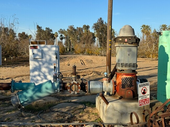
This Property Is For Sale
NEARBY LISTINGS FOR SALE OR LEASE
Property Detail
4611 W Kearney Blvd
Fresno, CA
Fruitvale Estate
326-030-24
N 100 FT OF LOT 47 FRUITVALE ESTATE
Farms
Fresno
X
California
06019C2085H
47
2025
0.59 AC
2025
W Outlying Fresno County
008600
Fresno
1,190 SF
DEMOGRAPHICS near 4611 W Kearney Blvd
1 Mile
3 Mile
5 Mile
2024 Total Population
248
13,355
111,393
2029 Population
249
13,554
113,280
Pop Growth 2024-2029
+ 0.40%
+ 1.49%
+ 1.69%
Average Age
37
36
34
2024 Total Households
70
3,810
33,197
HH Growth 2024-2029
+ 1.43%
+ 1.42%
+ 1.70%
Median Household Inc
$78,571
$58,295
$47,789
Avg Household Size
3.40
3.40
3.20
2024 Avg HH Vehicles
3.00
2.00
2.00
Median Home Value
$366,666
$336,315
$260,565
Median Year Built
1968
1986
1972
Nearby Places
Map Layers
Map Styles
 Street
 Aerial
- Restaurants
- Banks
- Shops
- Fitness
- Groceries
PUBLIC TRANSPORTATION
COMMUTER RAIL
Fresno (San Joaquins - Amtrak)
DRIVE
WALK
Distance
Fresno (San Joaquins - Amtrak)
13 min
7.8 mi
AIRPORT
Fresno Yosemite International
DRIVE
WALK
Distance
Fresno Yosemite International
18 min
11.1 mi
Freight Ports
Port of Stockton
DRIVE
WALK
Distance
Port of Stockton
157 min
128.7 mi
Nearby Properties
Address
Land Use
TOTAL SIZE
Lot Size
Zoning
Address
Land Use
TOTAL SIZE
Lot Size
Zoning
106,740 SF
63.59 AC
AE20
Address
Land Use
TOTAL SIZE
Lot Size
Zoning
60,438 SF
11.46 AC
M1
Address
Land Use
TOTAL SIZE
Lot Size
Zoning
47,175 SF
11.63 AC
M3
Address
Land Use
TOTAL SIZE
Lot Size
Zoning
26.15 AC
M3
Address
Land Use
TOTAL SIZE
Lot Size
Zoning
22.24 AC
M3
Address
Land Use
TOTAL SIZE
Lot Size
Zoning
49,471 SF
6.78 AC
M1
Address
Land Use
TOTAL SIZE
Lot Size
Zoning
7,020 SF
2.92 AC
M1
Address
Land Use
TOTAL SIZE
Lot Size
Zoning
2,048 SF
259 AC
AE20
Address
Land Use
TOTAL SIZE
Lot Size
Zoning
29,860 SF
20.12 AC
M3
Address
Land Use
TOTAL SIZE
Lot Size
Zoning
30,482 SF
2.56 AC
R1C
Address
Land Use
TOTAL SIZE
Lot Size
Zoning
2,146 SF
74.67 AC
AE20
Address
Land Use
TOTAL SIZE
Lot Size
Zoning
15.03 AC
M2
Address
Land Use
TOTAL SIZE
Lot Size
Zoning
21,688 SF
1.59 AC
R2A
Address
Land Use
TOTAL SIZE
Lot Size
Zoning
17,020 SF
5.05 AC
M1
Address
Land Use
TOTAL SIZE
Lot Size
Zoning
74.77 AC
AE40
Address
Land Use
TOTAL SIZE
Lot Size
Zoning
5,721 SF
39.52 AC
AE20
Address
Land Use
TOTAL SIZE
Lot Size
Zoning
274.95 AC
AE20
Address
Land Use
TOTAL SIZE
Lot Size
Zoning
16,720 SF
12.46 AC
M1
Address
Land Use
TOTAL SIZE
Lot Size
Zoning
20,594 SF
4.70 AC
M2
Address
Land Use
TOTAL SIZE
Lot Size
Zoning
7,320 SF
7.43 AC
CH
Address
Land Use
TOTAL SIZE
Lot Size
Zoning
67.47 AC
R1
Address
Land Use
TOTAL SIZE
Lot Size
Zoning
15,222 SF
26.92 AC
M2
Address
Land Use
TOTAL SIZE
Lot Size
Zoning
11,296 SF
19.79 AC
M3
Address
Land Use
TOTAL SIZE
Lot Size
Zoning
45,000 SF
9.53 AC
M3
Address
Land Use
TOTAL SIZE
Lot Size
Zoning
1,200 SF
46.99 AC
AE20
Address
Land Use
TOTAL SIZE
Lot Size
Zoning
200 AC
AE20
Address
Land Use
TOTAL SIZE
Lot Size
Zoning
26.89 AC
M3
Address
Land Use
TOTAL SIZE
Lot Size
Zoning
45,148 SF
2.35 AC
M1
Address
Land Use
TOTAL SIZE
Lot Size
Zoning
26,060 SF
4 AC
SPLIT
The World's #1 Commercial Real Estate Marketplace
Connect with us
© 2026 CoStar Group
The information above has been obtained from sources believed reliable. While we do not doubt its accuracy we have not verified it and make no guarantee, warranty or representation about it. It is your responsibility to independently confirm its accuracy and completeness. Any projections, opinions, assumptions, or estimates used are for example only and do not represent the current or future performance of the property. The value of this transaction to you depends on tax and other factors which should be evaluated by your tax, financial, and legal advisors. You and your advisors should conduct a careful, independent investigation of the property to determine to your satisfaction the suitability of the property for your needs.