Property Record
4613 S Staples St, Corpus Christi, TX 78411
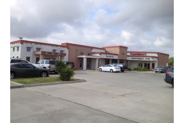


Property Detail
4613 S Staples St
382577
PROVIDENCE PROFESSIONAL PLAZA CONDOS, UNIT B, 32% COMMON AREA INTEREST
Commercialnec
Nueces
B and X Area of moderate flood hazard, usually the area between the limits of the 100-year and 500-year floods.
Texas
2024
1.44 AC
2025
Mid-City
002400
Corpus Christi
6,163 SF
Corpus Christi, TX
NEARBY LISTINGS FOR SALE OR LEASE
DEMOGRAPHICS near 4613 S Staples St
1 mile
3 mile
5 mile
2025 Total Population
11,432
108,548
203,280
2030 Population
11,209
106,681
200,491
Pop Growth 2025-2030
(1.95%)
(1.72%)
(1.37%)
Average Age
40
39
38
2025 Total Households
4,431
43,353
76,309
HH Growth 2025-2030
(2.21%)
(1.79%)
(1.52%)
Median Household Inc
$56,892
$63,358
$67,434
Avg Household Size
2.50
2.40
2.50
2025 Avg HH Vehicles
2.00
2.00
2.00
Median Home Value
$159,945
$199,260
$210,484
Median Year Built
1962
1974
1978
Nearby Places
Map Layers
Map Styles
 Street
 Aerial
Layers
 Traffic
 Biking
Places
Listings with unknown addresses are not visible on the map
- Restaurants
- Banks
- Shops
- Fitness
- Groceries
PUBLIC TRANSPORTATION
AIRPORT
Corpus Christi International
Drive
Walk
Distance
Corpus Christi International
19 min
12.0 mi
Freight Ports
Port of Corpus Christi
Drive
Walk
Distance
Port of Corpus Christi
12 min
7.1 mi
Nearby Properties
Address
Land Use
TOTAL SIZE
Lot Size
Zoning
Address
Land Use
TOTAL SIZE
Lot Size
Zoning
567,638 SF
18.37 AC
B4
Address
Land Use
TOTAL SIZE
Lot Size
Zoning
747,956 SF
39.67 AC
B-4
Address
Land Use
TOTAL SIZE
Lot Size
Zoning
414,230 SF
42.05 AC
R1A
Address
Land Use
TOTAL SIZE
Lot Size
Zoning
97,505 SF
29.76 AC
B-4
Address
Land Use
TOTAL SIZE
Lot Size
Zoning
273,740 SF
16.74 AC
A1
Address
Land Use
TOTAL SIZE
Lot Size
Zoning
176,076 SF
19.84 AC
R1B
Address
Land Use
TOTAL SIZE
Lot Size
Zoning
251,402 SF
7.17 AC
Address
Land Use
TOTAL SIZE
Lot Size
Zoning
117,000 SF
19.20 AC
R1B
Address
Land Use
TOTAL SIZE
Lot Size
Zoning
245,114 SF
16.86 AC
Address
Land Use
TOTAL SIZE
Lot Size
Zoning
212,125 SF
16.55 AC
Address
Land Use
TOTAL SIZE
Lot Size
Zoning
104,851 SF
18.71 AC
R1B
Address
Land Use
TOTAL SIZE
Lot Size
Zoning
30.95 AC
VI
Address
Land Use
TOTAL SIZE
Lot Size
Zoning
78,000 SF
6.92 AC
R1B
Address
Land Use
TOTAL SIZE
Lot Size
Zoning
96,495 SF
6.63 AC
AB
Address
Land Use
TOTAL SIZE
Lot Size
Zoning
1 SF
40.02 AC
R1B
Address
Land Use
TOTAL SIZE
Lot Size
Zoning
80,354 SF
7.11 AC
R1B
Address
Land Use
TOTAL SIZE
Lot Size
Zoning
65,301 SF
7.37 AC
B-4
Address
Land Use
TOTAL SIZE
Lot Size
Zoning
108,420 SF
20 AC
R1B
Address
Land Use
TOTAL SIZE
Lot Size
Zoning
13,773 SF
28.82 AC
R1B
Address
Land Use
TOTAL SIZE
Lot Size
Zoning
200,686 SF
17.77 AC
B4
Address
Land Use
TOTAL SIZE
Lot Size
Zoning
213,050 SF
34.44 AC
R1B
Address
Land Use
TOTAL SIZE
Lot Size
Zoning
114,121 SF
2.64 AC
B-4
Address
Land Use
TOTAL SIZE
Lot Size
Zoning
186,106 SF
6.54 AC
B1
Address
Land Use
TOTAL SIZE
Lot Size
Zoning
124,511 SF
10.74 AC
B-3
Address
Land Use
TOTAL SIZE
Lot Size
Zoning
192,450 SF
6.45 AC
Address
Land Use
TOTAL SIZE
Lot Size
Zoning
109,344 SF
17.34 AC
R1B
Address
Land Use
TOTAL SIZE
Lot Size
Zoning
71,556 SF
4.11 AC
R1B
Address
Land Use
TOTAL SIZE
Lot Size
Zoning
60,934 SF
12.20 AC
R1B
Address
Land Use
TOTAL SIZE
Lot Size
Zoning
66,412 SF
4.10 AC
I-2
Address
Land Use
TOTAL SIZE
Lot Size
Zoning
174,134 SF
19.26 AC
B4
The World's #1 Commercial Real Estate Marketplace
Connect with us
© 2026 CoStar Group
The information above has been obtained from sources believed reliable. While we do not doubt its accuracy we have not verified it and make no guarantee, warranty or representation about it. It is your responsibility to independently confirm its accuracy and completeness. Any projections, opinions, assumptions, or estimates used are for example only and do not represent the current or future performance of the property. The value of this transaction to you depends on tax and other factors which should be evaluated by your tax, financial, and legal advisors. You and your advisors should conduct a careful, independent investigation of the property to determine to your satisfaction the suitability of the property for your needs.