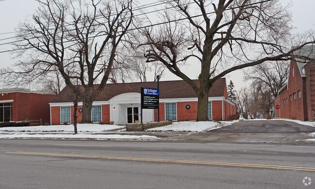
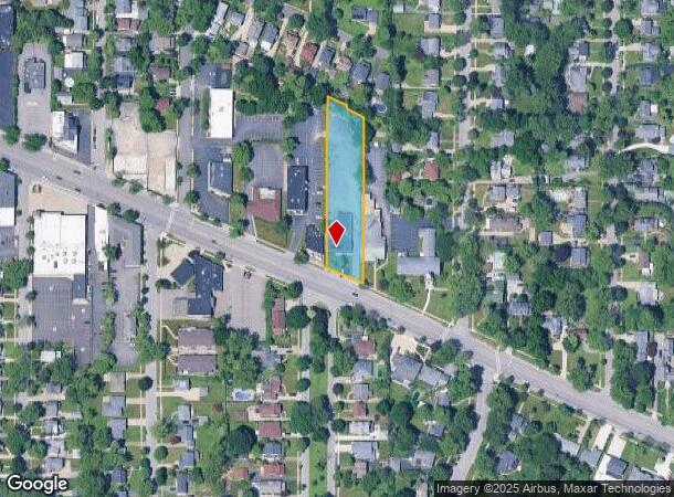
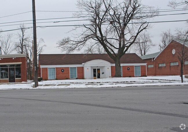
Property Record
4614 Main St, Buffalo, NY 14226
NEARBY LISTINGS FOR SALE OR LEASE
Property Detail
4614 Main St
142289 80.06-1-18.12
Holland Land Company Survey
Funeralhome
Erie
X
New York
36029C0209H
18.120
2024
1 AC
2024
North
009402
Buffalo/Niagara Falls
4,836 SF
Buffalo-Cheektowaga-Niagara Falls, NY
DEMOGRAPHICS near 4614 Main St
1 Mile
3 Mile
5 Mile
2024 Total Population
13,011
130,512
325,525
2029 Population
12,964
129,515
321,675
Pop Growth 2024-2029
(0.36%)
(0.76%)
(1.18%)
Average Age
41
39
40
2024 Total Households
5,358
51,981
136,479
HH Growth 2024-2029
(0.41%)
(0.83%)
(1.23%)
Median Household Inc
$104,432
$63,301
$62,381
Avg Household Size
2.30
2.30
2.20
2024 Avg HH Vehicles
2.00
2.00
1.00
Median Home Value
$256,120
$183,033
$186,244
Median Year Built
1953
1953
1954
Nearby Places
- Restaurants
- Banks
- Shops
- Fitness
- Groceries
PUBLIC TRANSPORTATION
COMMUTER RAIL
DRIVE
WALK
Distance
12 min
6.0 mi
DRIVE
WALK
Distance
12 min
6.1 mi
AIRPORT
Buffalo Niagara International
DRIVE
WALK
Distance
Buffalo Niagara International
8 min
3.7 mi
Niagara Falls International
DRIVE
WALK
Distance
Niagara Falls International
27 min
14.7 mi
SALE & LEASE HISTORY
LISTING DATE
SALE/LEASE

Sep 25, 2017
For Lease
Nearby Properties
Address
Land Use
TOTAL SIZE
Lot Size
Zoning
Address
Land Use
TOTAL SIZE
Lot Size
Zoning
2,592,064 SF
1,057.90 AC
Address
Land Use
TOTAL SIZE
Lot Size
Zoning
462,256 SF
568.62 AC
05C
Address
Land Use
TOTAL SIZE
Lot Size
Zoning
135,396 SF
146.32 AC
D-E
Address
Land Use
TOTAL SIZE
Lot Size
Zoning
109,328 SF
12.77 AC
GB
Address
Land Use
TOTAL SIZE
Lot Size
Zoning
646,259 SF
16.31 AC
D-M
Address
Land Use
TOTAL SIZE
Lot Size
Zoning
132,940 SF
41.50 AC
CF
Address
Land Use
TOTAL SIZE
Lot Size
Zoning
Address
Land Use
TOTAL SIZE
Lot Size
Zoning
177,000 SF
14.91 AC
CF
Address
Land Use
TOTAL SIZE
Lot Size
Zoning
8,565 SF
22.65 AC
Address
Land Use
TOTAL SIZE
Lot Size
Zoning
172,400 SF
116.50 AC
Address
Land Use
TOTAL SIZE
Lot Size
Zoning
216,724 SF
66.09 AC
05C
Address
Land Use
TOTAL SIZE
Lot Size
Zoning
100,737 SF
21.10 AC
CTR-5
Address
Land Use
TOTAL SIZE
Lot Size
Zoning
540,154 SF
7.06 AC
D-E
Address
Land Use
TOTAL SIZE
Lot Size
Zoning
181,897 SF
15.30 AC
CTR-2.5
Address
Land Use
TOTAL SIZE
Lot Size
Zoning
Address
Land Use
TOTAL SIZE
Lot Size
Zoning
71,053 SF
2.52 AC
OB
Address
Land Use
TOTAL SIZE
Lot Size
Zoning
172,001 SF
23.49 AC
Address
Land Use
TOTAL SIZE
Lot Size
Zoning
17,778 SF
14 AC
GB
Address
Land Use
TOTAL SIZE
Lot Size
Zoning
197,430 SF
8.20 AC
Address
Land Use
TOTAL SIZE
Lot Size
Zoning
197,430 SF
7.35 AC
Address
Land Use
TOTAL SIZE
Lot Size
Zoning
Address
Land Use
TOTAL SIZE
Lot Size
Zoning
3,456 SF
6.90 AC
MFR-5
Address
Land Use
TOTAL SIZE
Lot Size
Zoning
3,630 SF
10.50 AC
Address
Land Use
TOTAL SIZE
Lot Size
Zoning
Address
Land Use
TOTAL SIZE
Lot Size
Zoning
124,407 SF
10.38 AC
SC
Address
Land Use
TOTAL SIZE
Lot Size
Zoning
191,420 SF
59.30 AC
Address
Land Use
TOTAL SIZE
Lot Size
Zoning
132,000 SF
9.40 AC
Address
Land Use
TOTAL SIZE
Lot Size
Zoning
11,520 SF
8.70 AC
Address
Land Use
TOTAL SIZE
Lot Size
Zoning
3,712 SF
36.08 AC
03RA
Address
Land Use
TOTAL SIZE
Lot Size
Zoning
211,647 SF
1.76 AC
GB
The World's #1 Commercial Real Estate Marketplace
Connect with us
© 2025 CoStar Group
The information above has been obtained from sources believed reliable. While we do not doubt its accuracy we have not verified it and make no guarantee, warranty or representation about it. It is your responsibility to independently confirm its accuracy and completeness. Any projections, opinions, assumptions, or estimates used are for example only and do not represent the current or future performance of the property. The value of this transaction to you depends on tax and other factors which should be evaluated by your tax, financial, and legal advisors. You and your advisors should conduct a careful, independent investigation of the property to determine to your satisfaction the suitability of the property for your needs.