Property Record
4615 Rendon Rd, Fort Worth, TX 76140

Property Detail
4615 Rendon Rd
Dallas-Fort Worth-Arlington, TX
CATLETT, H G SURVEY ABSTRACT 369 TRACT 1A A370 TR 2F A762 TRS 1H2 1K & A930 TRS 14G 16D1
03837777
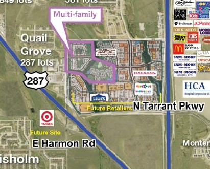
TARRANT
Timberlandforesttreesagricultural
Texas
AE The base floodplain where base flood elevations are provided. AE Zones are now used on new format FIRMs instead of A1-A30 Zones.
172 AC
2025
Southeast Ft Worth
2025
Dallas/Ft Worth
111317
NEARBY LISTINGS FOR SALE OR LEASE
DEMOGRAPHICS near 4615 Rendon Rd
1 mile
3 mile
5 mile
2025 Total Population
897
29,706
100,910
2030 Population
956
31,593
107,213
Pop Growth 2025-2030
+ 6.58%
+ 6.35%
+ 6.25%
Average Age
41
37
37
2025 Total Households
317
9,604
33,436
HH Growth 2025-2030
+ 6.62%
+ 6.54%
+ 6.42%
Median Household Inc
$90,892
$79,650
$80,947
Avg Household Size
2.70
3.00
3.00
2025 Avg HH Vehicles
2.00
2.00
2.00
Median Home Value
$328,333
$289,132
$306,480
Median Year Built
1987
1993
1995
Nearby Places
Map Layers
Map Styles
 Street
 Aerial
Layers
 Traffic
 Biking
Places
Listings with unknown addresses are not visible on the map
- Restaurants
- Banks
- Shops
- Fitness
- Groceries
PUBLIC TRANSPORTATION
AIRPORT
Dallas-Fort Worth International
Drive
Walk
Distance
Dallas-Fort Worth International
51 min
34.4 mi
Dallas Love Field
Drive
Walk
Distance
Dallas Love Field
61 min
44.2 mi
Freight Ports
Port of Shreveport
Drive
Walk
Distance
Port of Shreveport
252 min
229.9 mi
Nearby Properties
Address
Land Use
TOTAL SIZE
Lot Size
Zoning
Address
Land Use
TOTAL SIZE
Lot Size
Zoning
987,261 SF
63.16 AC
Address
Land Use
TOTAL SIZE
Lot Size
Zoning
181,611 SF
24.44 AC
Address
Land Use
TOTAL SIZE
Lot Size
Zoning
266,888 SF
20.85 AC
Address
Land Use
TOTAL SIZE
Lot Size
Zoning
279,543 SF
11.54 AC
Address
Land Use
TOTAL SIZE
Lot Size
Zoning
234,855 SF
33.10 AC
Address
Land Use
TOTAL SIZE
Lot Size
Zoning
141,411 SF
32.16 AC
Address
Land Use
TOTAL SIZE
Lot Size
Zoning
Address
Land Use
TOTAL SIZE
Lot Size
Zoning
4,888 SF
31.18 AC
Address
Land Use
TOTAL SIZE
Lot Size
Zoning
101,412 SF
7.36 AC
Address
Land Use
TOTAL SIZE
Lot Size
Zoning
96,000 SF
28.83 AC
Address
Land Use
TOTAL SIZE
Lot Size
Zoning
3,078 SF
28.32 AC
Address
Land Use
TOTAL SIZE
Lot Size
Zoning
86,408 SF
7.43 AC
Address
Land Use
TOTAL SIZE
Lot Size
Zoning
104,728 SF
5.83 AC
Address
Land Use
TOTAL SIZE
Lot Size
Zoning
46,200 SF
11.42 AC
Address
Land Use
TOTAL SIZE
Lot Size
Zoning
84,318 SF
28.83 AC
Address
Land Use
TOTAL SIZE
Lot Size
Zoning
98,914 SF
5.96 AC
Address
Land Use
TOTAL SIZE
Lot Size
Zoning
208,911 SF
15.02 AC
Address
Land Use
TOTAL SIZE
Lot Size
Zoning
3,852 SF
5.75 AC
Address
Land Use
TOTAL SIZE
Lot Size
Zoning
37,500 SF
1 AC
Address
Land Use
TOTAL SIZE
Lot Size
Zoning
45,862 SF
6 AC
Address
Land Use
TOTAL SIZE
Lot Size
Zoning
41,104 SF
2.87 AC
Address
Land Use
TOTAL SIZE
Lot Size
Zoning
66,000 SF
10.35 AC
Address
Land Use
TOTAL SIZE
Lot Size
Zoning
58,437 SF
17 AC
Address
Land Use
TOTAL SIZE
Lot Size
Zoning
36,348 SF
7.52 AC
Address
Land Use
TOTAL SIZE
Lot Size
Zoning
49,880 SF
13.27 AC
Address
Land Use
TOTAL SIZE
Lot Size
Zoning
35,790 SF
2.30 AC
Address
Land Use
TOTAL SIZE
Lot Size
Zoning
37,796 SF
6.16 AC
Address
Land Use
TOTAL SIZE
Lot Size
Zoning
30,302 SF
2.50 AC
Address
Land Use
TOTAL SIZE
Lot Size
Zoning
45,920 SF
2.25 AC
Address
Land Use
TOTAL SIZE
Lot Size
Zoning
47,334 SF
5 AC
The World's #1 Commercial Real Estate Marketplace
Connect with us
© 2026 CoStar Group
The information above has been obtained from sources believed reliable. While we do not doubt its accuracy we have not verified it and make no guarantee, warranty or representation about it. It is your responsibility to independently confirm its accuracy and completeness. Any projections, opinions, assumptions, or estimates used are for example only and do not represent the current or future performance of the property. The value of this transaction to you depends on tax and other factors which should be evaluated by your tax, financial, and legal advisors. You and your advisors should conduct a careful, independent investigation of the property to determine to your satisfaction the suitability of the property for your needs.