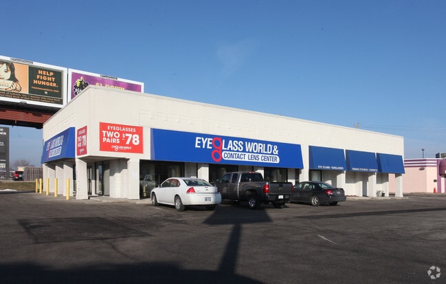
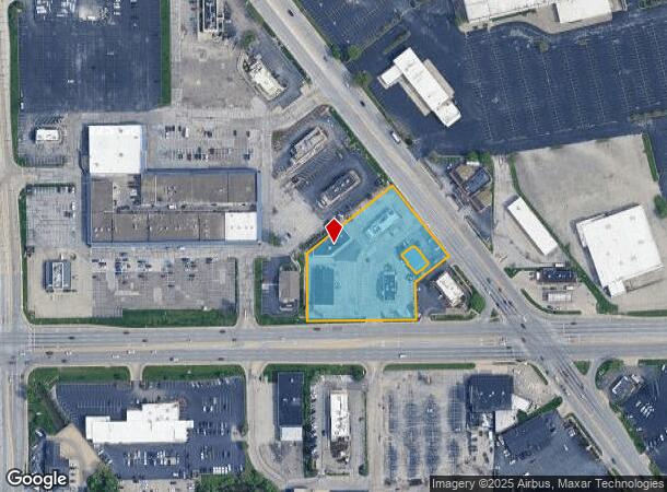
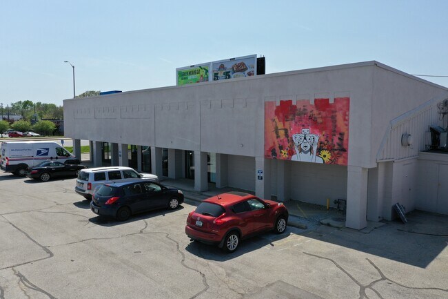
Property Record
3810 Lafayette Rd, Indianapolis, IN 46254
NEARBY LISTINGS FOR SALE OR LEASE
Property Detail
3810 Lafayette Rd
Indianapolis-Carmel-Anderson, IN
PT SE1/4 SE1/4 S18 T16 R3 BEG 219.6 W & 69.83 N OF SE COR P.O.B. N101.36 NE116.996 NW249.07 SW299.983 S185.61 E300 TO BEG 2875 SQ MID PT FOR PARCEL 6030574
49-06-18-105-002.000-674
Marion
Storebuilding
Indiana
2023
2.11 AC
2024
Speedway
310306
Indianapolis
8,617 SF
DEMOGRAPHICS near 3810 Lafayette Rd
1 Mile
3 Mile
5 Mile
2024 Total Population
11,403
100,271
250,223
2029 Population
11,227
98,412
248,513
Pop Growth 2024-2029
(1.54%)
(1.85%)
(0.68%)
Average Age
33
35
36
2024 Total Households
3,971
39,981
100,155
HH Growth 2024-2029
(1.64%)
(1.97%)
(0.65%)
Median Household Inc
$49,898
$52,940
$54,502
Avg Household Size
2.80
2.40
2.40
2024 Avg HH Vehicles
2.00
2.00
2.00
Median Home Value
$89,467
$156,709
$171,878
Median Year Built
1965
1975
1971
Nearby Places
Map Layers
Map Styles
 Street
 Aerial
- Restaurants
- Banks
- Shops
- Fitness
- Groceries
PUBLIC TRANSPORTATION
COMMUTER RAIL
Indianapolis (Cardinal - Amtrak)
DRIVE
WALK
Distance
Indianapolis (Cardinal - Amtrak)
13 min
7.0 mi
AIRPORT
Indianapolis International
DRIVE
WALK
Distance
Indianapolis International
29 min
15.6 mi
Freight Ports
Port of Toledo
DRIVE
WALK
Distance
Port of Toledo
271 min
225.9 mi
SALE & LEASE HISTORY
LISTING DATE
SALE/LEASE

Jun 20, 2022
For Sale
Nearby Properties
Address
Land Use
TOTAL SIZE
Lot Size
Zoning
Address
Land Use
TOTAL SIZE
Lot Size
Zoning
80,249 SF
71.96 AC
ZO01
Address
Land Use
TOTAL SIZE
Lot Size
Zoning
4,515 SF
23.95 AC
ZO01
Address
Land Use
TOTAL SIZE
Lot Size
Zoning
5,820 SF
32.03 AC
ZO01
Address
Land Use
TOTAL SIZE
Lot Size
Zoning
967,690 SF
59.63 AC
ZO01
Address
Land Use
TOTAL SIZE
Lot Size
Zoning
415,877 SF
55.83 AC
ZO01
Address
Land Use
TOTAL SIZE
Lot Size
Zoning
296,086 SF
6.19 AC
ZO01
Address
Land Use
TOTAL SIZE
Lot Size
Zoning
3,827 SF
24.15 AC
ZO01
Address
Land Use
TOTAL SIZE
Lot Size
Zoning
1,904 SF
47.31 AC
ZO01
Address
Land Use
TOTAL SIZE
Lot Size
Zoning
3,214 SF
14.29 AC
ZO01
Address
Land Use
TOTAL SIZE
Lot Size
Zoning
3,381 SF
30.61 AC
ZO01
Address
Land Use
TOTAL SIZE
Lot Size
Zoning
108,872 SF
30 AC
Address
Land Use
TOTAL SIZE
Lot Size
Zoning
3,546 SF
25.09 AC
ZO01
Address
Land Use
TOTAL SIZE
Lot Size
Zoning
18,154 SF
9.40 AC
ZO01
Address
Land Use
TOTAL SIZE
Lot Size
Zoning
3,878 SF
17.76 AC
Address
Land Use
TOTAL SIZE
Lot Size
Zoning
494 SF
36.18 AC
ZO01
Address
Land Use
TOTAL SIZE
Lot Size
Zoning
2,288 SF
6 AC
ZO01
Address
Land Use
TOTAL SIZE
Lot Size
Zoning
438,643 SF
43.63 AC
ZO01
Address
Land Use
TOTAL SIZE
Lot Size
Zoning
5,554 SF
23.52 AC
ZO01
Address
Land Use
TOTAL SIZE
Lot Size
Zoning
3,618 SF
31.13 AC
ZO01
Address
Land Use
TOTAL SIZE
Lot Size
Zoning
30,545 SF
3.41 AC
ZO01
Address
Land Use
TOTAL SIZE
Lot Size
Zoning
3,706 SF
30.57 AC
ZO01
Address
Land Use
TOTAL SIZE
Lot Size
Zoning
7,082 SF
19.18 AC
ZO01
Address
Land Use
TOTAL SIZE
Lot Size
Zoning
2,703 SF
17.50 AC
ZO01
Address
Land Use
TOTAL SIZE
Lot Size
Zoning
4,734 SF
30.98 AC
ZO01
Address
Land Use
TOTAL SIZE
Lot Size
Zoning
73,528 SF
80 AC
ZO01
Address
Land Use
TOTAL SIZE
Lot Size
Zoning
1,700 SF
40.37 AC
ZO01
Address
Land Use
TOTAL SIZE
Lot Size
Zoning
2,288 SF
21.42 AC
Address
Land Use
TOTAL SIZE
Lot Size
Zoning
3,802 SF
12.25 AC
Address
Land Use
TOTAL SIZE
Lot Size
Zoning
380,355 SF
26.75 AC
ZO01
Address
Land Use
TOTAL SIZE
Lot Size
Zoning
106,651 SF
11.35 AC
ZO01
The World's #1 Commercial Real Estate Marketplace
Connect with us
© 2025 CoStar Group
The information above has been obtained from sources believed reliable. While we do not doubt its accuracy we have not verified it and make no guarantee, warranty or representation about it. It is your responsibility to independently confirm its accuracy and completeness. Any projections, opinions, assumptions, or estimates used are for example only and do not represent the current or future performance of the property. The value of this transaction to you depends on tax and other factors which should be evaluated by your tax, financial, and legal advisors. You and your advisors should conduct a careful, independent investigation of the property to determine to your satisfaction the suitability of the property for your needs.