Property Record
4618 Saco Rd, Bakersfield, CA 93308


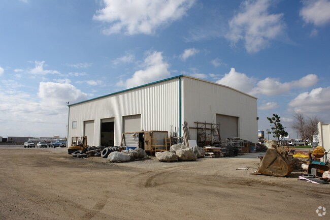
Property Detail
4618 Saco Rd
482-070-16-00-2
PARCEL MAP 7307 , LOT 1
Commercialnec
Kern
M-2
California
B and X Area of moderate flood hazard, usually the area between the limits of the 100-year and 500-year floods.
1
2024
5.17 AC
2025
North Bakersfield
003900
Bakersfield
6,000 SF
Bakersfield-Delano, CA
NEARBY LISTINGS FOR SALE OR LEASE
DEMOGRAPHICS near 4618 Saco Rd
1 mile
3 mile
5 mile
2025 Total Population
187
27,354
103,853
2030 Population
203
27,579
104,957
Pop Growth 2025-2030
+ 8.56%
+ 0.82%
+ 1.06%
Average Age
36
38
37
2025 Total Households
56
8,954
35,210
HH Growth 2025-2030
+ 8.93%
+ 0.77%
+ 1.04%
Median Household Inc
$139,285
$113,324
$86,716
Avg Household Size
3.20
3.00
2.90
2025 Avg HH Vehicles
3.00
2.00
2.00
Median Home Value
$583,333
$445,091
$401,666
Median Year Built
2011
2000
1993
Nearby Places
Map Layers
Map Styles
 Street
 Aerial
Layers
 Traffic
 Biking
Places
Listings with unknown addresses are not visible on the map
- Restaurants
- Banks
- Shops
- Fitness
- Groceries
PUBLIC TRANSPORTATION
COMMUTER RAIL
Drive
Walk
Distance
14 min
8.1 mi
AIRPORT
Meadows Field
Drive
Walk
Distance
Meadows Field
12 min
3.4 mi
Nearby Properties
Address
Land Use
TOTAL SIZE
Lot Size
Zoning
Address
Land Use
TOTAL SIZE
Lot Size
Zoning
2,645,250 SF
64.24 AC
M-2 PD H
Address
Land Use
TOTAL SIZE
Lot Size
Zoning
30,326 SF
19 AC
M3
Address
Land Use
TOTAL SIZE
Lot Size
Zoning
10,064 SF
13.44 AC
R3
Address
Land Use
TOTAL SIZE
Lot Size
Zoning
134,728 SF
7.56 AC
R3
Address
Land Use
TOTAL SIZE
Lot Size
Zoning
Address
Land Use
TOTAL SIZE
Lot Size
Zoning
2,129 SF
11.42 AC
M-2
Address
Land Use
TOTAL SIZE
Lot Size
Zoning
3,497 SF
31.27 AC
E
Address
Land Use
TOTAL SIZE
Lot Size
Zoning
3,383 SF
19.40 AC
M-2
Address
Land Use
TOTAL SIZE
Lot Size
Zoning
72,726 SF
13.15 AC
M2
Address
Land Use
TOTAL SIZE
Lot Size
Zoning
50,949 SF
78.05 AC
M-2
Address
Land Use
TOTAL SIZE
Lot Size
Zoning
54,960 SF
15.83 AC
M-2
Address
Land Use
TOTAL SIZE
Lot Size
Zoning
168,559 SF
5.34 AC
M-2
Address
Land Use
TOTAL SIZE
Lot Size
Zoning
12,000 SF
11.90 AC
M-2 PD
Address
Land Use
TOTAL SIZE
Lot Size
Zoning
357,609 SF
21.80 AC
M2
Address
Land Use
TOTAL SIZE
Lot Size
Zoning
57,560 SF
5.53 AC
C1
Address
Land Use
TOTAL SIZE
Lot Size
Zoning
7,196 SF
2.24 AC
Address
Land Use
TOTAL SIZE
Lot Size
Zoning
62,536 SF
2.11 AC
M2
Address
Land Use
TOTAL SIZE
Lot Size
Zoning
55,042 SF
0.49 AC
M1
Address
Land Use
TOTAL SIZE
Lot Size
Zoning
22,572 SF
44.92 AC
M-2 PD
Address
Land Use
TOTAL SIZE
Lot Size
Zoning
132,096 SF
8.93 AC
C-2
Address
Land Use
TOTAL SIZE
Lot Size
Zoning
144,439 SF
10.04 AC
M-2
Address
Land Use
TOTAL SIZE
Lot Size
Zoning
41,177 SF
4.59 AC
C-2 PCD
Address
Land Use
TOTAL SIZE
Lot Size
Zoning
3,870 SF
17.53 AC
C-2
Address
Land Use
TOTAL SIZE
Lot Size
Zoning
7,500 SF
3.28 AC
M-2 PD
Address
Land Use
TOTAL SIZE
Lot Size
Zoning
222,490 SF
13.44 AC
R3
Address
Land Use
TOTAL SIZE
Lot Size
Zoning
43,088 SF
2.07 AC
M2
Address
Land Use
TOTAL SIZE
Lot Size
Zoning
49,911 SF
2.20 AC
M-2
Address
Land Use
TOTAL SIZE
Lot Size
Zoning
36,642 SF
1.72 AC
M-2
The World's #1 Commercial Real Estate Marketplace
Connect with us
© 2026 CoStar Group
The information above has been obtained from sources believed reliable. While we do not doubt its accuracy we have not verified it and make no guarantee, warranty or representation about it. It is your responsibility to independently confirm its accuracy and completeness. Any projections, opinions, assumptions, or estimates used are for example only and do not represent the current or future performance of the property. The value of this transaction to you depends on tax and other factors which should be evaluated by your tax, financial, and legal advisors. You and your advisors should conduct a careful, independent investigation of the property to determine to your satisfaction the suitability of the property for your needs.