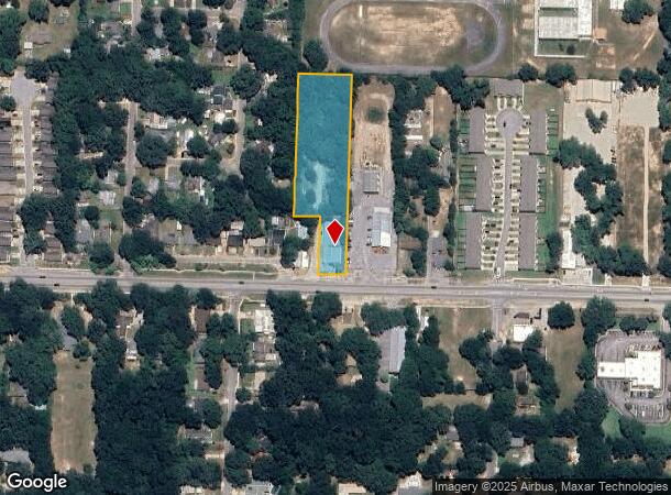
Property Record
4618 Saufley Field Rd, Pensacola, FL 32526


NEARBY LISTINGS FOR SALE OR LEASE
Property Detail
4618 Saufley Field Rd
39-1S-31-4309-000-000
Subdivision Number: 4309
Warehouse
W 165 FT OF S 660 FT OF SW1/4 OF SE 1/4 OR 8221 P 97 LESS S 225 FT OF W 82 FT OF SW1/4 OF SE1/4 LESS S 50 FT FOR STATE RD R/W (SAUFLEY FIELD RD)
X
Escambia
12033C0360G
Florida
2023
1.98 AC
2024
Myrtle Grove/Bellview
003308
Pensacola
7,906 SF
Pensacola-Ferry Pass-Brent, FL
DEMOGRAPHICS near 4618 Saufley Field Rd
1 Mile
3 Mile
5 Mile
2024 Total Population
6,339
49,750
116,937
2029 Population
6,373
50,328
119,585
Pop Growth 2024-2029
+ 0.54%
+ 1.16%
+ 2.26%
Average Age
39
39
38
2024 Total Households
2,486
19,303
43,656
HH Growth 2024-2029
+ 0.56%
+ 1.09%
+ 2.29%
Median Household Inc
$53,426
$50,079
$45,417
Avg Household Size
2.50
2.50
2.40
2024 Avg HH Vehicles
2.00
2.00
2.00
Median Home Value
$137,131
$148,438
$141,374
Median Year Built
1977
1978
1979
Nearby Places
Map Layers
Map Styles
 Street
 Aerial
- Restaurants
- Banks
- Shops
- Fitness
- Groceries
PUBLIC TRANSPORTATION
AIRPORT
Pensacola International
DRIVE
WALK
Distance
Pensacola International
18 min
8.1 mi
Freight Ports
Port of Mobile
DRIVE
WALK
Distance
Port of Mobile
62 min
52.4 mi
Nearby Properties
Address
Land Use
TOTAL SIZE
Lot Size
Zoning
Address
Land Use
TOTAL SIZE
Lot Size
Zoning
305,650 SF
21.90 AC
HDMU
Address
Land Use
TOTAL SIZE
Lot Size
Zoning
1,350,030 SF
80 AC
REC
Address
Land Use
TOTAL SIZE
Lot Size
Zoning
250,232 SF
19.24 AC
HDR
Address
Land Use
TOTAL SIZE
Lot Size
Zoning
178,038 SF
11.03 AC
COM
Address
Land Use
TOTAL SIZE
Lot Size
Zoning
141,728 SF
8.59 AC
COM
Address
Land Use
TOTAL SIZE
Lot Size
Zoning
158,233 SF
9.15 AC
HDMU
Address
Land Use
TOTAL SIZE
Lot Size
Zoning
83,923 SF
6.70 AC
HC/LI
Address
Land Use
TOTAL SIZE
Lot Size
Zoning
129,518 SF
6.44 AC
HDMU
Address
Land Use
TOTAL SIZE
Lot Size
Zoning
131,408 SF
21.67 AC
HC/LI
Address
Land Use
TOTAL SIZE
Lot Size
Zoning
197,958 SF
26.08 AC
COM
Address
Land Use
TOTAL SIZE
Lot Size
Zoning
129,532 SF
10.84 AC
COM
Address
Land Use
TOTAL SIZE
Lot Size
Zoning
103,671 SF
13.96 AC
HDMU
Address
Land Use
TOTAL SIZE
Lot Size
Zoning
138,048 SF
22.64 AC
HC/LI
Address
Land Use
TOTAL SIZE
Lot Size
Zoning
124,146 SF
5.79 AC
HDMU
Address
Land Use
TOTAL SIZE
Lot Size
Zoning
223,987 SF
36.60 AC
MDR
Address
Land Use
TOTAL SIZE
Lot Size
Zoning
64,870 SF
5.35 AC
HDMU
Address
Land Use
TOTAL SIZE
Lot Size
Zoning
3,926 SF
57.46 AC
HDMU
Address
Land Use
TOTAL SIZE
Lot Size
Zoning
84,005 SF
7.93 AC
COM
Address
Land Use
TOTAL SIZE
Lot Size
Zoning
65,355 SF
6.27 AC
COM
Address
Land Use
TOTAL SIZE
Lot Size
Zoning
105,225 SF
2.72 AC
HC/LI
Address
Land Use
TOTAL SIZE
Lot Size
Zoning
57,364 SF
7 AC
HC/LI
Address
Land Use
TOTAL SIZE
Lot Size
Zoning
46,512 SF
3.99 AC
HDMU
Address
Land Use
TOTAL SIZE
Lot Size
Zoning
54,312 SF
6.32 AC
HDMU
Address
Land Use
TOTAL SIZE
Lot Size
Zoning
48,922 SF
3.25 AC
COM
Address
Land Use
TOTAL SIZE
Lot Size
Zoning
78,951 SF
3.50 AC
COM
Address
Land Use
TOTAL SIZE
Lot Size
Zoning
51,259 SF
6.46 AC
COM
Address
Land Use
TOTAL SIZE
Lot Size
Zoning
49,868 SF
5.53 AC
HC/LI
Address
Land Use
TOTAL SIZE
Lot Size
Zoning
45,840 SF
5.68 AC
HDMU
Address
Land Use
TOTAL SIZE
Lot Size
Zoning
121,151 SF
121.70 AC
HC/LI
Address
Land Use
TOTAL SIZE
Lot Size
Zoning
41,302 SF
11.20 AC
MDR
The World's #1 Commercial Real Estate Marketplace
Connect with us
© 2025 CoStar Group
The information above has been obtained from sources believed reliable. While we do not doubt its accuracy we have not verified it and make no guarantee, warranty or representation about it. It is your responsibility to independently confirm its accuracy and completeness. Any projections, opinions, assumptions, or estimates used are for example only and do not represent the current or future performance of the property. The value of this transaction to you depends on tax and other factors which should be evaluated by your tax, financial, and legal advisors. You and your advisors should conduct a careful, independent investigation of the property to determine to your satisfaction the suitability of the property for your needs.