Property Record
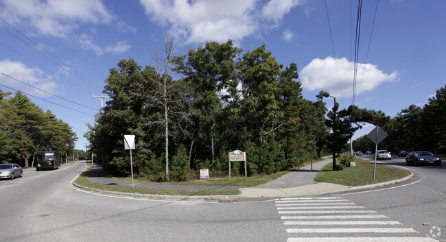
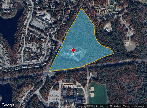
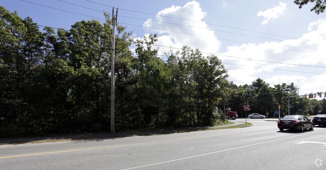
462 Old Barnstable Rd, Mashpee, MA 02649
Property Detail
462 Old Barnstable Rd
MASH-000073-000046
BARNSTABLE
Transientlodging
Massachusetts
C2
24.50 AC
B and X Area of moderate flood hazard, usually the area between the limits of the 100-year and 500-year floods.
Cape Cod
2025
Other Market Areas
2025
Barnstable Town, MA
015002
NEARBY LISTINGS FOR SALE OR LEASE
DEMOGRAPHICS near 462 Old Barnstable Rd
1 mile
3 mile
5 mile
2025 Total Population
3,039
15,348
41,712
2030 Population
3,003
15,227
41,707
Pop Growth 2025-2030
(1.18%)
(0.79%)
(0.01%)
Average Age
53
50
49
2025 Total Households
1,508
6,856
17,941
HH Growth 2025-2030
(1.39%)
(0.99%)
+ 0.04%
Median Household Inc
$92,559
$91,787
$98,912
Avg Household Size
2.00
2.20
2.30
2025 Avg HH Vehicles
2.00
2.00
2.00
Median Home Value
$645,305
$598,435
$642,178
Median Year Built
1987
1985
1983
Nearby Places
Map Layers
Map Styles
 Street
 Aerial
Transit
 Traffic
 Biking
Places
Listings with unknown addresses are not visible on the map
- Restaurants
- Banks
- Shops
- Fitness
- Groceries
PUBLIC TRANSPORTATION
AIRPORT
Martha's Vineyard
Drive
Walk
Distance
Martha's Vineyard
86 min
26.8 mi
Freight Ports
Port of New Bedford Harbor
Drive
Walk
Distance
Port of New Bedford Harbor
57 min
40.3 mi
Nearby Properties
Address
Land Use
TOTAL SIZE
Lot Size
Zoning
Address
Land Use
TOTAL SIZE
Lot Size
Zoning
12,713 SF
29.28 AC
C1
Address
Land Use
TOTAL SIZE
Lot Size
Zoning
10.94 AC
R3
Address
Land Use
TOTAL SIZE
Lot Size
Zoning
181,756 SF
135.43 AC
R5
Address
Land Use
TOTAL SIZE
Lot Size
Zoning
9 AC
C1
Address
Land Use
TOTAL SIZE
Lot Size
Zoning
15.10 AC
C1
Address
Land Use
TOTAL SIZE
Lot Size
Zoning
24.40 AC
R3
Address
Land Use
TOTAL SIZE
Lot Size
Zoning
2,993 SF
67.60 AC
R3
Address
Land Use
TOTAL SIZE
Lot Size
Zoning
65,930 SF
3.97 AC
C1
Address
Land Use
TOTAL SIZE
Lot Size
Zoning
27.80 AC
R3
Address
Land Use
TOTAL SIZE
Lot Size
Zoning
13.30 AC
I1
Address
Land Use
TOTAL SIZE
Lot Size
Zoning
41,386 SF
7.59 AC
AGA
Address
Land Use
TOTAL SIZE
Lot Size
Zoning
8,544 SF
20.31 AC
R3
Address
Land Use
TOTAL SIZE
Lot Size
Zoning
6.27 AC
R3
Address
Land Use
TOTAL SIZE
Lot Size
Zoning
8,910 SF
31.84 AC
R5
Address
Land Use
TOTAL SIZE
Lot Size
Zoning
31,520 SF
3.89 AC
I1
Address
Land Use
TOTAL SIZE
Lot Size
Zoning
3,000 SF
260.39 AC
PU
Address
Land Use
TOTAL SIZE
Lot Size
Zoning
Address
Land Use
TOTAL SIZE
Lot Size
Zoning
34.48 AC
R
Address
Land Use
TOTAL SIZE
Lot Size
Zoning
5.13 AC
Address
Land Use
TOTAL SIZE
Lot Size
Zoning
229.61 AC
R3
Address
Land Use
TOTAL SIZE
Lot Size
Zoning
250.40 AC
R5
Address
Land Use
TOTAL SIZE
Lot Size
Zoning
33.20 AC
R5
Address
Land Use
TOTAL SIZE
Lot Size
Zoning
240 SF
0.86 AC
R3
Address
Land Use
TOTAL SIZE
Lot Size
Zoning
21,396 SF
1.90 AC
C1
Address
Land Use
TOTAL SIZE
Lot Size
Zoning
3.37 AC
C1
Address
Land Use
TOTAL SIZE
Lot Size
Zoning
36,419 SF
7.29 AC
R3
Address
Land Use
TOTAL SIZE
Lot Size
Zoning
3.37 AC
Address
Land Use
TOTAL SIZE
Lot Size
Zoning
4,768 SF
0.81 AC
R3
Address
Land Use
TOTAL SIZE
Lot Size
Zoning
30 AC
The World's #1 Commercial Real Estate Marketplace
Connect with us
© 2026 CoStar Group
The information above has been obtained from sources believed reliable. While we do not doubt its accuracy we have not verified it and make no guarantee, warranty or representation about it. It is your responsibility to independently confirm its accuracy and completeness. Any projections, opinions, assumptions, or estimates used are for example only and do not represent the current or future performance of the property. The value of this transaction to you depends on tax and other factors which should be evaluated by your tax, financial, and legal advisors. You and your advisors should conduct a careful, independent investigation of the property to determine to your satisfaction the suitability of the property for your needs.