Property Record
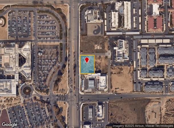
4628 Dale Rd, Modesto, CA 95356

This Property Is For Sale
NEARBY LISTINGS FOR SALE OR LEASE
Property Detail
4628 Dale Rd
078-71-08
PORTION PCLS1,2&8
Commercialacreage
Stanislaus
X
California
06077C0810F
0.71 AC
2025
Modesto
2025
Stockton/Modesto
000501
Modesto, CA
DEMOGRAPHICS near 4628 Dale Rd
1 Mile
3 Mile
5 Mile
2024 Total Population
8,612
64,140
136,030
2029 Population
8,820
64,776
136,975
Pop Growth 2024-2029
+ 2.42%
+ 0.99%
+ 0.69%
Average Age
39
38
39
2024 Total Households
2,997
21,459
47,266
HH Growth 2024-2029
+ 2.20%
+ 0.97%
+ 0.67%
Median Household Inc
$95,184
$79,961
$81,767
Avg Household Size
2.80
2.90
2.80
2024 Avg HH Vehicles
2.00
2.00
2.00
Median Home Value
$475,056
$399,443
$420,346
Median Year Built
1987
1983
1977
Nearby Places
Map Layers
Map Styles
 Street
 Aerial
- Restaurants
- Banks
- Shops
- Fitness
- Groceries
PUBLIC TRANSPORTATION
AIRPORT
Stockton Metro
DRIVE
WALK
Distance
Stockton Metro
29 min
20.0 mi
Freight Ports
Port of Stockton
DRIVE
WALK
Distance
Port of Stockton
37 min
28.5 mi
Nearby Properties
Address
Land Use
TOTAL SIZE
Lot Size
Zoning
Address
Land Use
TOTAL SIZE
Lot Size
Zoning
640,835 SF
47.18 AC
PC
Address
Land Use
TOTAL SIZE
Lot Size
Zoning
541,375 SF
37.18 AC
Address
Land Use
TOTAL SIZE
Lot Size
Zoning
706,042 SF
24.81 AC
PD109
Address
Land Use
TOTAL SIZE
Lot Size
Zoning
9.25 AC
MODSP
Address
Land Use
TOTAL SIZE
Lot Size
Zoning
20.31 AC
COUPD
Address
Land Use
TOTAL SIZE
Lot Size
Zoning
175,804 SF
13.79 AC
Address
Land Use
TOTAL SIZE
Lot Size
Zoning
189,239 SF
8.75 AC
PD
Address
Land Use
TOTAL SIZE
Lot Size
Zoning
127,142 SF
3.89 AC
MODSP
Address
Land Use
TOTAL SIZE
Lot Size
Zoning
33,530 SF
3.60 AC
Address
Land Use
TOTAL SIZE
Lot Size
Zoning
164,473 SF
3.50 AC
MODSP
Address
Land Use
TOTAL SIZE
Lot Size
Zoning
155,462 SF
13.69 AC
PD
Address
Land Use
TOTAL SIZE
Lot Size
Zoning
110,684 SF
5.03 AC
Address
Land Use
TOTAL SIZE
Lot Size
Zoning
41,260 SF
6 AC
MODSP
Address
Land Use
TOTAL SIZE
Lot Size
Zoning
45,916 SF
4.69 AC
MODPO
Address
Land Use
TOTAL SIZE
Lot Size
Zoning
139,552 SF
12.58 AC
COUPI
Address
Land Use
TOTAL SIZE
Lot Size
Zoning
85,040 SF
4.46 AC
Address
Land Use
TOTAL SIZE
Lot Size
Zoning
88,224 SF
5.13 AC
PD
Address
Land Use
TOTAL SIZE
Lot Size
Zoning
80,987 SF
4.33 AC
PD
Address
Land Use
TOTAL SIZE
Lot Size
Zoning
137,582 SF
19.21 AC
MODSP
Address
Land Use
TOTAL SIZE
Lot Size
Zoning
134,096 SF
10.74 AC
Address
Land Use
TOTAL SIZE
Lot Size
Zoning
130,630 SF
11.13 AC
PD
Address
Land Use
TOTAL SIZE
Lot Size
Zoning
122,944 SF
9.81 AC
Address
Land Use
TOTAL SIZE
Lot Size
Zoning
92,351 SF
3.85 AC
Address
Land Use
TOTAL SIZE
Lot Size
Zoning
70,352 SF
17.49 AC
MODSP
Address
Land Use
TOTAL SIZE
Lot Size
Zoning
157,353 SF
9 AC
Address
Land Use
TOTAL SIZE
Lot Size
Zoning
75,922 SF
3.93 AC
Address
Land Use
TOTAL SIZE
Lot Size
Zoning
139,638 SF
39.25 AC
Address
Land Use
TOTAL SIZE
Lot Size
Zoning
124,645 SF
8.10 AC
Address
Land Use
TOTAL SIZE
Lot Size
Zoning
71,877 SF
2 AC
MODSP
Address
Land Use
TOTAL SIZE
Lot Size
Zoning
66,350 SF
9.16 AC
The World's #1 Commercial Real Estate Marketplace
Connect with us
© 2026 CoStar Group
The information above has been obtained from sources believed reliable. While we do not doubt its accuracy we have not verified it and make no guarantee, warranty or representation about it. It is your responsibility to independently confirm its accuracy and completeness. Any projections, opinions, assumptions, or estimates used are for example only and do not represent the current or future performance of the property. The value of this transaction to you depends on tax and other factors which should be evaluated by your tax, financial, and legal advisors. You and your advisors should conduct a careful, independent investigation of the property to determine to your satisfaction the suitability of the property for your needs.