Property Record
4620 Grandview Ave, Cheyenne, WY 82009
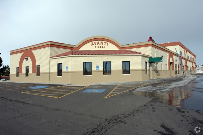
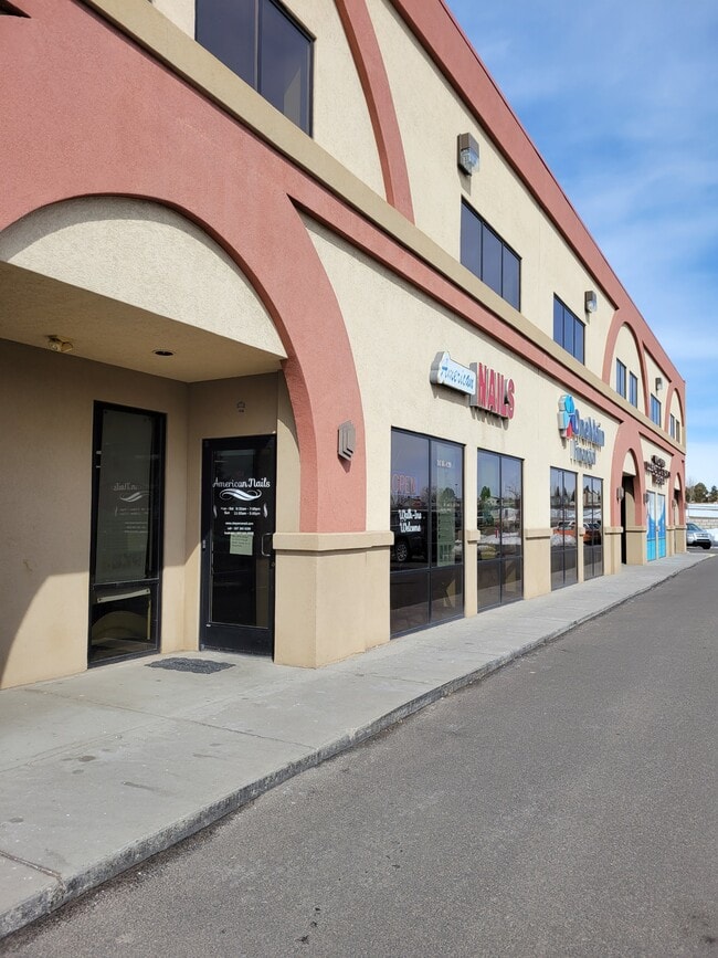
This Property Is For Sale
NEARBY LISTINGS FOR SALE OR LEASE
Property Detail
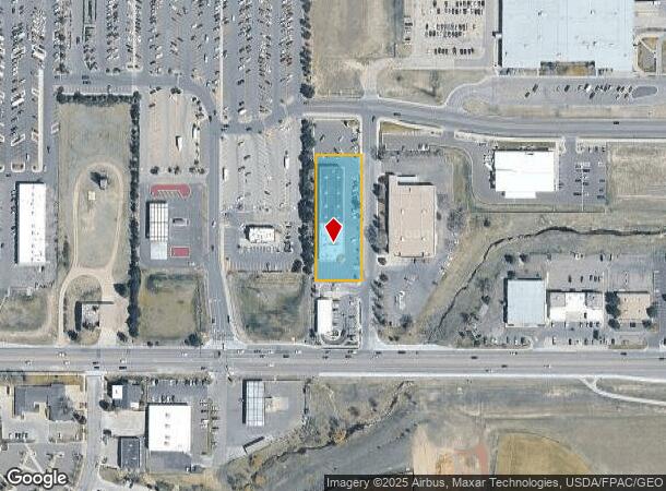
4620 Grandview Ave
Cheyenne, WY
Anderson Corner, Blocks 1-3
1-1120-0001-0001-3
SOUTH160FT N348FT&N188FT LOT1&PORTION LOT2; SECOND FILING
Commercialnec
Laramie
X
Wyoming
56021C1091F
1
2024
0.99 AC
2025
I-80 Corridor/Cheyenne
001402
Other Market Areas
31,151 SF
DEMOGRAPHICS near 4620 Grandview Ave
1 Mile
3 Mile
5 Mile
2024 Total Population
5,504
56,725
84,178
2029 Population
5,620
57,758
85,762
Pop Growth 2024-2029
+ 2.11%
+ 1.82%
+ 1.88%
Average Age
41
41
39
2024 Total Households
2,328
24,949
35,390
HH Growth 2024-2029
+ 2.28%
+ 1.93%
+ 1.99%
Median Household Inc
$72,122
$63,390
$61,246
Avg Household Size
2.30
2.20
2.30
2024 Avg HH Vehicles
2.00
2.00
2.00
Median Home Value
$289,905
$278,322
$282,007
Median Year Built
1976
1973
1977
Nearby Places
- Restaurants
- Banks
- Shops
- Fitness
- Groceries
Nearby Properties
Address
Land Use
TOTAL SIZE
Lot Size
Zoning
Address
Land Use
TOTAL SIZE
Lot Size
Zoning
240.51 AC
A2
Address
Land Use
TOTAL SIZE
Lot Size
Zoning
172,393 SF
12.16 AC
Address
Land Use
TOTAL SIZE
Lot Size
Zoning
Address
Land Use
TOTAL SIZE
Lot Size
Zoning
91,021 SF
7.40 AC
Address
Land Use
TOTAL SIZE
Lot Size
Zoning
148,018 SF
Address
Land Use
TOTAL SIZE
Lot Size
Zoning
210,717 SF
18.28 AC
Address
Land Use
TOTAL SIZE
Lot Size
Zoning
136,488 SF
13.38 AC
CB
Address
Land Use
TOTAL SIZE
Lot Size
Zoning
219,227 SF
21.97 AC
CB
Address
Land Use
TOTAL SIZE
Lot Size
Zoning
118,588 SF
3.20 AC
CB
Address
Land Use
TOTAL SIZE
Lot Size
Zoning
69,726 SF
0.80 AC
CBD
Address
Land Use
TOTAL SIZE
Lot Size
Zoning
323,835 SF
Address
Land Use
TOTAL SIZE
Lot Size
Zoning
109,096 SF
4.03 AC
MR2
Address
Land Use
TOTAL SIZE
Lot Size
Zoning
193,881 SF
21.36 AC
CB
Address
Land Use
TOTAL SIZE
Lot Size
Zoning
109,744 SF
7.04 AC
Address
Land Use
TOTAL SIZE
Lot Size
Zoning
204,822 SF
6.88 AC
HR1
Address
Land Use
TOTAL SIZE
Lot Size
Zoning
76,524 SF
6 AC
Address
Land Use
TOTAL SIZE
Lot Size
Zoning
132,839 SF
6.38 AC
Address
Land Use
TOTAL SIZE
Lot Size
Zoning
85,314 SF
5.50 AC
P
Address
Land Use
TOTAL SIZE
Lot Size
Zoning
81,948 SF
9.39 AC
CB
Address
Land Use
TOTAL SIZE
Lot Size
Zoning
142,588 SF
3.54 AC
PUD
Address
Land Use
TOTAL SIZE
Lot Size
Zoning
69,941 SF
4.31 AC
LI
Address
Land Use
TOTAL SIZE
Lot Size
Zoning
88,107 SF
10.73 AC
Address
Land Use
TOTAL SIZE
Lot Size
Zoning
86,860 SF
1.70 AC
CB
Address
Land Use
TOTAL SIZE
Lot Size
Zoning
59,325 SF
0.85 AC
CBD
Address
Land Use
TOTAL SIZE
Lot Size
Zoning
96,088 SF
8.34 AC
Address
Land Use
TOTAL SIZE
Lot Size
Zoning
69,103 SF
17.34 AC
Address
Land Use
TOTAL SIZE
Lot Size
Zoning
79,186 SF
3.09 AC
Address
Land Use
TOTAL SIZE
Lot Size
Zoning
108,332 SF
0.80 AC
MUB
Address
Land Use
TOTAL SIZE
Lot Size
Zoning
67,628 SF
2.23 AC
Address
Land Use
TOTAL SIZE
Lot Size
Zoning
148,152 SF
15.54 AC
CB
The World's #1 Commercial Real Estate Marketplace
Connect with us
© 2025 CoStar Group
The information above has been obtained from sources believed reliable. While we do not doubt its accuracy we have not verified it and make no guarantee, warranty or representation about it. It is your responsibility to independently confirm its accuracy and completeness. Any projections, opinions, assumptions, or estimates used are for example only and do not represent the current or future performance of the property. The value of this transaction to you depends on tax and other factors which should be evaluated by your tax, financial, and legal advisors. You and your advisors should conduct a careful, independent investigation of the property to determine to your satisfaction the suitability of the property for your needs.