Property Record
4623 Hartley Bridge Rd, Macon, GA 31216


NEARBY LISTINGS FOR SALE OR LEASE
Property Detail
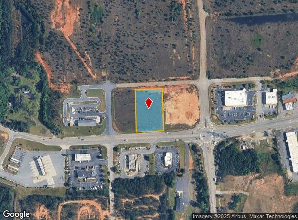
4623 Hartley Bridge Rd
Macon-Bibb County, GA
Hartley Station
L120-0101
HARTLEY STATION
Commercialacreage
Bibb
X
Georgia
13021C0230G
2d
2025
1.19 AC
2025
Outlying Bibb County
013603
Atlanta
DEMOGRAPHICS near 4623 Hartley Bridge Rd
1 Mile
3 Mile
5 Mile
2024 Total Population
745
14,518
36,532
2029 Population
729
14,363
36,553
Pop Growth 2024-2029
(2.15%)
(1.07%)
+ 0.06%
Average Age
44
40
38
2024 Total Households
206
5,039
13,047
HH Growth 2024-2029
(1.94%)
(1.01%)
+ 0.03%
Median Household Inc
$81,097
$58,789
$50,398
Avg Household Size
2.50
2.60
2.60
2024 Avg HH Vehicles
2.00
2.00
2.00
Median Home Value
$175,237
$168,861
$148,793
Median Year Built
1991
1986
1981
Nearby Places
Map Layers
Map Styles
 Street
 Aerial
- Restaurants
- Banks
- Shops
- Fitness
- Groceries
Nearby Properties
Address
Land Use
TOTAL SIZE
Lot Size
Zoning
Address
Land Use
TOTAL SIZE
Lot Size
Zoning
275 SF
95.56 AC
M-1
Address
Land Use
TOTAL SIZE
Lot Size
Zoning
365,220 SF
51.44 AC
M-1
Address
Land Use
TOTAL SIZE
Lot Size
Zoning
670,720 SF
117.04 AC
M-1
Address
Land Use
TOTAL SIZE
Lot Size
Zoning
360,406 SF
33.02 AC
M-1
Address
Land Use
TOTAL SIZE
Lot Size
Zoning
258,116 SF
66.27 AC
A
Address
Land Use
TOTAL SIZE
Lot Size
Zoning
29,160 SF
22.56 AC
A/R-3
Address
Land Use
TOTAL SIZE
Lot Size
Zoning
248,000 SF
33 AC
M-1
Address
Land Use
TOTAL SIZE
Lot Size
Zoning
5,096 SF
17.65 AC
A
Address
Land Use
TOTAL SIZE
Lot Size
Zoning
13,596 SF
9.04 AC
R-3
Address
Land Use
TOTAL SIZE
Lot Size
Zoning
1,590 SF
10.52 AC
R-3
Address
Land Use
TOTAL SIZE
Lot Size
Zoning
56,533 SF
26.25 AC
C-4/M-1
Address
Land Use
TOTAL SIZE
Lot Size
Zoning
52,615 SF
16.38 AC
A
Address
Land Use
TOTAL SIZE
Lot Size
Zoning
75,047 SF
45.39 AC
R-1AAA
Address
Land Use
TOTAL SIZE
Lot Size
Zoning
11,864 SF
16.72 AC
M-1
Address
Land Use
TOTAL SIZE
Lot Size
Zoning
64,482 SF
13.30 AC
C-4
Address
Land Use
TOTAL SIZE
Lot Size
Zoning
30,568 SF
7.44 AC
A
Address
Land Use
TOTAL SIZE
Lot Size
Zoning
37,468 SF
2.22 AC
C-4
Address
Land Use
TOTAL SIZE
Lot Size
Zoning
336 SF
32.89 AC
PDI
Address
Land Use
TOTAL SIZE
Lot Size
Zoning
48,108 SF
6.58 AC
C-2
Address
Land Use
TOTAL SIZE
Lot Size
Zoning
37,970 SF
21.38 AC
Address
Land Use
TOTAL SIZE
Lot Size
Zoning
18,696 SF
6.44 AC
C-4
Address
Land Use
TOTAL SIZE
Lot Size
Zoning
11,322 SF
8.82 AC
R-1AAA
Address
Land Use
TOTAL SIZE
Lot Size
Zoning
8,378 SF
7.20 AC
PDC
Address
Land Use
TOTAL SIZE
Lot Size
Zoning
26,692 SF
9.52 AC
M-1
Address
Land Use
TOTAL SIZE
Lot Size
Zoning
13,340 SF
1.85 AC
C-4
Address
Land Use
TOTAL SIZE
Lot Size
Zoning
22,566 SF
3.12 AC
C-4
Address
Land Use
TOTAL SIZE
Lot Size
Zoning
44,763 SF
6.07 AC
R-1AAA
Address
Land Use
TOTAL SIZE
Lot Size
Zoning
46,999 SF
14.59 AC
R-1AAA
Address
Land Use
TOTAL SIZE
Lot Size
Zoning
19,034 SF
4.84 AC
R-1AAA
Address
Land Use
TOTAL SIZE
Lot Size
Zoning
16,680 SF
2.14 AC
PDC
The World's #1 Commercial Real Estate Marketplace
Connect with us
© 2025 CoStar Group
The information above has been obtained from sources believed reliable. While we do not doubt its accuracy we have not verified it and make no guarantee, warranty or representation about it. It is your responsibility to independently confirm its accuracy and completeness. Any projections, opinions, assumptions, or estimates used are for example only and do not represent the current or future performance of the property. The value of this transaction to you depends on tax and other factors which should be evaluated by your tax, financial, and legal advisors. You and your advisors should conduct a careful, independent investigation of the property to determine to your satisfaction the suitability of the property for your needs.