Property Record
4625 Thatcher Ave, Pueblo, CO 81005


NEARBY LISTINGS FOR SALE OR LEASE
-
-
View all Pueblo listings for sale on LoopNet.com
Property Detail
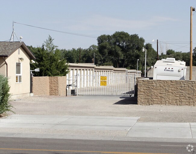
4625 Thatcher Ave
0-5-33-4-00-009
Com-Thatcher Bd
Commercialacreage
COM AT STONE BEING SE COR SEC 33-20-65 TH WLY ALONG SEC,LINE BETW SECS 33-20-65 + 4-21-65 A DIST OF 2320.59 FT,TO A PT TH NLY AT ANG OF 90 DEG 00 MIN RT A DIST OF 23,FT TO PT OF BEG SD PT OF BEG BEING ON N R/W LINE CO RD,TH CONTINUE NLY A DIST 709 FT
X
Pueblo
08101C0493D
Colorado
2024
4.39 AC
2024
Colorado East Area
002802
Other Market Areas
46,610 SF
Pueblo, CO
DEMOGRAPHICS near 4625 Thatcher Ave
1 Mile
3 Mile
5 Mile
2024 Total Population
5,666
50,985
102,983
2029 Population
5,826
52,153
105,490
Pop Growth 2024-2029
+ 2.82%
+ 2.29%
+ 2.43%
Average Age
46
41
41
2024 Total Households
2,460
21,397
42,407
HH Growth 2024-2029
+ 2.85%
+ 2.39%
+ 2.57%
Median Household Inc
$69,442
$51,960
$50,498
Avg Household Size
2.20
2.30
2.30
2024 Avg HH Vehicles
2.00
2.00
2.00
Median Home Value
$279,522
$224,405
$220,293
Median Year Built
1982
1964
1966
Nearby Places
Map Layers
Map Styles
 Street
 Aerial
- Restaurants
- Banks
- Shops
- Fitness
- Groceries
Nearby Properties
Address
Land Use
TOTAL SIZE
Lot Size
Zoning
Address
Land Use
TOTAL SIZE
Lot Size
Zoning
79,394 SF
5.57 AC
R5:RES/MUL
Address
Land Use
TOTAL SIZE
Lot Size
Zoning
47,007 SF
8.79 AC
Address
Land Use
TOTAL SIZE
Lot Size
Zoning
40,986 SF
0.65 AC
R5:RES/MUL
Address
Land Use
TOTAL SIZE
Lot Size
Zoning
56,088 SF
4 AC
Address
Land Use
TOTAL SIZE
Lot Size
Zoning
94,278 SF
2.11 AC
R-5
Address
Land Use
TOTAL SIZE
Lot Size
Zoning
33,866 SF
3.34 AC
Address
Land Use
TOTAL SIZE
Lot Size
Zoning
199,914 SF
13.48 AC
B4:COMM/RE
Address
Land Use
TOTAL SIZE
Lot Size
Zoning
35,530 SF
0.55 AC
R-4
Address
Land Use
TOTAL SIZE
Lot Size
Zoning
22,611 SF
6.85 AC
S1:SPC/PUB
Address
Land Use
TOTAL SIZE
Lot Size
Zoning
19,763 SF
2.50 AC
R2:RES/1 F
Address
Land Use
TOTAL SIZE
Lot Size
Zoning
113,152 SF
5.84 AC
R4:RES/MUL
Address
Land Use
TOTAL SIZE
Lot Size
Zoning
71,751 SF
2.73 AC
R3:RES/2 F
Address
Land Use
TOTAL SIZE
Lot Size
Zoning
12,150 SF
1.10 AC
Address
Land Use
TOTAL SIZE
Lot Size
Zoning
12,018 SF
0.76 AC
B2:COMM/SU
Address
Land Use
TOTAL SIZE
Lot Size
Zoning
93,055 SF
9 AC
PUD
Address
Land Use
TOTAL SIZE
Lot Size
Zoning
133,969 SF
22.36 AC
B4:COMM/RE
Address
Land Use
TOTAL SIZE
Lot Size
Zoning
81,140 SF
3.22 AC
Address
Land Use
TOTAL SIZE
Lot Size
Zoning
154,378 SF
14.33 AC
B4:COMM/RE
Address
Land Use
TOTAL SIZE
Lot Size
Zoning
95,309 SF
8.74 AC
B4:COMM/RE
Address
Land Use
TOTAL SIZE
Lot Size
Zoning
76,149 SF
4.29 AC
B3:COMM/H&
Address
Land Use
TOTAL SIZE
Lot Size
Zoning
152,286 SF
6.29 AC
Address
Land Use
TOTAL SIZE
Lot Size
Zoning
98,072 SF
8.07 AC
R-5
Address
Land Use
TOTAL SIZE
Lot Size
Zoning
58,440 SF
4.42 AC
B-3
Address
Land Use
TOTAL SIZE
Lot Size
Zoning
10,200 SF
0.60 AC
R-3
Address
Land Use
TOTAL SIZE
Lot Size
Zoning
25 SF
5.74 AC
B3:COMM/H&
Address
Land Use
TOTAL SIZE
Lot Size
Zoning
9,034 SF
0.89 AC
R5:RES/MUL
Address
Land Use
TOTAL SIZE
Lot Size
Zoning
18,480 SF
2.22 AC
B4:COMM/RE
Address
Land Use
TOTAL SIZE
Lot Size
Zoning
4,802 SF
639.07 AC
S-1
Address
Land Use
TOTAL SIZE
Lot Size
Zoning
76,764 SF
3.81 AC
R4:RES/MUL
Address
Land Use
TOTAL SIZE
Lot Size
Zoning
12,031 SF
1.27 AC
R5:RES/MUL
The World's #1 Commercial Real Estate Marketplace
Connect with us
© 2025 CoStar Group
The information above has been obtained from sources believed reliable. While we do not doubt its accuracy we have not verified it and make no guarantee, warranty or representation about it. It is your responsibility to independently confirm its accuracy and completeness. Any projections, opinions, assumptions, or estimates used are for example only and do not represent the current or future performance of the property. The value of this transaction to you depends on tax and other factors which should be evaluated by your tax, financial, and legal advisors. You and your advisors should conduct a careful, independent investigation of the property to determine to your satisfaction the suitability of the property for your needs.