Property Record
4625 Xenia St N, Saint Petersburg, FL 33714


NEARBY LISTINGS FOR SALE OR LEASE
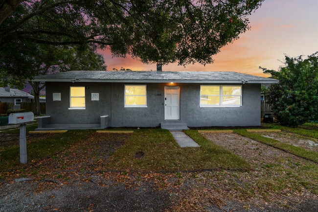
Property Detail
4625 Xenia St N
Tampa-St. Petersburg-Clearwater, FL
Lakeside Sub
02-31-16-48636-001-0230
LAKESIDE SUB BLK 1, LOT 23 & S 1/2 OF LOT 22
Multifamilydwelling
Pinellas
A
Florida
12103C0208J
23,22
2024
Clearvista
2025
Tampa/St Petersburg
024603
DEMOGRAPHICS near 4625 Xenia St N
1 Mile
3 Mile
5 Mile
2024 Total Population
16,137
126,581
286,418
2029 Population
16,255
127,011
286,890
Pop Growth 2024-2029
+ 0.73%
+ 0.34%
+ 0.16%
Average Age
44
43
43
2024 Total Households
7,300
58,301
130,664
HH Growth 2024-2029
+ 1.05%
+ 0.25%
0.00%
Median Household Inc
$45,724
$60,727
$60,335
Avg Household Size
2.10
2.10
2.10
2024 Avg HH Vehicles
2.00
2.00
2.00
Median Home Value
$140,790
$250,160
$255,784
Median Year Built
1964
1964
1968
Nearby Places
Map Layers
Map Styles
 Street
 Aerial
- Restaurants
- Banks
- Shops
- Fitness
- Groceries
PUBLIC TRANSPORTATION
AIRPORT
St Pete-Clearwater International
DRIVE
WALK
Distance
St Pete-Clearwater International
21 min
9.1 mi
Tampa International
DRIVE
WALK
Distance
Tampa International
28 min
17.0 mi
Sarasota/Bradenton International
DRIVE
WALK
Distance
Sarasota/Bradenton International
52 min
35.5 mi
SALE & LEASE HISTORY
LISTING DATE
SALE/LEASE

Feb 07, 2024
For Sale
Nearby Properties
Address
Land Use
TOTAL SIZE
Lot Size
Zoning
Address
Land Use
TOTAL SIZE
Lot Size
Zoning
807,604 SF
9.61 AC
Address
Land Use
TOTAL SIZE
Lot Size
Zoning
478,217 SF
9.84 AC
Address
Land Use
TOTAL SIZE
Lot Size
Zoning
447,664 SF
34.44 AC
Address
Land Use
TOTAL SIZE
Lot Size
Zoning
346,420 SF
17.95 AC
Address
Land Use
TOTAL SIZE
Lot Size
Zoning
372,436 SF
22.30 AC
Address
Land Use
TOTAL SIZE
Lot Size
Zoning
404,063 SF
12.98 AC
Address
Land Use
TOTAL SIZE
Lot Size
Zoning
404,899 SF
35.35 AC
Address
Land Use
TOTAL SIZE
Lot Size
Zoning
330,467 SF
1.88 AC
Address
Land Use
TOTAL SIZE
Lot Size
Zoning
240,736 SF
58.40 AC
Address
Land Use
TOTAL SIZE
Lot Size
Zoning
359,527 SF
19.65 AC
Address
Land Use
TOTAL SIZE
Lot Size
Zoning
324,579 SF
16.97 AC
Address
Land Use
TOTAL SIZE
Lot Size
Zoning
309,526 SF
36.85 AC
C2
Address
Land Use
TOTAL SIZE
Lot Size
Zoning
265,688 SF
27.52 AC
Address
Land Use
TOTAL SIZE
Lot Size
Zoning
444,770 SF
14.95 AC
Address
Land Use
TOTAL SIZE
Lot Size
Zoning
464,493 SF
17.41 AC
Address
Land Use
TOTAL SIZE
Lot Size
Zoning
300,546 SF
6.49 AC
Address
Land Use
TOTAL SIZE
Lot Size
Zoning
111,757 SF
16.04 AC
Address
Land Use
TOTAL SIZE
Lot Size
Zoning
100,904 SF
8.54 AC
Address
Land Use
TOTAL SIZE
Lot Size
Zoning
261,995 SF
17.08 AC
Address
Land Use
TOTAL SIZE
Lot Size
Zoning
170,146 SF
17.78 AC
Address
Land Use
TOTAL SIZE
Lot Size
Zoning
106,573 SF
2.69 AC
Address
Land Use
TOTAL SIZE
Lot Size
Zoning
110,494 SF
0.77 AC
Address
Land Use
TOTAL SIZE
Lot Size
Zoning
244,896 SF
28.70 AC
Address
Land Use
TOTAL SIZE
Lot Size
Zoning
172,600 SF
20.57 AC
Address
Land Use
TOTAL SIZE
Lot Size
Zoning
172,768 SF
15.05 AC
RPD20
Address
Land Use
TOTAL SIZE
Lot Size
Zoning
99,116 SF
20.60 AC
Address
Land Use
TOTAL SIZE
Lot Size
Zoning
88,793 SF
13.78 AC
IL
Address
Land Use
TOTAL SIZE
Lot Size
Zoning
175,547 SF
15.81 AC
Address
Land Use
TOTAL SIZE
Lot Size
Zoning
113,365 SF
13.32 AC
Address
Land Use
TOTAL SIZE
Lot Size
Zoning
269,582 SF
16.72 AC
The World's #1 Commercial Real Estate Marketplace
Connect with us
© 2025 CoStar Group
The information above has been obtained from sources believed reliable. While we do not doubt its accuracy we have not verified it and make no guarantee, warranty or representation about it. It is your responsibility to independently confirm its accuracy and completeness. Any projections, opinions, assumptions, or estimates used are for example only and do not represent the current or future performance of the property. The value of this transaction to you depends on tax and other factors which should be evaluated by your tax, financial, and legal advisors. You and your advisors should conduct a careful, independent investigation of the property to determine to your satisfaction the suitability of the property for your needs.