Property Record
462541 State Road 200, Yulee, FL 32097
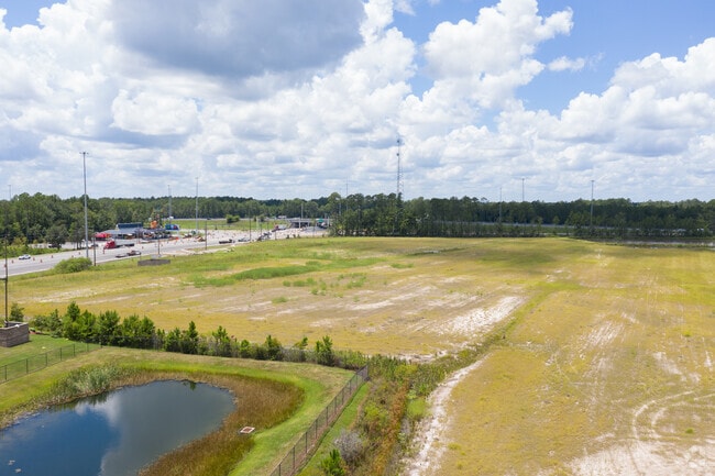
Property Detail
462541 State Road 200
Jacksonville, FL
PT E WATERMAN GRANT SEC 44-2N-27E IN OR 1928/632 BEING PARCEL B (EX ESMT IN OR 1484/1762 & UTIL ESMTS IN OR 1568/217,OR 1568/220) 60 FT ESMT FOR INGRESS/EGRESS IN OR 2621/888
39-2N-26-0000-0001-0040
NASSAU
Commercialacreage
Florida
CI
1
2025
55.27 AC
2025
Nassau County
050306
Jacksonville (Florida)
11,151 SF
NEARBY LISTINGS FOR SALE OR LEASE
DEMOGRAPHICS near 462541 State Road 200
1 mile
3 mile
5 mile
2025 Total Population
3,313
13,171
19,913
2030 Population
3,975
15,322
22,807
Pop Growth 2025-2030
+ 19.98%
+ 16.33%
+ 14.53%
Average Age
38
37
39
2025 Total Households
1,007
4,171
6,728
HH Growth 2025-2030
+ 19.46%
+ 16.09%
+ 14.21%
Median Household Inc
$109,344
$107,883
$97,782
Avg Household Size
2.70
2.90
2.80
2025 Avg HH Vehicles
2.00
2.00
2.00
Median Home Value
$269,897
$351,725
$323,965
Median Year Built
2011
2010
2010
Nearby Places
Map Layers
Map Styles
 Street
 Aerial
Layers
 Traffic
 Biking
Places
Listings with unknown addresses are not visible on the map
- Restaurants
- Banks
- Shops
- Fitness
- Groceries
PUBLIC TRANSPORTATION
AIRPORT
Jacksonville International
Drive
Walk
Distance
Jacksonville International
19 min
12.8 mi
Nearby Properties
Address
Land Use
TOTAL SIZE
Lot Size
Zoning
Address
Land Use
TOTAL SIZE
Lot Size
Zoning
249,913 SF
160.04 AC
OR
Address
Land Use
TOTAL SIZE
Lot Size
Zoning
306,222 SF
21.65 AC
PD - ENCPA
Address
Land Use
TOTAL SIZE
Lot Size
Zoning
291,580 SF
12.56 AC
PD - ENCPA
Address
Land Use
TOTAL SIZE
Lot Size
Zoning
223,389 SF
25.75 AC
RG-1
Address
Land Use
TOTAL SIZE
Lot Size
Zoning
302,387 SF
29.60 AC
PD - ENCPA
Address
Land Use
TOTAL SIZE
Lot Size
Zoning
134,139 SF
27.49 AC
PD - ENCPA
Address
Land Use
TOTAL SIZE
Lot Size
Zoning
91,196 SF
86.52 AC
OR
Address
Land Use
TOTAL SIZE
Lot Size
Zoning
83,799 SF
13.18 AC
PD - ENCPA
Address
Land Use
TOTAL SIZE
Lot Size
Zoning
42,189 SF
7.69 AC
PD - ENCPA
Address
Land Use
TOTAL SIZE
Lot Size
Zoning
56,491 SF
3.52 AC
PD - ENCPA
Address
Land Use
TOTAL SIZE
Lot Size
Zoning
92,327 SF
22.06 AC
OR
Address
Land Use
TOTAL SIZE
Lot Size
Zoning
23,934 SF
20.45 AC
CN
Address
Land Use
TOTAL SIZE
Lot Size
Zoning
13,472 SF
Address
Land Use
TOTAL SIZE
Lot Size
Zoning
81,960 SF
2.90 AC
PD - ENCPA
Address
Land Use
TOTAL SIZE
Lot Size
Zoning
104,064 SF
5.27 AC
CHT
Address
Land Use
TOTAL SIZE
Lot Size
Zoning
59,703 SF
12.06 AC
GPU
Address
Land Use
TOTAL SIZE
Lot Size
Zoning
38,211 SF
5.54 AC
PD - ENCPA
Address
Land Use
TOTAL SIZE
Lot Size
Zoning
12,594 SF
Address
Land Use
TOTAL SIZE
Lot Size
Zoning
25,920 SF
14.72 AC
GPU
Address
Land Use
TOTAL SIZE
Lot Size
Zoning
41,762 SF
1.93 AC
CHT
Address
Land Use
TOTAL SIZE
Lot Size
Zoning
33,733 SF
2.78 AC
CHT
Address
Land Use
TOTAL SIZE
Lot Size
Zoning
16,518 SF
23.33 AC
PD - ENCPA
Address
Land Use
TOTAL SIZE
Lot Size
Zoning
18,750 SF
4.58 AC
CI
Address
Land Use
TOTAL SIZE
Lot Size
Zoning
18,276 SF
1.57 AC
PD - ENCPA
Address
Land Use
TOTAL SIZE
Lot Size
Zoning
29,862 SF
1.68 AC
CHT
Address
Land Use
TOTAL SIZE
Lot Size
Zoning
6,285 SF
Address
Land Use
TOTAL SIZE
Lot Size
Zoning
25,635 SF
4.24 AC
CI
Address
Land Use
TOTAL SIZE
Lot Size
Zoning
25.03 AC
CHT
Address
Land Use
TOTAL SIZE
Lot Size
Zoning
11,598 SF
1.03 AC
PD - ENCPA
The World's #1 Commercial Real Estate Marketplace
Connect with us
© 2026 CoStar Group
The information above has been obtained from sources believed reliable. While we do not doubt its accuracy we have not verified it and make no guarantee, warranty or representation about it. It is your responsibility to independently confirm its accuracy and completeness. Any projections, opinions, assumptions, or estimates used are for example only and do not represent the current or future performance of the property. The value of this transaction to you depends on tax and other factors which should be evaluated by your tax, financial, and legal advisors. You and your advisors should conduct a careful, independent investigation of the property to determine to your satisfaction the suitability of the property for your needs.