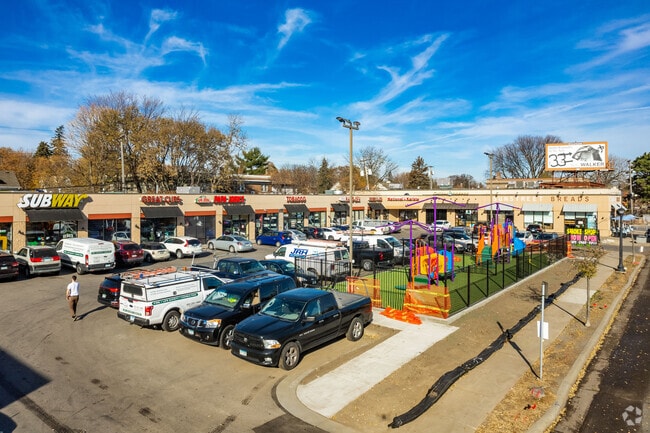
Property Record
4626 Nicollet Ave, Minneapolis, MN 55419


NEARBY LISTINGS FOR SALE OR LEASE
Property Detail
4626 Nicollet Ave
Minneapolis-St. Paul-Bloomington, MN-WI
Swans 2Nd Addn To Mpls
15-028-24-21-0003
LOT 002 BLOCK 001 A SWANS 2ND ADDN TO MPLS 45.00 X 127.00
Commercialnec
Hennepin
X
Minnesota
27053C0367F
2
2024
0.92 AC
2024
Calhoun
110800
Minneapolis/St Paul
20,684 SF
DEMOGRAPHICS near 4626 Nicollet Ave
1 Mile
3 Mile
5 Mile
2024 Total Population
20,741
198,408
460,017
2029 Population
20,119
194,948
453,537
Pop Growth 2024-2029
(3.00%)
(1.74%)
(1.41%)
Average Age
40
38
38
2024 Total Households
8,295
85,233
207,509
HH Growth 2024-2029
(3.22%)
(1.81%)
(1.35%)
Median Household Inc
$114,541
$84,380
$76,310
Avg Household Size
2.40
2.20
2.10
2024 Avg HH Vehicles
2.00
2.00
1.00
Median Home Value
$398,934
$363,002
$363,913
Median Year Built
1945
1948
1958
Nearby Places
Map Layers
Map Styles
 Street
 Aerial
- Restaurants
- Banks
- Shops
- Fitness
- Groceries
PUBLIC TRANSPORTATION
COMMUTER RAIL
Target Field Station (Northstar Corridor - Northstar Commuter Rail)
DRIVE
WALK
Distance
Target Field Station (Northstar Corridor - Northstar Commuter Rail)
11 min
5.2 mi
AIRPORT
Minneapolis-St Paul International/Wold-Chamberlain
DRIVE
WALK
Distance
Minneapolis-St Paul International/Wold-Chamberlain
16 min
8.8 mi
Freight Ports
Port Milwaukee
DRIVE
WALK
Distance
Port Milwaukee
379 min
341.6 mi
SALE & LEASE HISTORY
LISTING DATE
SALE/LEASE

Sep 25, 2016
For Lease
Oct 24, 2017
For Lease
Nearby Properties
Address
Land Use
TOTAL SIZE
Lot Size
Zoning
Address
Land Use
TOTAL SIZE
Lot Size
Zoning
275,782 SF
2.40 AC
C3A
Address
Land Use
TOTAL SIZE
Lot Size
Zoning
659,076 SF
1.45 AC
C3A
Address
Land Use
TOTAL SIZE
Lot Size
Zoning
1.50 AC
Address
Land Use
TOTAL SIZE
Lot Size
Zoning
264,176 SF
1.61 AC
OR2
Address
Land Use
TOTAL SIZE
Lot Size
Zoning
233,886 SF
1.63 AC
R5
Address
Land Use
TOTAL SIZE
Lot Size
Zoning
2.23 AC
Address
Land Use
TOTAL SIZE
Lot Size
Zoning
239,539 SF
1.29 AC
OR2
Address
Land Use
TOTAL SIZE
Lot Size
Zoning
295,036 SF
1.82 AC
R6
Address
Land Use
TOTAL SIZE
Lot Size
Zoning
424,327 SF
2.16 AC
Address
Land Use
TOTAL SIZE
Lot Size
Zoning
346,787 SF
1.94 AC
R3
Address
Land Use
TOTAL SIZE
Lot Size
Zoning
186,691 SF
0.80 AC
C3A
Address
Land Use
TOTAL SIZE
Lot Size
Zoning
160,202 SF
0.74 AC
C3A
Address
Land Use
TOTAL SIZE
Lot Size
Zoning
179,243 SF
1.05 AC
C2
Address
Land Use
TOTAL SIZE
Lot Size
Zoning
186,761 SF
1.14 AC
C3A
Address
Land Use
TOTAL SIZE
Lot Size
Zoning
2.01 AC
Address
Land Use
TOTAL SIZE
Lot Size
Zoning
283,912 SF
2.17 AC
R6
Address
Land Use
TOTAL SIZE
Lot Size
Zoning
307,923 SF
1.33 AC
R5
Address
Land Use
TOTAL SIZE
Lot Size
Zoning
184,111 SF
0.29 AC
C3A
Address
Land Use
TOTAL SIZE
Lot Size
Zoning
170,290 SF
2.28 AC
OR2
Address
Land Use
TOTAL SIZE
Lot Size
Zoning
229,198 SF
1.39 AC
R3
Address
Land Use
TOTAL SIZE
Lot Size
Zoning
Address
Land Use
TOTAL SIZE
Lot Size
Zoning
186,059 SF
0.64 AC
C3A
Address
Land Use
TOTAL SIZE
Lot Size
Zoning
186,322 SF
4.81 AC
OR2
Address
Land Use
TOTAL SIZE
Lot Size
Zoning
219,788 SF
0.90 AC
C3A
Address
Land Use
TOTAL SIZE
Lot Size
Zoning
170,866 SF
4.44 AC
R6
Address
Land Use
TOTAL SIZE
Lot Size
Zoning
Address
Land Use
TOTAL SIZE
Lot Size
Zoning
Address
Land Use
TOTAL SIZE
Lot Size
Zoning
254,517 SF
2.22 AC
C3A
Address
Land Use
TOTAL SIZE
Lot Size
Zoning
Address
Land Use
TOTAL SIZE
Lot Size
Zoning
The World's #1 Commercial Real Estate Marketplace
Connect with us
© 2025 CoStar Group
The information above has been obtained from sources believed reliable. While we do not doubt its accuracy we have not verified it and make no guarantee, warranty or representation about it. It is your responsibility to independently confirm its accuracy and completeness. Any projections, opinions, assumptions, or estimates used are for example only and do not represent the current or future performance of the property. The value of this transaction to you depends on tax and other factors which should be evaluated by your tax, financial, and legal advisors. You and your advisors should conduct a careful, independent investigation of the property to determine to your satisfaction the suitability of the property for your needs.