Property Record
4635 14 Mile Rd Ne, Rockford, MI 49341
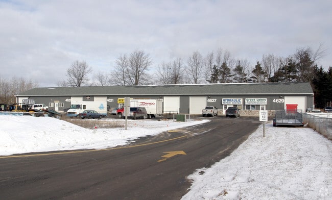

NEARBY LISTINGS FOR SALE OR LEASE
Property Detail
4635 14 Mile Rd Ne
41-06-12-476-001
PART OF SE 1/4 COM 213.0 FT NELY ALONG NLY LINE OF 14 MILE RD /HWY M-57 150 FT WIDE/ FROM INT OF NLY LINE OF SD RD & W LINE
Commercialnec
Kent
X
Michigan
26081C0195D
3.63 AC
2024
Outlying Kent County
2025
West Michigan
010602
Grand Rapids-Wyoming, MI
DEMOGRAPHICS near 4635 14 Mile Rd Ne
1 Mile
3 Mile
5 Mile
2024 Total Population
1,382
10,554
32,548
2029 Population
1,400
10,691
33,006
Pop Growth 2024-2029
+ 1.30%
+ 1.30%
+ 1.41%
Average Age
39
39
39
2024 Total Households
475
3,687
11,712
HH Growth 2024-2029
+ 1.26%
+ 1.30%
+ 1.40%
Median Household Inc
$119,917
$103,226
$94,971
Avg Household Size
2.90
2.80
2.70
2024 Avg HH Vehicles
2.00
2.00
2.00
Median Home Value
$288,541
$275,917
$275,814
Median Year Built
1992
1993
1992
Nearby Places
Map Layers
Map Styles
 Street
 Aerial
- Restaurants
- Banks
- Shops
- Fitness
- Groceries
PUBLIC TRANSPORTATION
AIRPORT
Gerald R Ford International
DRIVE
WALK
Distance
Gerald R Ford International
40 min
26.2 mi
SALE & LEASE HISTORY
LISTING DATE
SALE/LEASE

Jun 14, 2023
For Lease
Nearby Properties
Address
Land Use
TOTAL SIZE
Lot Size
Zoning
Address
Land Use
TOTAL SIZE
Lot Size
Zoning
413,330 SF
20.83 AC
I-1
Address
Land Use
TOTAL SIZE
Lot Size
Zoning
40,800 SF
109.96 AC
IC
Address
Land Use
TOTAL SIZE
Lot Size
Zoning
Address
Land Use
TOTAL SIZE
Lot Size
Zoning
99.87 AC
R4
Address
Land Use
TOTAL SIZE
Lot Size
Zoning
13,955 SF
196.11 AC
MHP
Address
Land Use
TOTAL SIZE
Lot Size
Zoning
64,075 SF
11.13 AC
I-1
Address
Land Use
TOTAL SIZE
Lot Size
Zoning
3,400 SF
8.59 AC
C2
Address
Land Use
TOTAL SIZE
Lot Size
Zoning
36,324 SF
8.29 AC
C2
Address
Land Use
TOTAL SIZE
Lot Size
Zoning
8.86 AC
C2
Address
Land Use
TOTAL SIZE
Lot Size
Zoning
Address
Land Use
TOTAL SIZE
Lot Size
Zoning
66,590 SF
4.06 AC
I-1
Address
Land Use
TOTAL SIZE
Lot Size
Zoning
Address
Land Use
TOTAL SIZE
Lot Size
Zoning
49,647 SF
5.30 AC
I-1
Address
Land Use
TOTAL SIZE
Lot Size
Zoning
68,724 SF
7.53 AC
I-1
Address
Land Use
TOTAL SIZE
Lot Size
Zoning
64,632 SF
3.75 AC
I-1
Address
Land Use
TOTAL SIZE
Lot Size
Zoning
61,816 SF
5.10 AC
H-C
Address
Land Use
TOTAL SIZE
Lot Size
Zoning
1,400 SF
60 AC
I-1
Address
Land Use
TOTAL SIZE
Lot Size
Zoning
23,280 SF
Address
Land Use
TOTAL SIZE
Lot Size
Zoning
56,500 SF
5.94 AC
I-1
Address
Land Use
TOTAL SIZE
Lot Size
Zoning
3.56 AC
C2
Address
Land Use
TOTAL SIZE
Lot Size
Zoning
24,800 SF
3.90 AC
Address
Land Use
TOTAL SIZE
Lot Size
Zoning
16,000 SF
9.83 AC
Address
Land Use
TOTAL SIZE
Lot Size
Zoning
572 SF
16.47 AC
R-4
Address
Land Use
TOTAL SIZE
Lot Size
Zoning
Address
Land Use
TOTAL SIZE
Lot Size
Zoning
8,684 SF
3.54 AC
Address
Land Use
TOTAL SIZE
Lot Size
Zoning
14,653 SF
1.80 AC
H-C
Address
Land Use
TOTAL SIZE
Lot Size
Zoning
31,843 SF
3.48 AC
C2
Address
Land Use
TOTAL SIZE
Lot Size
Zoning
Address
Land Use
TOTAL SIZE
Lot Size
Zoning
13,520 SF
Address
Land Use
TOTAL SIZE
Lot Size
Zoning
The World's #1 Commercial Real Estate Marketplace
Connect with us
© 2026 CoStar Group
The information above has been obtained from sources believed reliable. While we do not doubt its accuracy we have not verified it and make no guarantee, warranty or representation about it. It is your responsibility to independently confirm its accuracy and completeness. Any projections, opinions, assumptions, or estimates used are for example only and do not represent the current or future performance of the property. The value of this transaction to you depends on tax and other factors which should be evaluated by your tax, financial, and legal advisors. You and your advisors should conduct a careful, independent investigation of the property to determine to your satisfaction the suitability of the property for your needs.