Property Record
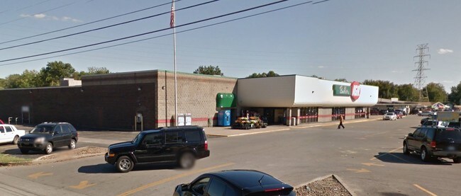
4635 N 1St Ave, Evansville, IN 47710

NEARBY LISTINGS FOR SALE OR LEASE
Property Detail
4635 N 1St Ave
82-06-07-034-082.076-020
PT NW NE 7-6-10
Supermarket
Vanderburgh
X
Indiana
18163C0114E
6.32 AC
2024
Northside/Airport
2024
Evansville
003400
Evansville, IN-KY
60,785 SF
DEMOGRAPHICS near 4635 N 1St Ave
1 Mile
3 Mile
5 Mile
2024 Total Population
7,444
43,337
113,754
2029 Population
7,362
43,632
114,372
Pop Growth 2024-2029
(1.10%)
+ 0.68%
+ 0.54%
Average Age
42
41
40
2024 Total Households
3,295
18,289
48,510
HH Growth 2024-2029
(1.21%)
+ 0.69%
+ 0.59%
Median Household Inc
$53,508
$47,028
$51,950
Avg Household Size
2.20
2.20
2.20
2024 Avg HH Vehicles
2.00
2.00
2.00
Median Home Value
$137,777
$115,705
$141,982
Median Year Built
1963
1960
1961
Nearby Places
Map Layers
Map Styles
 Street
 Aerial
- Restaurants
- Banks
- Shops
- Fitness
- Groceries
PUBLIC TRANSPORTATION
AIRPORT
Evansville Regional
DRIVE
WALK
Distance
Evansville Regional
9 min
3.2 mi
Freight Ports
Port of Toledo
DRIVE
WALK
Distance
Port of Toledo
458 min
390.7 mi
SALE & LEASE HISTORY
LISTING DATE
SALE/LEASE

Jan 27, 2017
For Sale
Nearby Properties
Address
Land Use
TOTAL SIZE
Lot Size
Zoning
Address
Land Use
TOTAL SIZE
Lot Size
Zoning
51,342 SF
4.43 AC
Address
Land Use
TOTAL SIZE
Lot Size
Zoning
21,831 SF
3.03 AC
Address
Land Use
TOTAL SIZE
Lot Size
Zoning
992,266 SF
116.92 AC
Address
Land Use
TOTAL SIZE
Lot Size
Zoning
23,796 SF
17.29 AC
Address
Land Use
TOTAL SIZE
Lot Size
Zoning
223,202 SF
2.28 AC
Address
Land Use
TOTAL SIZE
Lot Size
Zoning
148,186 SF
6.67 AC
Address
Land Use
TOTAL SIZE
Lot Size
Zoning
784,971 SF
15.37 AC
Address
Land Use
TOTAL SIZE
Lot Size
Zoning
20,286 SF
4.57 AC
Address
Land Use
TOTAL SIZE
Lot Size
Zoning
1,936 SF
11.70 AC
Address
Land Use
TOTAL SIZE
Lot Size
Zoning
61,652 SF
15.02 AC
Address
Land Use
TOTAL SIZE
Lot Size
Zoning
311,804 SF
31.94 AC
Address
Land Use
TOTAL SIZE
Lot Size
Zoning
1,053,789 SF
52.82 AC
Address
Land Use
TOTAL SIZE
Lot Size
Zoning
16,292 SF
6.87 AC
Address
Land Use
TOTAL SIZE
Lot Size
Zoning
298,374 SF
18.16 AC
Address
Land Use
TOTAL SIZE
Lot Size
Zoning
5,808 SF
12.20 AC
Address
Land Use
TOTAL SIZE
Lot Size
Zoning
68,706 SF
13.46 AC
Address
Land Use
TOTAL SIZE
Lot Size
Zoning
39,264 SF
45.28 AC
Address
Land Use
TOTAL SIZE
Lot Size
Zoning
5,464 SF
150.50 AC
Address
Land Use
TOTAL SIZE
Lot Size
Zoning
1,700 SF
7.68 AC
Address
Land Use
TOTAL SIZE
Lot Size
Zoning
21,670 SF
13.92 AC
Address
Land Use
TOTAL SIZE
Lot Size
Zoning
4,284 SF
13.14 AC
Address
Land Use
TOTAL SIZE
Lot Size
Zoning
16,104 SF
8.58 AC
Address
Land Use
TOTAL SIZE
Lot Size
Zoning
33,898 SF
2.34 AC
Address
Land Use
TOTAL SIZE
Lot Size
Zoning
464,692 SF
24.75 AC
Address
Land Use
TOTAL SIZE
Lot Size
Zoning
157,596 SF
27.82 AC
Address
Land Use
TOTAL SIZE
Lot Size
Zoning
141,720 SF
5.68 AC
Address
Land Use
TOTAL SIZE
Lot Size
Zoning
461,175 SF
22.84 AC
Address
Land Use
TOTAL SIZE
Lot Size
Zoning
266,552 SF
21.57 AC
Address
Land Use
TOTAL SIZE
Lot Size
Zoning
13.45 AC
Address
Land Use
TOTAL SIZE
Lot Size
Zoning
146,778 SF
14.11 AC
The World's #1 Commercial Real Estate Marketplace
Connect with us
© 2026 CoStar Group
The information above has been obtained from sources believed reliable. While we do not doubt its accuracy we have not verified it and make no guarantee, warranty or representation about it. It is your responsibility to independently confirm its accuracy and completeness. Any projections, opinions, assumptions, or estimates used are for example only and do not represent the current or future performance of the property. The value of this transaction to you depends on tax and other factors which should be evaluated by your tax, financial, and legal advisors. You and your advisors should conduct a careful, independent investigation of the property to determine to your satisfaction the suitability of the property for your needs.