Property Record
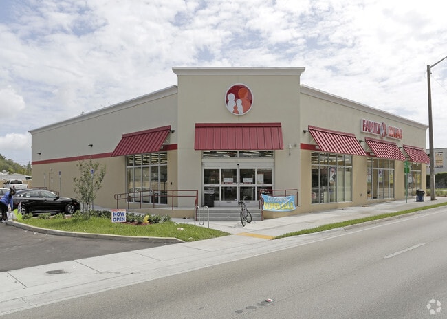
4635 Nw 27Th Ave, Miami, FL 33142


Property Detail
4635 Nw 27Th Ave
30-3122-072-0010
46TH STREET FD PB 171-088 T-23665 TR A LOT SIZE 39370 SQ FT M/L FAU 30 3122 002 0100 & 30 3122- 067-0010 0020 & 0030
Storemultistory
MIAMI/DADE
6051
Florida
B and X Area of moderate flood hazard, usually the area between the limits of the 100-year and 500-year floods.
0.90 AC
2024
Miami
2025
South Florida
001803
Miami-Miami Beach-Kendall, FL
9,315 SF
NEARBY LISTINGS FOR SALE OR LEASE
DEMOGRAPHICS near 4635 Nw 27Th Ave
1 mile
3 mile
5 mile
2025 Total Population
27,730
233,563
676,747
2030 Population
29,893
250,154
726,742
Pop Growth 2025-2030
+ 7.80%
+ 7.10%
+ 7.39%
Average Age
40
41
42
2025 Total Households
9,543
81,964
264,779
HH Growth 2025-2030
+ 7.73%
+ 7.18%
+ 7.67%
Median Household Inc
$40,933
$46,603
$62,194
Avg Household Size
2.80
2.70
2.40
2025 Avg HH Vehicles
1.00
1.00
1.00
Median Home Value
$359,536
$419,449
$491,447
Median Year Built
1964
1963
1972
Nearby Places
Map Layers
Map Styles
 Street
 Aerial
Layers
 Traffic
 Biking
Places
Listings with unknown addresses are not visible on the map
- Restaurants
- Banks
- Shops
- Fitness
- Groceries
PUBLIC TRANSPORTATION
COMMUTER RAIL
Brownsville (Metrorail Green Line - Miami-Dade Transit (Metrorail/Metromover))
Drive
Walk
Distance
Brownsville (Metrorail Green Line - Miami-Dade Transit (Metrorail/Metromover))
0 min
6 min
0.4 mi
Earlington Heights (Metrorail Green Line - Miami-Dade Transit (Metrorail/Metromover))
Drive
Walk
Distance
Earlington Heights (Metrorail Green Line - Miami-Dade Transit (Metrorail/Metromover))
10 min
17 min
0.9 mi
AIRPORT
Miami International
Drive
Walk
Distance
Miami International
16 min
6.6 mi
Fort Lauderdale/Hollywood International
Drive
Walk
Distance
Fort Lauderdale/Hollywood International
33 min
22.8 mi
Freight Ports
Port of Miami
Drive
Walk
Distance
Port of Miami
15 min
7.3 mi
SALE & LEASE HISTORY
LISTING DATE
SALE/LEASE

Oct 24, 2016
For Sale
Dec 19, 2024
For Sale
Nearby Properties
Address
Land Use
TOTAL SIZE
Lot Size
Zoning
Address
Land Use
TOTAL SIZE
Lot Size
Zoning
955,966 SF
38.91 AC
9600
Address
Land Use
TOTAL SIZE
Lot Size
Zoning
928,000 SF
14.30 AC
8000
Address
Land Use
TOTAL SIZE
Lot Size
Zoning
16.13 AC
6100
Address
Land Use
TOTAL SIZE
Lot Size
Zoning
2,789,683 SF
33.23 AC
7300
Address
Land Use
TOTAL SIZE
Lot Size
Zoning
2,403,353 SF
7.37 AC
6100
Address
Land Use
TOTAL SIZE
Lot Size
Zoning
256,089 SF
20.35 AC
7600
Address
Land Use
TOTAL SIZE
Lot Size
Zoning
585,775 SF
1.86 AC
6101
Address
Land Use
TOTAL SIZE
Lot Size
Zoning
570,694 SF
1.37 AC
4604
Address
Land Use
TOTAL SIZE
Lot Size
Zoning
566,165 SF
2.09 AC
6101
Address
Land Use
TOTAL SIZE
Lot Size
Zoning
7.62 AC
7200
Address
Land Use
TOTAL SIZE
Lot Size
Zoning
996,100 SF
3.58 AC
9600
Address
Land Use
TOTAL SIZE
Lot Size
Zoning
627,685 SF
2.06 AC
6100
Address
Land Use
TOTAL SIZE
Lot Size
Zoning
328,554 SF
668.26 AC
8900
Address
Land Use
TOTAL SIZE
Lot Size
Zoning
428,154 SF
1.39 AC
6101
Address
Land Use
TOTAL SIZE
Lot Size
Zoning
596,081 SF
4.33 AC
9600
Address
Land Use
TOTAL SIZE
Lot Size
Zoning
1,700 SF
7.24 AC
7100
Address
Land Use
TOTAL SIZE
Lot Size
Zoning
1,212,604 SF
10.50 AC
9600
Address
Land Use
TOTAL SIZE
Lot Size
Zoning
648,350 SF
9.78 AC
6118
Address
Land Use
TOTAL SIZE
Lot Size
Zoning
545,220 SF
15.32 AC
6100
Address
Land Use
TOTAL SIZE
Lot Size
Zoning
480,664 SF
26.03 AC
9600
Address
Land Use
TOTAL SIZE
Lot Size
Zoning
474,561 SF
1.69 AC
6100
Address
Land Use
TOTAL SIZE
Lot Size
Zoning
499,370 SF
1.45 AC
7000
Address
Land Use
TOTAL SIZE
Lot Size
Zoning
306,775 SF
29.70 AC
7000
Address
Land Use
TOTAL SIZE
Lot Size
Zoning
299,169 SF
1.21 AC
6107
Address
Land Use
TOTAL SIZE
Lot Size
Zoning
451,817 SF
6400
Address
Land Use
TOTAL SIZE
Lot Size
Zoning
763,761 SF
8 AC
6402
Address
Land Use
TOTAL SIZE
Lot Size
Zoning
2 SF
154.10 AC
8900
Address
Land Use
TOTAL SIZE
Lot Size
Zoning
214,154 SF
0.66 AC
6100
Address
Land Use
TOTAL SIZE
Lot Size
Zoning
619,411 SF
7.33 AC
9600
Address
Land Use
TOTAL SIZE
Lot Size
Zoning
367,056 SF
1.26 AC
6100
The World's #1 Commercial Real Estate Marketplace
Connect with us
© 2026 CoStar Group
The information above has been obtained from sources believed reliable. While we do not doubt its accuracy we have not verified it and make no guarantee, warranty or representation about it. It is your responsibility to independently confirm its accuracy and completeness. Any projections, opinions, assumptions, or estimates used are for example only and do not represent the current or future performance of the property. The value of this transaction to you depends on tax and other factors which should be evaluated by your tax, financial, and legal advisors. You and your advisors should conduct a careful, independent investigation of the property to determine to your satisfaction the suitability of the property for your needs.