Property Record
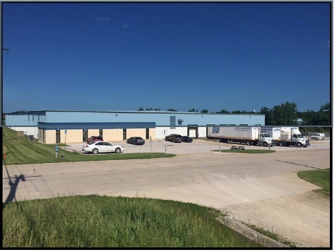
4639 N Interstate Dr, Columbia, MO 65202

Property Detail
4639 N Interstate Dr
12-709-30-00-006-00-01
SUR 428-402 PT SW
Publicstorage
Boone
ML
Missouri
B and X Area of moderate flood hazard, usually the area between the limits of the 100-year and 500-year floods.
5 AC
2025
Columbia/Jefferson City
2025
Other Market Areas
001508
Columbia, MO
60,000 SF
NEARBY LISTINGS FOR SALE OR LEASE
-
-
View all Columbia listings for lease on LoopNet.com
DEMOGRAPHICS near 4639 N Interstate Dr
1 mile
3 mile
5 mile
2025 Total Population
6,577
32,205
94,913
2030 Population
6,806
33,570
98,739
Pop Growth 2025-2030
+ 3.48%
+ 4.24%
+ 4.03%
Average Age
36
37
35
2025 Total Households
2,454
13,231
38,368
HH Growth 2025-2030
+ 3.67%
+ 4.45%
+ 4.38%
Median Household Inc
$92,950
$70,141
$60,211
Avg Household Size
2.50
2.30
2.20
2025 Avg HH Vehicles
2.00
2.00
2.00
Median Home Value
$221,061
$200,190
$218,754
Median Year Built
1999
1991
1986
Nearby Places
Map Layers
Map Styles
 Street
 Aerial
Layers
 Traffic
 Biking
Places
Listings with unknown addresses are not visible on the map
- Restaurants
- Banks
- Shops
- Fitness
- Groceries
PUBLIC TRANSPORTATION
AIRPORT
Columbia Regional
Drive
Walk
Distance
Columbia Regional
22 min
16.9 mi
SALE & LEASE HISTORY
LISTING DATE
SALE/LEASE

Sep 25, 2016
For Lease
Sep 25, 2016
For Lease
Mar 06, 2024
For Lease
Nearby Properties
Address
Land Use
TOTAL SIZE
Lot Size
Zoning
Address
Land Use
TOTAL SIZE
Lot Size
Zoning
321,295 SF
79.83 AC
Address
Land Use
TOTAL SIZE
Lot Size
Zoning
87,060 SF
0.37 AC
R3
Address
Land Use
TOTAL SIZE
Lot Size
Zoning
184,413 SF
17.63 AC
CP
Address
Land Use
TOTAL SIZE
Lot Size
Zoning
259,538 SF
26.78 AC
M1
Address
Land Use
TOTAL SIZE
Lot Size
Zoning
56,305 SF
12 AC
CP
Address
Land Use
TOTAL SIZE
Lot Size
Zoning
151,550 SF
53.69 AC
MC
Address
Land Use
TOTAL SIZE
Lot Size
Zoning
35,436 SF
19.09 AC
Address
Land Use
TOTAL SIZE
Lot Size
Zoning
83,978 SF
8.60 AC
C3
Address
Land Use
TOTAL SIZE
Lot Size
Zoning
167,255 SF
14.14 AC
Address
Land Use
TOTAL SIZE
Lot Size
Zoning
63,121 SF
11.28 AC
Address
Land Use
TOTAL SIZE
Lot Size
Zoning
41,600 SF
5.42 AC
Address
Land Use
TOTAL SIZE
Lot Size
Zoning
30,872 SF
4.70 AC
Address
Land Use
TOTAL SIZE
Lot Size
Zoning
276,234 SF
14.78 AC
C3
Address
Land Use
TOTAL SIZE
Lot Size
Zoning
5,200 SF
11 AC
M1
Address
Land Use
TOTAL SIZE
Lot Size
Zoning
88,738 SF
3.55 AC
CP
Address
Land Use
TOTAL SIZE
Lot Size
Zoning
120,052 SF
13.59 AC
C3
Address
Land Use
TOTAL SIZE
Lot Size
Zoning
65,759 SF
4.90 AC
MC
Address
Land Use
TOTAL SIZE
Lot Size
Zoning
113.90 AC
M1
Address
Land Use
TOTAL SIZE
Lot Size
Zoning
50,852 SF
10.64 AC
C3
Address
Land Use
TOTAL SIZE
Lot Size
Zoning
117,114 SF
7.66 AC
Address
Land Use
TOTAL SIZE
Lot Size
Zoning
87,255 SF
3.41 AC
Address
Land Use
TOTAL SIZE
Lot Size
Zoning
51,224 SF
7.42 AC
C1
Address
Land Use
TOTAL SIZE
Lot Size
Zoning
63,165 SF
6.53 AC
M1
Address
Land Use
TOTAL SIZE
Lot Size
Zoning
60,000 SF
6.91 AC
Address
Land Use
TOTAL SIZE
Lot Size
Zoning
36,410 SF
4.40 AC
C3
Address
Land Use
TOTAL SIZE
Lot Size
Zoning
3,078 SF
9.41 AC
R4
Address
Land Use
TOTAL SIZE
Lot Size
Zoning
172,056 SF
31.81 AC
MC
Address
Land Use
TOTAL SIZE
Lot Size
Zoning
100,322 SF
5.67 AC
ML
Address
Land Use
TOTAL SIZE
Lot Size
Zoning
87,408 SF
13.26 AC
Address
Land Use
TOTAL SIZE
Lot Size
Zoning
63,370 SF
10.60 AC
C3
The World's #1 Commercial Real Estate Marketplace
Connect with us
© 2026 CoStar Group
The information above has been obtained from sources believed reliable. While we do not doubt its accuracy we have not verified it and make no guarantee, warranty or representation about it. It is your responsibility to independently confirm its accuracy and completeness. Any projections, opinions, assumptions, or estimates used are for example only and do not represent the current or future performance of the property. The value of this transaction to you depends on tax and other factors which should be evaluated by your tax, financial, and legal advisors. You and your advisors should conduct a careful, independent investigation of the property to determine to your satisfaction the suitability of the property for your needs.