Property Record
464073 State Road 200, Yulee, FL 32097
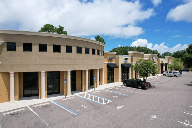

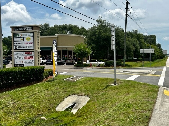


Property Detail
464073 State Road 200
24-2N-28-0000-0018-0000
PT GOVT LOT 3 OF SEC 24-2N-28E IN OR 2125/802 BEING PARCELS 1 & 2
Regionalshoppingcenterormallwithanchorstore
NASSAU
CI
Florida
B and X Area of moderate flood hazard, usually the area between the limits of the 100-year and 500-year floods.
3
2025
2.88 AC
2025
Nassau County
050308
Jacksonville (Florida)
33,818 SF
Jacksonville, FL
NEARBY LISTINGS FOR SALE OR LEASE
DEMOGRAPHICS near 464073 State Road 200
1 mile
3 mile
5 mile
2025 Total Population
3,638
20,560
45,091
2030 Population
4,051
23,022
50,508
Pop Growth 2025-2030
+ 11.35%
+ 11.97%
+ 12.01%
Average Age
46
43
45
2025 Total Households
1,532
8,153
18,203
HH Growth 2025-2030
+ 11.42%
+ 12.07%
+ 12.19%
Median Household Inc
$76,165
$99,927
$92,343
Avg Household Size
2.40
2.50
2.40
2025 Avg HH Vehicles
2.00
2.00
2.00
Median Home Value
$436,938
$442,857
$429,165
Median Year Built
2006
2009
2005
Nearby Places
Map Layers
Map Styles
 Street
 Aerial
Layers
 Traffic
 Biking
Places
Listings with unknown addresses are not visible on the map
- Restaurants
- Banks
- Shops
- Fitness
- Groceries
PUBLIC TRANSPORTATION
AIRPORT
Jacksonville International
Drive
Walk
Distance
Jacksonville International
32 min
20.2 mi
Freight Ports
Jacksonville Port
Drive
Walk
Distance
Jacksonville Port
42 min
29.7 mi
SALE & LEASE HISTORY
LISTING DATE
SALE/LEASE

Sep 25, 2016
For Lease
Oct 26, 2022
For Lease
Oct 17, 2016
For Lease
Jun 16, 2023
For Lease
Feb 03, 2020
For Lease
Dec 22, 2016
For Lease
Dec 07, 2017
For Lease
Aug 04, 2017
For Lease
Nearby Properties
Address
Land Use
TOTAL SIZE
Lot Size
Zoning
Address
Land Use
TOTAL SIZE
Lot Size
Zoning
327,682 SF
24.09 AC
RG-2
Address
Land Use
TOTAL SIZE
Lot Size
Zoning
282,898 SF
22.88 AC
RG-2
Address
Land Use
TOTAL SIZE
Lot Size
Zoning
493,661 SF
49.08 AC
PUD
Address
Land Use
TOTAL SIZE
Lot Size
Zoning
210,010 SF
19.36 AC
RG-1
Address
Land Use
TOTAL SIZE
Lot Size
Zoning
134,407 SF
2.77 AC
PUD
Address
Land Use
TOTAL SIZE
Lot Size
Zoning
63,363 SF
10.41 AC
PUD
Address
Land Use
TOTAL SIZE
Lot Size
Zoning
66,417 SF
8.75 AC
PUD
Address
Land Use
TOTAL SIZE
Lot Size
Zoning
163,686 SF
28.08 AC
CI
Address
Land Use
TOTAL SIZE
Lot Size
Zoning
105,105 SF
2.65 AC
CG
Address
Land Use
TOTAL SIZE
Lot Size
Zoning
145,581 SF
3 AC
CG
Address
Land Use
TOTAL SIZE
Lot Size
Zoning
59,770 SF
8.51 AC
GPU
Address
Land Use
TOTAL SIZE
Lot Size
Zoning
48,863 SF
40.38 AC
RG-1
Address
Land Use
TOTAL SIZE
Lot Size
Zoning
125,733 SF
10.89 AC
IW
Address
Land Use
TOTAL SIZE
Lot Size
Zoning
109,094 SF
11.03 AC
IW
Address
Land Use
TOTAL SIZE
Lot Size
Zoning
44,933 SF
5.03 AC
PUD
Address
Land Use
TOTAL SIZE
Lot Size
Zoning
24.41 AC
IW
Address
Land Use
TOTAL SIZE
Lot Size
Zoning
35,660 SF
10.05 AC
OR
Address
Land Use
TOTAL SIZE
Lot Size
Zoning
44,734 SF
9.59 AC
OR
Address
Land Use
TOTAL SIZE
Lot Size
Zoning
95,332 SF
23.03 AC
PUD
Address
Land Use
TOTAL SIZE
Lot Size
Zoning
35,296 SF
6.72 AC
PUD
Address
Land Use
TOTAL SIZE
Lot Size
Zoning
32,449 SF
7.57 AC
CI
Address
Land Use
TOTAL SIZE
Lot Size
Zoning
48,460 SF
14.60 AC
PUD
Address
Land Use
TOTAL SIZE
Lot Size
Zoning
50,286 SF
4.39 AC
PUD
Address
Land Use
TOTAL SIZE
Lot Size
Zoning
35,463 SF
9.08 AC
PUD
Address
Land Use
TOTAL SIZE
Lot Size
Zoning
12,927 SF
8.03 AC
OR
Address
Land Use
TOTAL SIZE
Lot Size
Zoning
71.76 AC
OR
Address
Land Use
TOTAL SIZE
Lot Size
Zoning
48,321 SF
8.18 AC
IW
Address
Land Use
TOTAL SIZE
Lot Size
Zoning
28,738 SF
3.72 AC
CG
Address
Land Use
TOTAL SIZE
Lot Size
Zoning
19,000 SF
21.27 AC
PUD
The World's #1 Commercial Real Estate Marketplace
Connect with us
© 2026 CoStar Group
The information above has been obtained from sources believed reliable. While we do not doubt its accuracy we have not verified it and make no guarantee, warranty or representation about it. It is your responsibility to independently confirm its accuracy and completeness. Any projections, opinions, assumptions, or estimates used are for example only and do not represent the current or future performance of the property. The value of this transaction to you depends on tax and other factors which should be evaluated by your tax, financial, and legal advisors. You and your advisors should conduct a careful, independent investigation of the property to determine to your satisfaction the suitability of the property for your needs.