Property Record
4644 Peoria St, Denver, CO 80239


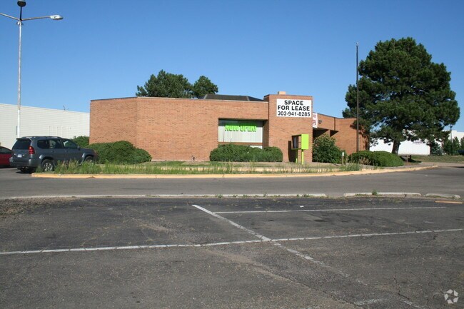

Property Detail
4644 Peoria St
1242-00-080
MONTBELLO #8 B1 BEG 60FT E & 1287.88FT N SW COR NW/4 S24/T3/R67 TH N 175.76FT E 200FT N 60.34FT S40.0011E 285.19F S50W 92.19FT SE CV/R 66.47FT S12.5925W 45.11FT N83.1626W
Storebuilding
DENVER
B-8
Colorado
2025
1.67 AC
2025
East I-70/Montbello
008312
Denver
11,972 SF
Denver-Aurora-Centennial, CO
NEARBY LISTINGS FOR SALE OR LEASE
DEMOGRAPHICS near 4644 Peoria St
1 mile
3 mile
5 mile
2025 Total Population
11,489
103,721
272,025
2030 Population
11,661
106,614
279,644
Pop Growth 2025-2030
+ 1.50%
+ 2.79%
+ 2.80%
Average Age
35
35
36
2025 Total Households
3,396
33,110
92,613
HH Growth 2025-2030
+ 1.62%
+ 3.14%
+ 3.01%
Median Household Inc
$72,378
$91,438
$84,307
Avg Household Size
3.10
3.00
2.80
2025 Avg HH Vehicles
2.00
2.00
2.00
Median Home Value
$376,999
$492,463
$476,509
Median Year Built
1979
1997
1984
Nearby Places
Map Layers
Map Styles
 Street
 Aerial
Layers
 Traffic
 Biking
Places
Listings with unknown addresses are not visible on the map
- Restaurants
- Banks
- Shops
- Fitness
- Groceries
PUBLIC TRANSPORTATION
COMMUTER RAIL
Peoria Station Track 1 (Union Station to Denver Airport Station - Regional Transportation District)
Drive
Walk
Distance
Peoria Station Track 1 (Union Station to Denver Airport Station - Regional Transportation District)
3 min
1.3 mi
Peoria Station Track 2 (Union Station to Denver Airport Station - Regional Transportation District)
Drive
Walk
Distance
Peoria Station Track 2 (Union Station to Denver Airport Station - Regional Transportation District)
3 min
1.3 mi
AIRPORT
Denver International
Drive
Walk
Distance
Denver International
20 min
15.3 mi
Freight Ports
Tulsa Port Of Catoosa
Drive
Walk
Distance
Tulsa Port Of Catoosa
717 min
700.8 mi
Nearby Properties
Address
Land Use
TOTAL SIZE
Lot Size
Zoning
Address
Land Use
TOTAL SIZE
Lot Size
Zoning
368,450 SF
48.59 AC
Address
Land Use
TOTAL SIZE
Lot Size
Zoning
353,829 SF
4.51 AC
Address
Land Use
TOTAL SIZE
Lot Size
Zoning
880,442 SF
67.95 AC
I-B
Address
Land Use
TOTAL SIZE
Lot Size
Zoning
244,271 SF
15.30 AC
Address
Land Use
TOTAL SIZE
Lot Size
Zoning
525,050 SF
105.06 AC
Address
Land Use
TOTAL SIZE
Lot Size
Zoning
169,941 SF
4.08 AC
I-B
Address
Land Use
TOTAL SIZE
Lot Size
Zoning
723,053 SF
32.44 AC
M-IMX-12
Address
Land Use
TOTAL SIZE
Lot Size
Zoning
269,025 SF
18.86 AC
M-RX-5
Address
Land Use
TOTAL SIZE
Lot Size
Zoning
45,803 SF
1.96 AC
M-IMX-5
Address
Land Use
TOTAL SIZE
Lot Size
Zoning
335,757 SF
36.88 AC
CMP-EI2
Address
Land Use
TOTAL SIZE
Lot Size
Zoning
102,444 SF
3.76 AC
GTWY
Address
Land Use
TOTAL SIZE
Lot Size
Zoning
691,200 SF
38.09 AC
Address
Land Use
TOTAL SIZE
Lot Size
Zoning
3,573.99 AC
A3
Address
Land Use
TOTAL SIZE
Lot Size
Zoning
109,982 SF
2.92 AC
M-IMX-12
Address
Land Use
TOTAL SIZE
Lot Size
Zoning
390,822 SF
13.47 AC
O-1
Address
Land Use
TOTAL SIZE
Lot Size
Zoning
273,184 SF
1.89 AC
Address
Land Use
TOTAL SIZE
Lot Size
Zoning
6.97 AC
C-MU-20
Address
Land Use
TOTAL SIZE
Lot Size
Zoning
651,423 SF
82.50 AC
I-2
Address
Land Use
TOTAL SIZE
Lot Size
Zoning
131,544 SF
3.92 AC
Address
Land Use
TOTAL SIZE
Lot Size
Zoning
646,975 SF
32.60 AC
M-IMX-8
Address
Land Use
TOTAL SIZE
Lot Size
Zoning
185,207 SF
9.94 AC
C-MU-20
Address
Land Use
TOTAL SIZE
Lot Size
Zoning
269,622 SF
12.90 AC
Address
Land Use
TOTAL SIZE
Lot Size
Zoning
124,526 SF
10 AC
M-RH-3
Address
Land Use
TOTAL SIZE
Lot Size
Zoning
268,268 SF
29.99 AC
I-B
Address
Land Use
TOTAL SIZE
Lot Size
Zoning
58,997 SF
2.05 AC
S-CC-5X
Address
Land Use
TOTAL SIZE
Lot Size
Zoning
400,000 SF
22.91 AC
I-0
Address
Land Use
TOTAL SIZE
Lot Size
Zoning
178,235 SF
1.38 AC
RFBAD
Address
Land Use
TOTAL SIZE
Lot Size
Zoning
92,598 SF
2.78 AC
G-TW
Address
Land Use
TOTAL SIZE
Lot Size
Zoning
238,845 SF
1.70 AC
Address
Land Use
TOTAL SIZE
Lot Size
Zoning
624,019 SF
4.09 AC
The World's #1 Commercial Real Estate Marketplace
Connect with us
© 2026 CoStar Group
The information above has been obtained from sources believed reliable. While we do not doubt its accuracy we have not verified it and make no guarantee, warranty or representation about it. It is your responsibility to independently confirm its accuracy and completeness. Any projections, opinions, assumptions, or estimates used are for example only and do not represent the current or future performance of the property. The value of this transaction to you depends on tax and other factors which should be evaluated by your tax, financial, and legal advisors. You and your advisors should conduct a careful, independent investigation of the property to determine to your satisfaction the suitability of the property for your needs.