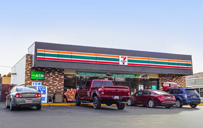
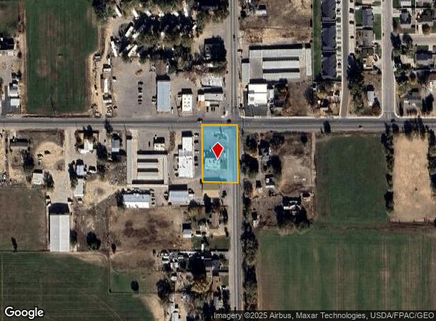
Property Record
465 N 2500 W, Vernal, UT 84078

NEARBY LISTINGS FOR SALE OR LEASE
-
-
View all Vernal listings for sale on LoopNet.com
Property Detail
465 N 2500 W
04:118:0035
BEG AT THE NE CORNER OF SEC 20, T4S, R21E, SLM, TH S 01*5723" E ALG THE E LN OF SEC 20, A DISTANCE OF 239.00 FT; TH S
Miscellaneous
Uintah
X
Utah
49047C0655D
0.80 AC
2024
Utah North Area
2024
Other Market Areas
968301
Vernal, UT
DEMOGRAPHICS near 465 N 2500 W
1 Mile
3 Mile
5 Mile
2024 Total Population
2,170
19,855
27,662
2029 Population
2,374
21,878
30,452
Pop Growth 2024-2029
+ 9.40%
+ 10.19%
+ 10.09%
Average Age
35
34
34
2024 Total Households
722
6,911
9,543
HH Growth 2024-2029
+ 8.86%
+ 9.84%
+ 9.72%
Median Household Inc
$75,456
$61,164
$61,348
Avg Household Size
3.00
2.80
2.90
2024 Avg HH Vehicles
2.00
2.00
2.00
Median Home Value
$384,343
$267,167
$269,230
Median Year Built
1990
1987
1991
Nearby Places
Map Layers
Map Styles
 Street
 Aerial
- Restaurants
- Banks
- Shops
- Fitness
- Groceries
SALE & LEASE HISTORY
LISTING DATE
SALE/LEASE

Nov 15, 2019
For Sale
Nearby Properties
Address
Land Use
TOTAL SIZE
Lot Size
Zoning
Address
Land Use
TOTAL SIZE
Lot Size
Zoning
115,697 SF
4.23 AC
Address
Land Use
TOTAL SIZE
Lot Size
Zoning
13.52 AC
Address
Land Use
TOTAL SIZE
Lot Size
Zoning
186,357 SF
10.19 AC
Address
Land Use
TOTAL SIZE
Lot Size
Zoning
8.33 AC
Address
Land Use
TOTAL SIZE
Lot Size
Zoning
7.09 AC
Address
Land Use
TOTAL SIZE
Lot Size
Zoning
1.87 AC
Address
Land Use
TOTAL SIZE
Lot Size
Zoning
72,730 SF
1.70 AC
Address
Land Use
TOTAL SIZE
Lot Size
Zoning
Address
Land Use
TOTAL SIZE
Lot Size
Zoning
Address
Land Use
TOTAL SIZE
Lot Size
Zoning
3.07 AC
Address
Land Use
TOTAL SIZE
Lot Size
Zoning
45,183 SF
2 AC
Address
Land Use
TOTAL SIZE
Lot Size
Zoning
7.30 AC
Address
Land Use
TOTAL SIZE
Lot Size
Zoning
2.86 AC
Address
Land Use
TOTAL SIZE
Lot Size
Zoning
Address
Land Use
TOTAL SIZE
Lot Size
Zoning
27,275 SF
3.24 AC
Address
Land Use
TOTAL SIZE
Lot Size
Zoning
42,946 SF
3.94 AC
Address
Land Use
TOTAL SIZE
Lot Size
Zoning
3.15 AC
Address
Land Use
TOTAL SIZE
Lot Size
Zoning
1.40 AC
Address
Land Use
TOTAL SIZE
Lot Size
Zoning
44,235 SF
3.94 AC
Address
Land Use
TOTAL SIZE
Lot Size
Zoning
4.47 AC
Address
Land Use
TOTAL SIZE
Lot Size
Zoning
Address
Land Use
TOTAL SIZE
Lot Size
Zoning
3.03 AC
Address
Land Use
TOTAL SIZE
Lot Size
Zoning
13,696 SF
2.01 AC
Address
Land Use
TOTAL SIZE
Lot Size
Zoning
4.99 AC
Address
Land Use
TOTAL SIZE
Lot Size
Zoning
6,572 SF
1.36 AC
Address
Land Use
TOTAL SIZE
Lot Size
Zoning
1,820 SF
13.45 AC
Address
Land Use
TOTAL SIZE
Lot Size
Zoning
1.30 AC
Address
Land Use
TOTAL SIZE
Lot Size
Zoning
Address
Land Use
TOTAL SIZE
Lot Size
Zoning
3.12 AC
Address
Land Use
TOTAL SIZE
Lot Size
Zoning
3.76 AC
The World's #1 Commercial Real Estate Marketplace
Connect with us
© 2025 CoStar Group
The information above has been obtained from sources believed reliable. While we do not doubt its accuracy we have not verified it and make no guarantee, warranty or representation about it. It is your responsibility to independently confirm its accuracy and completeness. Any projections, opinions, assumptions, or estimates used are for example only and do not represent the current or future performance of the property. The value of this transaction to you depends on tax and other factors which should be evaluated by your tax, financial, and legal advisors. You and your advisors should conduct a careful, independent investigation of the property to determine to your satisfaction the suitability of the property for your needs.