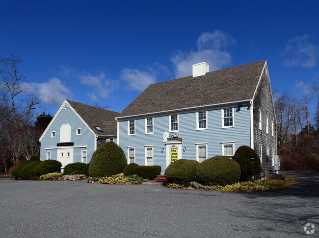
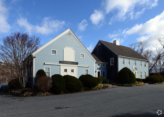
Property Record
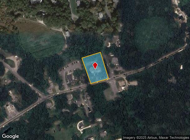
4650 Falmouth Rd, Cotuit, MA 02635
NEARBY LISTINGS FOR SALE OR LEASE
-
-
View all Cotuit listings for sale on LoopNet.com
Property Detail
4650 Falmouth Rd
COTU-000010-000000-000008-000002
Barnstable
Officebuilding
Massachusetts
X
8002
25001C0539J
1.06 AC
2025
Cape Cod
2025
Other Market Areas
013200
Barnstable Town, MA
7,014 SF
DEMOGRAPHICS near 4650 Falmouth Rd
1 Mile
3 Mile
5 Mile
2024 Total Population
2,730
17,333
42,132
2029 Population
2,757
17,552
42,837
Pop Growth 2024-2029
+ 0.99%
+ 1.26%
+ 1.67%
Average Age
47
48
48
2024 Total Households
1,109
7,295
17,865
HH Growth 2024-2029
+ 0.81%
+ 1.06%
+ 1.72%
Median Household Inc
$89,268
$91,628
$98,363
Avg Household Size
2.40
2.30
2.30
2024 Avg HH Vehicles
2.00
2.00
2.00
Median Home Value
$464,338
$476,052
$478,382
Median Year Built
1984
1984
1984
Nearby Places
Map Layers
Map Styles
 Street
 Aerial
- Restaurants
- Banks
- Shops
- Fitness
- Groceries
PUBLIC TRANSPORTATION
COMMUTER RAIL
Hyannis (CapeFLYER - Cape Cod Regional Transit Authority)
DRIVE
WALK
Distance
Hyannis (CapeFLYER - Cape Cod Regional Transit Authority)
17 min
9.5 mi
AIRPORT
Martha's Vineyard
DRIVE
WALK
Distance
Martha's Vineyard
89 min
29.4 mi
Freight Ports
Port of New Bedford Harbor
DRIVE
WALK
Distance
Port of New Bedford Harbor
62 min
43.6 mi
Nearby Properties
Address
Land Use
TOTAL SIZE
Lot Size
Zoning
Address
Land Use
TOTAL SIZE
Lot Size
Zoning
12,713 SF
29.28 AC
C1
Address
Land Use
TOTAL SIZE
Lot Size
Zoning
10.94 AC
R3
Address
Land Use
TOTAL SIZE
Lot Size
Zoning
9 AC
C1
Address
Land Use
TOTAL SIZE
Lot Size
Zoning
15.10 AC
C1
Address
Land Use
TOTAL SIZE
Lot Size
Zoning
3.28 AC
RF
Address
Land Use
TOTAL SIZE
Lot Size
Zoning
24.40 AC
R3
Address
Land Use
TOTAL SIZE
Lot Size
Zoning
65,930 SF
3.97 AC
C1
Address
Land Use
TOTAL SIZE
Lot Size
Zoning
6.44 AC
RF
Address
Land Use
TOTAL SIZE
Lot Size
Zoning
8,472 SF
14.29 AC
R
Address
Land Use
TOTAL SIZE
Lot Size
Zoning
6,460 SF
9 AC
RF
Address
Land Use
TOTAL SIZE
Lot Size
Zoning
2,429 SF
67.57 AC
R
Address
Land Use
TOTAL SIZE
Lot Size
Zoning
4.66 AC
R
Address
Land Use
TOTAL SIZE
Lot Size
Zoning
27.80 AC
R3
Address
Land Use
TOTAL SIZE
Lot Size
Zoning
13.30 AC
I1
Address
Land Use
TOTAL SIZE
Lot Size
Zoning
8,544 SF
20.31 AC
R3
Address
Land Use
TOTAL SIZE
Lot Size
Zoning
6.27 AC
R3
Address
Land Use
TOTAL SIZE
Lot Size
Zoning
Address
Land Use
TOTAL SIZE
Lot Size
Zoning
9,162 SF
3.11 AC
RF
Address
Land Use
TOTAL SIZE
Lot Size
Zoning
1.34 AC
RF
Address
Land Use
TOTAL SIZE
Lot Size
Zoning
3.92 AC
R
Address
Land Use
TOTAL SIZE
Lot Size
Zoning
7,528 SF
2.20 AC
RF
Address
Land Use
TOTAL SIZE
Lot Size
Zoning
2.32 AC
RF
Address
Land Use
TOTAL SIZE
Lot Size
Zoning
1.52 AC
RF;RF-
Address
Land Use
TOTAL SIZE
Lot Size
Zoning
34.48 AC
R
Address
Land Use
TOTAL SIZE
Lot Size
Zoning
0.28 AC
RF
Address
Land Use
TOTAL SIZE
Lot Size
Zoning
7.55 AC
VB-A;S
Address
Land Use
TOTAL SIZE
Lot Size
Zoning
69,251 SF
7.06 AC
S&D;RF
Address
Land Use
TOTAL SIZE
Lot Size
Zoning
6,226 SF
2.85 AC
Address
Land Use
TOTAL SIZE
Lot Size
Zoning
158.42 AC
R
Address
Land Use
TOTAL SIZE
Lot Size
Zoning
2.45 AC
RC;RF-
The World's #1 Commercial Real Estate Marketplace
Connect with us
© 2025 CoStar Group
The information above has been obtained from sources believed reliable. While we do not doubt its accuracy we have not verified it and make no guarantee, warranty or representation about it. It is your responsibility to independently confirm its accuracy and completeness. Any projections, opinions, assumptions, or estimates used are for example only and do not represent the current or future performance of the property. The value of this transaction to you depends on tax and other factors which should be evaluated by your tax, financial, and legal advisors. You and your advisors should conduct a careful, independent investigation of the property to determine to your satisfaction the suitability of the property for your needs.