Property Record
4650 S Hampton Rd, Dallas, TX 75232


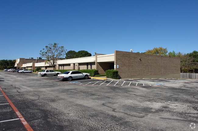
Property Detail
4650 S Hampton Rd
00000502211000000
BLK 6050 PT TR 9 ACS 2.384 ADJ BLK 13/6049 INT201200197060 DD07062012 CO-DC 6050 000 00900 2006050 000
Officebuilding
DALLAS
Z239
Texas
B and X Area of moderate flood hazard, usually the area between the limits of the 100-year and 500-year floods.
9
2024
2.38 AC
2025
Southwest Dallas
011004
Dallas/Ft Worth
30,496 SF
Dallas-Fort Worth-Arlington, TX
NEARBY LISTINGS FOR SALE OR LEASE
DEMOGRAPHICS near 4650 S Hampton Rd
1 mile
3 mile
5 mile
2025 Total Population
9,865
122,827
303,271
2030 Population
10,069
125,685
311,979
Pop Growth 2025-2030
+ 2.07%
+ 2.33%
+ 2.87%
Average Age
40
37
37
2025 Total Households
3,641
41,080
100,793
HH Growth 2025-2030
+ 1.95%
+ 2.30%
+ 2.92%
Median Household Inc
$65,146
$54,132
$57,077
Avg Household Size
2.60
2.90
2.90
2025 Avg HH Vehicles
2.00
2.00
2.00
Median Home Value
$264,237
$243,181
$245,993
Median Year Built
1965
1969
1969
Nearby Places
Map Layers
Map Styles
 Street
 Aerial
Transit
 Traffic
 Biking
Places
Listings with unknown addresses are not visible on the map
- Restaurants
- Banks
- Shops
- Fitness
- Groceries
PUBLIC TRANSPORTATION
COMMUTER RAIL
Drive
Walk
Distance
13 min
8.9 mi
AIRPORT
Dallas Love Field
Drive
Walk
Distance
Dallas Love Field
23 min
13.9 mi
Dallas-Fort Worth International
Drive
Walk
Distance
Dallas-Fort Worth International
34 min
25.4 mi
SALE & LEASE HISTORY
LISTING DATE
SALE/LEASE

Jul 12, 2023
For Lease
Jan 04, 2026
For Lease
Nearby Properties
Address
Land Use
TOTAL SIZE
Lot Size
Zoning
Address
Land Use
TOTAL SIZE
Lot Size
Zoning
271,956 SF
23.18 AC
Z298
Address
Land Use
TOTAL SIZE
Lot Size
Zoning
344,801 SF
7.24 AC
Z125
Address
Land Use
TOTAL SIZE
Lot Size
Zoning
192,086 SF
27.05 AC
Z125
Address
Land Use
TOTAL SIZE
Lot Size
Zoning
399,458 SF
24.51 AC
MF2
Address
Land Use
TOTAL SIZE
Lot Size
Zoning
552,991 SF
34.27 AC
Z164
Address
Land Use
TOTAL SIZE
Lot Size
Zoning
374,400 SF
6.15 AC
Z150
Address
Land Use
TOTAL SIZE
Lot Size
Zoning
532,726 SF
64.28 AC
Z248
Address
Land Use
TOTAL SIZE
Lot Size
Zoning
344,952 SF
14.39 AC
Z239
Address
Land Use
TOTAL SIZE
Lot Size
Zoning
389,900 SF
22.88 AC
Z298
Address
Land Use
TOTAL SIZE
Lot Size
Zoning
131,904 SF
11.99 AC
Z297
Address
Land Use
TOTAL SIZE
Lot Size
Zoning
414,118 SF
49.01 AC
Z294
Address
Land Use
TOTAL SIZE
Lot Size
Zoning
187,130 SF
15.39 AC
Z163
Address
Land Use
TOTAL SIZE
Lot Size
Zoning
220,975 SF
10.52 AC
Z151
Address
Land Use
TOTAL SIZE
Lot Size
Zoning
173,856 SF
30.94 AC
Z163
Address
Land Use
TOTAL SIZE
Lot Size
Zoning
235,897 SF
7.97 AC
Z150
Address
Land Use
TOTAL SIZE
Lot Size
Zoning
312,180 SF
22.71 AC
Z163
Address
Land Use
TOTAL SIZE
Lot Size
Zoning
142,616 SF
13.99 AC
Z125
Address
Land Use
TOTAL SIZE
Lot Size
Zoning
273,300 SF
12.52 AC
Z164
Address
Land Use
TOTAL SIZE
Lot Size
Zoning
213,351 SF
9.88 AC
Z164
Address
Land Use
TOTAL SIZE
Lot Size
Zoning
187,296 SF
9.93 AC
Z163
Address
Land Use
TOTAL SIZE
Lot Size
Zoning
216,983 SF
11.25 AC
Z163
Address
Land Use
TOTAL SIZE
Lot Size
Zoning
96,401 SF
12.97 AC
Z248
Address
Land Use
TOTAL SIZE
Lot Size
Zoning
243,554 SF
11.13 AC
Z163
Address
Land Use
TOTAL SIZE
Lot Size
Zoning
178,050 SF
7.38 AC
Z164
Address
Land Use
TOTAL SIZE
Lot Size
Zoning
176,388 SF
6.94 AC
Z150
Address
Land Use
TOTAL SIZE
Lot Size
Zoning
168,106 SF
37.51 AC
Z298
Address
Land Use
TOTAL SIZE
Lot Size
Zoning
172,726 SF
12.77 AC
Z412
Address
Land Use
TOTAL SIZE
Lot Size
Zoning
151,850 SF
8.70 AC
Z248
Address
Land Use
TOTAL SIZE
Lot Size
Zoning
249,176 SF
11.72 AC
Z163
Address
Land Use
TOTAL SIZE
Lot Size
Zoning
1,097,024 SF
46.65 AC
Z115
The World's #1 Commercial Real Estate Marketplace
Connect with us
© 2026 CoStar Group
The information above has been obtained from sources believed reliable. While we do not doubt its accuracy we have not verified it and make no guarantee, warranty or representation about it. It is your responsibility to independently confirm its accuracy and completeness. Any projections, opinions, assumptions, or estimates used are for example only and do not represent the current or future performance of the property. The value of this transaction to you depends on tax and other factors which should be evaluated by your tax, financial, and legal advisors. You and your advisors should conduct a careful, independent investigation of the property to determine to your satisfaction the suitability of the property for your needs.