Property Record
4650 W Oakey Blvd, Las Vegas, NV 89102

NEARBY LISTINGS FOR SALE OR LEASE
Property Detail
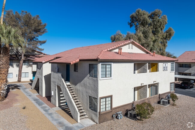
4650 W Oakey Blvd
Las Vegas-Henderson-Paradise, NV
Parcel Map File 52 Page 20
162-06-201-001
PARCEL MAP FILE 52 PAGE 20 LOT 2
Apartment
Clark
X
Nevada
32003C2165D
2
2025
9.57 AC
2025
Buffalo
001004
Las Vegas
1,994 SF
DEMOGRAPHICS near 4650 W Oakey Blvd
1 Mile
3 Mile
5 Mile
2024 Total Population
22,008
173,856
482,711
2029 Population
23,667
187,490
519,044
Pop Growth 2024-2029
+ 7.54%
+ 7.84%
+ 7.53%
Average Age
40
39
39
2024 Total Households
8,413
66,736
192,964
HH Growth 2024-2029
+ 7.69%
+ 8.03%
+ 7.59%
Median Household Inc
$44,438
$44,579
$44,485
Avg Household Size
2.50
2.50
2.40
2024 Avg HH Vehicles
2.00
2.00
1.00
Median Home Value
$282,291
$290,677
$299,119
Median Year Built
1976
1981
1985
Nearby Places
Map Layers
Map Styles
 Street
 Aerial
- Restaurants
- Banks
- Shops
- Fitness
- Groceries
PUBLIC TRANSPORTATION
AIRPORT
Harry Reid International
DRIVE
WALK
Distance
Harry Reid International
16 min
8.6 mi
Boulder City Municipal
DRIVE
WALK
Distance
Boulder City Municipal
40 min
30.9 mi
Freight Ports
Port of Long Beach
DRIVE
WALK
Distance
Port of Long Beach
318 min
284.4 mi
SALE & LEASE HISTORY
LISTING DATE
SALE/LEASE

Sep 24, 2016
For Sale
Dec 29, 2017
For Sale
Nearby Properties
Address
Land Use
TOTAL SIZE
Lot Size
Zoning
Address
Land Use
TOTAL SIZE
Lot Size
Zoning
1,044,724 SF
56.56 AC
Address
Land Use
TOTAL SIZE
Lot Size
Zoning
1,172,527 SF
19.67 AC
H1
Address
Land Use
TOTAL SIZE
Lot Size
Zoning
1,494,289 SF
65.25 AC
H1
Address
Land Use
TOTAL SIZE
Lot Size
Zoning
248,689 SF
19.45 AC
H1
Address
Land Use
TOTAL SIZE
Lot Size
Zoning
315,865 SF
19.85 AC
Address
Land Use
TOTAL SIZE
Lot Size
Zoning
754,711 SF
24.79 AC
H1
Address
Land Use
TOTAL SIZE
Lot Size
Zoning
1,345,377 SF
88.53 AC
H1
Address
Land Use
TOTAL SIZE
Lot Size
Zoning
1,069,498 SF
28.36 AC
H1
Address
Land Use
TOTAL SIZE
Lot Size
Zoning
162,214 SF
4.32 AC
Address
Land Use
TOTAL SIZE
Lot Size
Zoning
497,331 SF
24.44 AC
Address
Land Use
TOTAL SIZE
Lot Size
Zoning
34,354 SF
33.06 AC
Address
Land Use
TOTAL SIZE
Lot Size
Zoning
1,617,320 SF
7.21 AC
PD
Address
Land Use
TOTAL SIZE
Lot Size
Zoning
115,059 SF
30.12 AC
Address
Land Use
TOTAL SIZE
Lot Size
Zoning
20,924 SF
17.50 AC
H1
Address
Land Use
TOTAL SIZE
Lot Size
Zoning
24,965 SF
25.75 AC
Address
Land Use
TOTAL SIZE
Lot Size
Zoning
1,283,663 SF
8.56 AC
PD
Address
Land Use
TOTAL SIZE
Lot Size
Zoning
80.45 AC
CV
Address
Land Use
TOTAL SIZE
Lot Size
Zoning
573,491 SF
38.94 AC
Address
Land Use
TOTAL SIZE
Lot Size
Zoning
109,306 SF
25.79 AC
H1
Address
Land Use
TOTAL SIZE
Lot Size
Zoning
34.83 AC
CV
Address
Land Use
TOTAL SIZE
Lot Size
Zoning
814,789 SF
13.75 AC
C1
Address
Land Use
TOTAL SIZE
Lot Size
Zoning
38.80 AC
CV
Address
Land Use
TOTAL SIZE
Lot Size
Zoning
7,630 SF
12.71 AC
H1
Address
Land Use
TOTAL SIZE
Lot Size
Zoning
64,229 SF
15.49 AC
Address
Land Use
TOTAL SIZE
Lot Size
Zoning
443,153 SF
7.13 AC
H1
Address
Land Use
TOTAL SIZE
Lot Size
Zoning
88,160 SF
18.56 AC
Address
Land Use
TOTAL SIZE
Lot Size
Zoning
8.96 AC
L:PD
Address
Land Use
TOTAL SIZE
Lot Size
Zoning
6,310 SF
3.68 AC
The World's #1 Commercial Real Estate Marketplace
Connect with us
© 2025 CoStar Group
The information above has been obtained from sources believed reliable. While we do not doubt its accuracy we have not verified it and make no guarantee, warranty or representation about it. It is your responsibility to independently confirm its accuracy and completeness. Any projections, opinions, assumptions, or estimates used are for example only and do not represent the current or future performance of the property. The value of this transaction to you depends on tax and other factors which should be evaluated by your tax, financial, and legal advisors. You and your advisors should conduct a careful, independent investigation of the property to determine to your satisfaction the suitability of the property for your needs.