Property Record
4650 N Washington Blvd, Arlington, VA 22201


Save to a Folder
{{folder.Name}}
{{folder.ListingIds.length}} Properties
{{folder.ListingIds.length}} Property
Create a New Folder
Property Detail
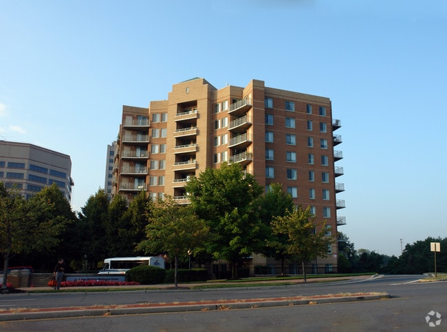
4650 N Washington Blvd
14-013-050
PARCEL D-1 RESUB PARCEL B-1 WESTERN POCAHONTAS CORP 180,410 SQ FT 4.14164 AC
Apartment
Arlington
C-O-2.5
Virginia
B and X Area of moderate flood hazard, usually the area between the limits of the 100-year and 500-year floods.
50
2026
4.14 AC
2026
Ballston/Virginia Square
101401
Washington, DC
989,001 SF
Washington-Arlington-Alexandria, DC-VA-MD-WV
NEARBY LISTINGS FOR SALE OR LEASE
DEMOGRAPHICS near 4650 N Washington Blvd
1 mile
3 mile
5 mile
2025 Total Population
44,802
251,258
615,076
2030 Population
46,462
259,645
636,370
Pop Growth 2025-2030
+ 3.71%
+ 3.34%
+ 3.46%
Average Age
38
38
39
2025 Total Households
21,242
107,330
275,093
HH Growth 2025-2030
+ 3.96%
+ 3.54%
+ 3.89%
Median Household Inc
$155,337
$134,541
$131,981
Avg Household Size
2.00
2.20
2.10
2025 Avg HH Vehicles
1.00
1.00
1.00
Median Home Value
$878,010
$875,754
$740,608
Median Year Built
1988
1975
1968
Nearby Places
Map Layers
Map Styles
 Street
 Aerial
Layers
 Traffic
 Biking
Places
Listings with unknown addresses are not visible on the map
- Restaurants
- Banks
- Shops
- Fitness
- Groceries
PUBLIC TRANSPORTATION
TRANSIT/SUBWAY
Ballston-Mu (Orange Line - Washington Metropolitan Area Transit Authority Metrorail (Metrorail), Silver Line - Washington Metropolitan Area Transit Authority Metrorail (Metrorail))
Drive
Walk
Distance
Ballston-Mu (Orange Line - Washington Metropolitan Area Transit Authority Metrorail (Metrorail), Silver Line - Washington Metropolitan Area Transit Authority Metrorail (Metrorail))
2 min
9 min
0.5 mi
Virginia Square-Gmu (Orange Line - Washington Metropolitan Area Transit Authority Metrorail (Metrorail), Silver Line - Washington Metropolitan Area Transit Authority Metrorail (Metrorail))
Drive
Walk
Distance
Virginia Square-Gmu (Orange Line - Washington Metropolitan Area Transit Authority Metrorail (Metrorail), Silver Line - Washington Metropolitan Area Transit Authority Metrorail (Metrorail))
3 min
18 min
1.0 mi
COMMUTER RAIL
Alexandria (Fredericksburg Line - Virginia Railway Express, Manassas Line - Virginia Railway Express)
Drive
Walk
Distance
Alexandria (Fredericksburg Line - Virginia Railway Express, Manassas Line - Virginia Railway Express)
11 min
6.4 mi
L'enfant (Fredericksburg Line - Virginia Railway Express, Manassas Line - Virginia Railway Express)
Drive
Walk
Distance
L'enfant (Fredericksburg Line - Virginia Railway Express, Manassas Line - Virginia Railway Express)
12 min
6.5 mi
AIRPORT
Ronald Reagan Washington Ntl
Drive
Walk
Distance
Ronald Reagan Washington Ntl
14 min
7.7 mi
Washington Dulles International
Drive
Walk
Distance
Washington Dulles International
36 min
21.8 mi
Freight Ports
Port of Baltimore
Drive
Walk
Distance
Port of Baltimore
65 min
44.6 mi
Nearby Properties
Address
Land Use
TOTAL SIZE
Lot Size
Zoning
Address
Land Use
TOTAL SIZE
Lot Size
Zoning
900,000 SF
260 AC
S-3A
Address
Land Use
TOTAL SIZE
Lot Size
Zoning
77.26 AC
R-3/GT
Address
Land Use
TOTAL SIZE
Lot Size
Zoning
13,476 SF
1.81 AC
Address
Land Use
TOTAL SIZE
Lot Size
Zoning
20.19 AC
S-3A/S-D
Address
Land Use
TOTAL SIZE
Lot Size
Zoning
636,768 SF
1.91 AC
C-O-ROSSLY
Address
Land Use
TOTAL SIZE
Lot Size
Zoning
62,298 SF
2.58 AC
R-5
Address
Land Use
TOTAL SIZE
Lot Size
Zoning
1,882 SF
0.97 AC
C-O-A
Address
Land Use
TOTAL SIZE
Lot Size
Zoning
633,810 SF
3.45 AC
RA-H-3.2
Address
Land Use
TOTAL SIZE
Lot Size
Zoning
26,879 SF
0.82 AC
C-O
Address
Land Use
TOTAL SIZE
Lot Size
Zoning
580,759 SF
0.69 AC
C-O/C-O-RO
Address
Land Use
TOTAL SIZE
Lot Size
Zoning
591,243 SF
1.90 AC
RA-H-3.2
Address
Land Use
TOTAL SIZE
Lot Size
Zoning
18,426 SF
0.95 AC
C-3
Address
Land Use
TOTAL SIZE
Lot Size
Zoning
986,000 SF
2.30 AC
C-O-A
Address
Land Use
TOTAL SIZE
Lot Size
Zoning
224,700 SF
1.30 AC
C-O-2.5
Address
Land Use
TOTAL SIZE
Lot Size
Zoning
11,358 SF
2.19 AC
C-2
Address
Land Use
TOTAL SIZE
Lot Size
Zoning
0.94 AC
C-O-2.5
Address
Land Use
TOTAL SIZE
Lot Size
Zoning
9,800 SF
1.40 AC
C-O-A
Address
Land Use
TOTAL SIZE
Lot Size
Zoning
924,015 SF
89.81 AC
S-3A
Address
Land Use
TOTAL SIZE
Lot Size
Zoning
523,155 SF
1.76 AC
RA-H-3.2
Address
Land Use
TOTAL SIZE
Lot Size
Zoning
12,635 SF
1.75 AC
RA4.8
Address
Land Use
TOTAL SIZE
Lot Size
Zoning
727,145 SF
19.72 AC
S-3A
Address
Land Use
TOTAL SIZE
Lot Size
Zoning
528 SF
296.59 AC
MU-11;MU-1
Address
Land Use
TOTAL SIZE
Lot Size
Zoning
597,364 SF
1.66 AC
C-O/C-O-2.
Address
Land Use
TOTAL SIZE
Lot Size
Zoning
1,600 SF
1.92 AC
RA6-15/RC
Address
Land Use
TOTAL SIZE
Lot Size
Zoning
354,000 SF
0.67 AC
C-O-ROSSLY
Address
Land Use
TOTAL SIZE
Lot Size
Zoning
17,238 SF
0.80 AC
C-O
Address
Land Use
TOTAL SIZE
Lot Size
Zoning
8,000 SF
0.60 AC
C-O-A
Address
Land Use
TOTAL SIZE
Lot Size
Zoning
4,050 SF
3.82 AC
RA6-15
Address
Land Use
TOTAL SIZE
Lot Size
Zoning
463,979 SF
19.23 AC
220
Address
Land Use
TOTAL SIZE
Lot Size
Zoning
942,000 SF
13.98 AC
RA6-15
The World's #1 Commercial Real Estate Marketplace
Connect with us
© 2026 CoStar Group
The information above has been obtained from sources believed reliable. While we do not doubt its accuracy we have not verified it and make no guarantee, warranty or representation about it. It is your responsibility to independently confirm its accuracy and completeness. Any projections, opinions, assumptions, or estimates used are for example only and do not represent the current or future performance of the property. The value of this transaction to you depends on tax and other factors which should be evaluated by your tax, financial, and legal advisors. You and your advisors should conduct a careful, independent investigation of the property to determine to your satisfaction the suitability of the property for your needs.