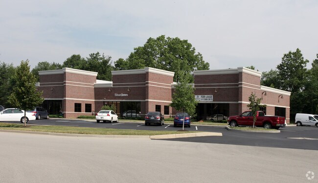
Property Record
4654 Killarney Dr, Carmel, IN 46033


NEARBY LISTINGS FOR SALE OR LEASE
-
-
-
-
-
SR 32 & Promenade of Noblesville Pkwy @ Promenade of Noblesville Pkwy
Noblesville, IN 46062
Negotiable
3,167 SF
Office
-
-
View all Carmel listings for sale on LoopNet.com
Property Detail
4654 Killarney Dr
29-10-08-000-024.000-015
The Bridgewater Club Section L
Officebuilding
ACREAGE .95, SECTION 8, TOWNSHIP 18, RANGE 4
X
Hamilton
18057C0139G
Indiana
2023
0.95 AC
2024
Carmel
110515
Indianapolis
9,600 SF
Indianapolis-Carmel-Greenwood, IN
DEMOGRAPHICS near 4654 Killarney Dr
1 mile
3 mile
5 mile
2024 Total Population
5,198
56,646
157,156
2029 Population
5,875
63,980
177,153
Pop Growth 2024-2029
+ 13.02%
+ 12.95%
+ 12.72%
Average Age
40
39
39
2024 Total Households
1,891
20,296
59,522
HH Growth 2024-2029
+ 13.01%
+ 12.96%
+ 12.83%
Median Household Inc
$146,852
$110,229
$98,924
Avg Household Size
2.70
2.70
2.60
2024 Avg HH Vehicles
2.00
2.00
2.00
Median Home Value
$489,969
$382,199
$331,185
Median Year Built
2011
2003
1998
Nearby Places
Map Layers
Map Styles
 Street
 Aerial
Transit
 Traffic
 Biking
Places
Listings with unknown addresses are not visible on the map
- Restaurants
- Banks
- Shops
- Fitness
- Groceries
PUBLIC TRANSPORTATION
AIRPORT
Indianapolis International
Drive
Walk
Distance
Indianapolis International
58 min
35.6 mi
Freight Ports
Port of Toledo
Drive
Walk
Distance
Port of Toledo
258 min
214.0 mi
Nearby Properties
Address
Land Use
TOTAL SIZE
Lot Size
Zoning
Address
Land Use
TOTAL SIZE
Lot Size
Zoning
372,542 SF
32.10 AC
Address
Land Use
TOTAL SIZE
Lot Size
Zoning
451,785 SF
13.04 AC
Address
Land Use
TOTAL SIZE
Lot Size
Zoning
236,320 SF
20.74 AC
Address
Land Use
TOTAL SIZE
Lot Size
Zoning
357,660 SF
22.37 AC
Address
Land Use
TOTAL SIZE
Lot Size
Zoning
6.46 AC
Address
Land Use
TOTAL SIZE
Lot Size
Zoning
318,922 SF
31.70 AC
Address
Land Use
TOTAL SIZE
Lot Size
Zoning
296,315 SF
17.65 AC
Address
Land Use
TOTAL SIZE
Lot Size
Zoning
97,726 SF
8.49 AC
Address
Land Use
TOTAL SIZE
Lot Size
Zoning
188,239 SF
11.15 AC
Address
Land Use
TOTAL SIZE
Lot Size
Zoning
297,641 SF
70.35 AC
Address
Land Use
TOTAL SIZE
Lot Size
Zoning
239,148 SF
18.56 AC
Address
Land Use
TOTAL SIZE
Lot Size
Zoning
186,668 SF
19.09 AC
Address
Land Use
TOTAL SIZE
Lot Size
Zoning
173,884 SF
14.07 AC
Address
Land Use
TOTAL SIZE
Lot Size
Zoning
209,778 SF
24.45 AC
Address
Land Use
TOTAL SIZE
Lot Size
Zoning
153,602 SF
50.17 AC
Address
Land Use
TOTAL SIZE
Lot Size
Zoning
141,666 SF
76.66 AC
Address
Land Use
TOTAL SIZE
Lot Size
Zoning
238,722 SF
24.27 AC
Address
Land Use
TOTAL SIZE
Lot Size
Zoning
73,680 SF
19.08 AC
Address
Land Use
TOTAL SIZE
Lot Size
Zoning
241,000 SF
15.01 AC
Address
Land Use
TOTAL SIZE
Lot Size
Zoning
290,862 SF
2.54 AC
Address
Land Use
TOTAL SIZE
Lot Size
Zoning
96,434 SF
6.05 AC
Address
Land Use
TOTAL SIZE
Lot Size
Zoning
129,005 SF
13.19 AC
Address
Land Use
TOTAL SIZE
Lot Size
Zoning
151,448 SF
10.58 AC
Address
Land Use
TOTAL SIZE
Lot Size
Zoning
110,412 SF
9.70 AC
Address
Land Use
TOTAL SIZE
Lot Size
Zoning
129,634 SF
12.71 AC
Address
Land Use
TOTAL SIZE
Lot Size
Zoning
110,178 SF
18.90 AC
Address
Land Use
TOTAL SIZE
Lot Size
Zoning
61,290 SF
7.91 AC
Address
Land Use
TOTAL SIZE
Lot Size
Zoning
101,050 SF
62.43 AC
Address
Land Use
TOTAL SIZE
Lot Size
Zoning
139,190 SF
12.06 AC
Address
Land Use
TOTAL SIZE
Lot Size
Zoning
228,180 SF
13.05 AC
The World's #1 Commercial Real Estate Marketplace
Connect with us
© 2026 CoStar Group
The information above has been obtained from sources believed reliable. While we do not doubt its accuracy we have not verified it and make no guarantee, warranty or representation about it. It is your responsibility to independently confirm its accuracy and completeness. Any projections, opinions, assumptions, or estimates used are for example only and do not represent the current or future performance of the property. The value of this transaction to you depends on tax and other factors which should be evaluated by your tax, financial, and legal advisors. You and your advisors should conduct a careful, independent investigation of the property to determine to your satisfaction the suitability of the property for your needs.