Property Record
4656 State Route 42, Kiamesha Lake, NY 12751


NEARBY LISTINGS FOR SALE OR LEASE
Property Detail
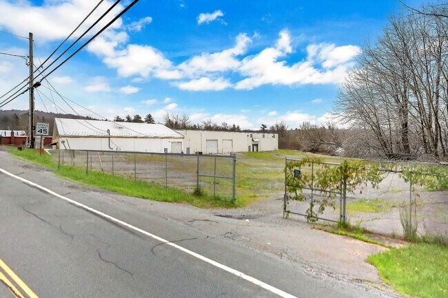
4656 State Route 42
Warehouse
Sullivan
A
New York
36105C0470F
1.001
2025
1.72 AC
2024
Hudson Valley Area
951500
Other Market Areas
17,760 SF
4689-010-0-0013-001-001
DEMOGRAPHICS near 4656 State Route 42
1 Mile
3 Mile
5 Mile
2024 Total Population
602
11,774
21,639
2029 Population
621
12,287
22,493
Pop Growth 2024-2029
+ 3.16%
+ 4.36%
+ 3.95%
Average Age
42
39
39
2024 Total Households
255
4,565
7,880
HH Growth 2024-2029
+ 3.53%
+ 4.84%
+ 4.58%
Median Household Inc
$45,833
$40,549
$42,771
Avg Household Size
2.30
2.40
2.40
2024 Avg HH Vehicles
1.00
1.00
2.00
Median Home Value
$147,058
$167,218
$172,859
Median Year Built
1971
1973
1976
Nearby Places
- Restaurants
- Banks
- Shops
- Fitness
- Groceries
SALE & LEASE HISTORY
LISTING DATE
SALE/LEASE

Oct 19, 2021
For Sale
Dec 20, 2019
For Sale
Nearby Properties
Address
Land Use
TOTAL SIZE
Lot Size
Zoning
Address
Land Use
TOTAL SIZE
Lot Size
Zoning
1,777,903 SF
117.40 AC
PRD
Address
Land Use
TOTAL SIZE
Lot Size
Zoning
423,920 SF
131.50 AC
PRD
Address
Land Use
TOTAL SIZE
Lot Size
Zoning
154,000 SF
36.19 AC
B1
Address
Land Use
TOTAL SIZE
Lot Size
Zoning
286,801 SF
371.77 AC
SR
Address
Land Use
TOTAL SIZE
Lot Size
Zoning
3,123 SF
48.30 AC
RR
Address
Land Use
TOTAL SIZE
Lot Size
Zoning
222,345 SF
165.77 AC
B1
Address
Land Use
TOTAL SIZE
Lot Size
Zoning
69,742 SF
21.63 AC
PRD
Address
Land Use
TOTAL SIZE
Lot Size
Zoning
209,366 SF
32.32 AC
HC1
Address
Land Use
TOTAL SIZE
Lot Size
Zoning
100,167 SF
9.60 AC
BLI
Address
Land Use
TOTAL SIZE
Lot Size
Zoning
17,812 SF
3.50 AC
RM
Address
Land Use
TOTAL SIZE
Lot Size
Zoning
48,976 SF
297.25 AC
SR
Address
Land Use
TOTAL SIZE
Lot Size
Zoning
Address
Land Use
TOTAL SIZE
Lot Size
Zoning
14,841 SF
17.19 AC
HC2
Address
Land Use
TOTAL SIZE
Lot Size
Zoning
104,739 SF
9.68 AC
HC2
Address
Land Use
TOTAL SIZE
Lot Size
Zoning
648 SF
74.20 AC
RR
Address
Land Use
TOTAL SIZE
Lot Size
Zoning
4,950 SF
56.24 AC
PRD
Address
Land Use
TOTAL SIZE
Lot Size
Zoning
54,525 SF
6.33 AC
HC
Address
Land Use
TOTAL SIZE
Lot Size
Zoning
1,984 SF
215.35 AC
PRD
Address
Land Use
TOTAL SIZE
Lot Size
Zoning
53,981 SF
24.71 AC
Address
Land Use
TOTAL SIZE
Lot Size
Zoning
6,042 SF
12.38 AC
EBG
Address
Land Use
TOTAL SIZE
Lot Size
Zoning
56,378 SF
13.65 AC
HC2
Address
Land Use
TOTAL SIZE
Lot Size
Zoning
10,787 SF
13.80 AC
HC
Address
Land Use
TOTAL SIZE
Lot Size
Zoning
55,365 SF
13.01 AC
HC2
Address
Land Use
TOTAL SIZE
Lot Size
Zoning
55,365 SF
9.33 AC
HC2
Address
Land Use
TOTAL SIZE
Lot Size
Zoning
16,520 SF
4.50 AC
R1
Address
Land Use
TOTAL SIZE
Lot Size
Zoning
39,176 SF
64.72 AC
SR
Address
Land Use
TOTAL SIZE
Lot Size
Zoning
55,365 SF
11.85 AC
HC2
Address
Land Use
TOTAL SIZE
Lot Size
Zoning
76,528 SF
12.08 AC
BL1
Address
Land Use
TOTAL SIZE
Lot Size
Zoning
52,290 SF
26.40 AC
RM
Address
Land Use
TOTAL SIZE
Lot Size
Zoning
21,288 SF
2.55 AC
BLI
The World's #1 Commercial Real Estate Marketplace
Connect with us
© 2025 CoStar Group
The information above has been obtained from sources believed reliable. While we do not doubt its accuracy we have not verified it and make no guarantee, warranty or representation about it. It is your responsibility to independently confirm its accuracy and completeness. Any projections, opinions, assumptions, or estimates used are for example only and do not represent the current or future performance of the property. The value of this transaction to you depends on tax and other factors which should be evaluated by your tax, financial, and legal advisors. You and your advisors should conduct a careful, independent investigation of the property to determine to your satisfaction the suitability of the property for your needs.