Property Record
467 Meriwether Rd Nw, Milledgeville, GA 31061


NEARBY LISTINGS FOR SALE OR LEASE
Property Detail
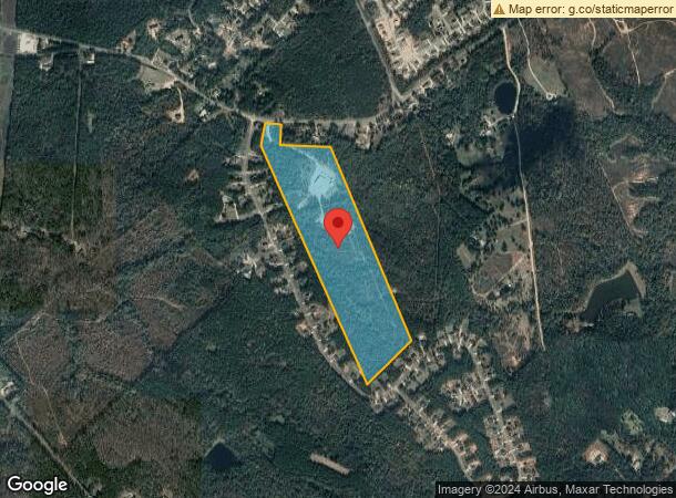
467 Meriwether Rd Nw
065-031C
PAR 2A S/S MERIW RD DB 1042-68 PLAT BK 13-65
Publicstorage
Baldwin
X
Georgia
13141C0250B
48 AC
2025
Georgia South Area
2025
Other Market Areas
970302
Milledgeville, GA
8,012 SF
DEMOGRAPHICS near 467 Meriwether Rd Nw
1 Mile
3 Mile
5 Mile
2024 Total Population
719
5,874
16,012
2029 Population
716
5,945
16,304
Pop Growth 2024-2029
(0.42%)
+ 1.21%
+ 1.82%
Average Age
42
44
43
2024 Total Households
287
2,422
6,598
HH Growth 2024-2029
(0.35%)
+ 1.24%
+ 1.85%
Median Household Inc
$84,166
$78,264
$71,902
Avg Household Size
2.50
2.40
2.30
2024 Avg HH Vehicles
2.00
2.00
2.00
Median Home Value
$223,750
$260,273
$240,032
Median Year Built
1993
1993
1990
Nearby Places
Map Layers
Map Styles
 Street
 Aerial
- Restaurants
- Banks
- Shops
- Fitness
- Groceries
SALE & LEASE HISTORY
LISTING DATE
SALE/LEASE

Sep 24, 2016
For Sale
Mar 15, 2017
For Sale
Nearby Properties
Address
Land Use
TOTAL SIZE
Lot Size
Zoning
Address
Land Use
TOTAL SIZE
Lot Size
Zoning
107,725 SF
18.56 AC
COMMERCIAL
Address
Land Use
TOTAL SIZE
Lot Size
Zoning
25,807 SF
10.05 AC
UNZONED RU
Address
Land Use
TOTAL SIZE
Lot Size
Zoning
118,622 SF
7.99 AC
UNZONED RU
Address
Land Use
TOTAL SIZE
Lot Size
Zoning
99,553 SF
8.94 AC
COMMERCIAL
Address
Land Use
TOTAL SIZE
Lot Size
Zoning
17,010 SF
24.34 AC
UNZONED RU
Address
Land Use
TOTAL SIZE
Lot Size
Zoning
132,661 SF
7.21 AC
RESIDENTIA
Address
Land Use
TOTAL SIZE
Lot Size
Zoning
6,000 SF
40.60 AC
RESIDENTIA
Address
Land Use
TOTAL SIZE
Lot Size
Zoning
25,129 SF
7.39 AC
COMMERCIAL
Address
Land Use
TOTAL SIZE
Lot Size
Zoning
13,637 SF
5.31 AC
RESIDENTIA
Address
Land Use
TOTAL SIZE
Lot Size
Zoning
14,767 SF
2.11 AC
COMMERCIAL
Address
Land Use
TOTAL SIZE
Lot Size
Zoning
51,982 SF
3.77 AC
RESIDENTIA
Address
Land Use
TOTAL SIZE
Lot Size
Zoning
26,393 SF
13.87 AC
COMMERCIAL
Address
Land Use
TOTAL SIZE
Lot Size
Zoning
67,190 SF
2.13 AC
RESIDENTIA
Address
Land Use
TOTAL SIZE
Lot Size
Zoning
2,496 SF
4.81 AC
RESIDENTIA
Address
Land Use
TOTAL SIZE
Lot Size
Zoning
12,000 SF
5 AC
COMMERCIAL
Address
Land Use
TOTAL SIZE
Lot Size
Zoning
25,800 SF
1.77 AC
COMMERCIAL
Address
Land Use
TOTAL SIZE
Lot Size
Zoning
4,073 SF
9.36 AC
RESIDENTIA
Address
Land Use
TOTAL SIZE
Lot Size
Zoning
8,944 SF
1.40 AC
UNZONED RU
Address
Land Use
TOTAL SIZE
Lot Size
Zoning
23,458 SF
2.37 AC
UNZONED RU
Address
Land Use
TOTAL SIZE
Lot Size
Zoning
9,650 SF
4.93 AC
COMMERCIAL
Address
Land Use
TOTAL SIZE
Lot Size
Zoning
6,220 SF
2 AC
UNZONED RU
Address
Land Use
TOTAL SIZE
Lot Size
Zoning
487.78 AC
UNZONED RU
Address
Land Use
TOTAL SIZE
Lot Size
Zoning
4,630 SF
1.38 AC
COMMERCIAL
Address
Land Use
TOTAL SIZE
Lot Size
Zoning
1,581 SF
2.24 AC
RESIDENTIA
Address
Land Use
TOTAL SIZE
Lot Size
Zoning
6,300 SF
8.86 AC
RESIDENTIA
Address
Land Use
TOTAL SIZE
Lot Size
Zoning
5,463 SF
1.86 AC
COMMERCIAL
Address
Land Use
TOTAL SIZE
Lot Size
Zoning
8,556 SF
1.44 AC
RESIDENTIA
Address
Land Use
TOTAL SIZE
Lot Size
Zoning
22,800 SF
2.18 AC
RESIDENTIA
Address
Land Use
TOTAL SIZE
Lot Size
Zoning
31,000 SF
3.72 AC
C-2
Address
Land Use
TOTAL SIZE
Lot Size
Zoning
11,124 SF
1.28 AC
RESIDENTIA
The World's #1 Commercial Real Estate Marketplace
Connect with us
© 2026 CoStar Group
The information above has been obtained from sources believed reliable. While we do not doubt its accuracy we have not verified it and make no guarantee, warranty or representation about it. It is your responsibility to independently confirm its accuracy and completeness. Any projections, opinions, assumptions, or estimates used are for example only and do not represent the current or future performance of the property. The value of this transaction to you depends on tax and other factors which should be evaluated by your tax, financial, and legal advisors. You and your advisors should conduct a careful, independent investigation of the property to determine to your satisfaction the suitability of the property for your needs.