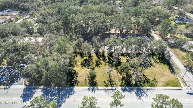
Property Record
4672 Sunbeam Rd, Jacksonville, FL 32257


NEARBY LISTINGS FOR SALE OR LEASE
Property Detail
4672 Sunbeam Rd
Jacksonville, FL
Section Land
149028-0000
33-3S-27E 1.06 W1/2 OF NE1/4 OF NE1/4 OF NE1/4 PT RECD O/R 21260-2122 (EX PT RECD O/R 6198-1596)
Commercialacreage
Duval
X
Florida
12031C0554H
1.07 AC
2025
Mandarin
2026
Jacksonville (Florida)
016730
DEMOGRAPHICS near 4672 Sunbeam Rd
1 Mile
3 Mile
5 Mile
2024 Total Population
10,473
79,338
166,719
2029 Population
11,098
83,188
174,658
Pop Growth 2024-2029
+ 5.97%
+ 4.85%
+ 4.76%
Average Age
38
39
40
2024 Total Households
4,192
34,771
71,391
HH Growth 2024-2029
+ 5.89%
+ 5.06%
+ 4.93%
Median Household Inc
$69,489
$63,473
$69,853
Avg Household Size
2.40
2.20
2.30
2024 Avg HH Vehicles
2.00
2.00
2.00
Median Home Value
$296,945
$267,109
$286,899
Median Year Built
1990
1985
1988
Nearby Places
Map Layers
Map Styles
 Street
 Aerial
- Restaurants
- Banks
- Shops
- Fitness
- Groceries
PUBLIC TRANSPORTATION
AIRPORT
Jacksonville International
DRIVE
WALK
Distance
Jacksonville International
35 min
28.0 mi
SALE & LEASE HISTORY
LISTING DATE
SALE/LEASE

Sep 24, 2016
For Sale
May 30, 2019
For Sale
Jul 25, 2024
For Sale
Nearby Properties
Address
Land Use
TOTAL SIZE
Lot Size
Zoning
Address
Land Use
TOTAL SIZE
Lot Size
Zoning
1,159,855 SF
89.44 AC
RMD-D
Address
Land Use
TOTAL SIZE
Lot Size
Zoning
1,013,318 SF
131.30 AC
PUD
Address
Land Use
TOTAL SIZE
Lot Size
Zoning
723,629 SF
18.30 AC
PUD
Address
Land Use
TOTAL SIZE
Lot Size
Zoning
810,921 SF
58.85 AC
PUD
Address
Land Use
TOTAL SIZE
Lot Size
Zoning
446,326 SF
23.68 AC
RMD-D
Address
Land Use
TOTAL SIZE
Lot Size
Zoning
464,189 SF
44.85 AC
RMD-D
Address
Land Use
TOTAL SIZE
Lot Size
Zoning
287,406 SF
32.10 AC
CCG-1
Address
Land Use
TOTAL SIZE
Lot Size
Zoning
358,537 SF
29.16 AC
RMD-C
Address
Land Use
TOTAL SIZE
Lot Size
Zoning
367,197 SF
42.36 AC
RMD-B
Address
Land Use
TOTAL SIZE
Lot Size
Zoning
193,941 SF
7.35 AC
PUD
Address
Land Use
TOTAL SIZE
Lot Size
Zoning
266,087 SF
35.07 AC
RMD-D
Address
Land Use
TOTAL SIZE
Lot Size
Zoning
569,816 SF
17.76 AC
PUD
Address
Land Use
TOTAL SIZE
Lot Size
Zoning
365,629 SF
23.23 AC
RMD-D
Address
Land Use
TOTAL SIZE
Lot Size
Zoning
273,616 SF
34.49 AC
RMD-B
Address
Land Use
TOTAL SIZE
Lot Size
Zoning
307,396 SF
24.45 AC
PUD
Address
Land Use
TOTAL SIZE
Lot Size
Zoning
304,017 SF
20.58 AC
RMD-D
Address
Land Use
TOTAL SIZE
Lot Size
Zoning
348,919 SF
18.08 AC
RMD-D
Address
Land Use
TOTAL SIZE
Lot Size
Zoning
330,037 SF
28.33 AC
RMD-C
Address
Land Use
TOTAL SIZE
Lot Size
Zoning
313,009 SF
22.50 AC
RMD-D
Address
Land Use
TOTAL SIZE
Lot Size
Zoning
291,833 SF
16.91 AC
CRO
Address
Land Use
TOTAL SIZE
Lot Size
Zoning
236,068 SF
18.87 AC
PUD
Address
Land Use
TOTAL SIZE
Lot Size
Zoning
404,315 SF
19.27 AC
RMD-D
Address
Land Use
TOTAL SIZE
Lot Size
Zoning
237,625 SF
29.34 AC
RMD-B
Address
Land Use
TOTAL SIZE
Lot Size
Zoning
485,498 SF
12.25 AC
PUD
Address
Land Use
TOTAL SIZE
Lot Size
Zoning
310,849 SF
16.16 AC
RMD-C
Address
Land Use
TOTAL SIZE
Lot Size
Zoning
294,353 SF
14.58 AC
RMD-D
Address
Land Use
TOTAL SIZE
Lot Size
Zoning
169,086 SF
10.01 AC
PUD
Address
Land Use
TOTAL SIZE
Lot Size
Zoning
236,617 SF
16.38 AC
RMD-D
Address
Land Use
TOTAL SIZE
Lot Size
Zoning
278,282 SF
20.45 AC
RMD-D
Address
Land Use
TOTAL SIZE
Lot Size
Zoning
250,507 SF
26.01 AC
PUD
The World's #1 Commercial Real Estate Marketplace
Connect with us
© 2026 CoStar Group
The information above has been obtained from sources believed reliable. While we do not doubt its accuracy we have not verified it and make no guarantee, warranty or representation about it. It is your responsibility to independently confirm its accuracy and completeness. Any projections, opinions, assumptions, or estimates used are for example only and do not represent the current or future performance of the property. The value of this transaction to you depends on tax and other factors which should be evaluated by your tax, financial, and legal advisors. You and your advisors should conduct a careful, independent investigation of the property to determine to your satisfaction the suitability of the property for your needs.