Property Record
46775 Melrose Ct, Sterling, VA 20164
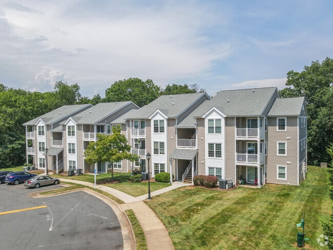

Property Detail
46775 Melrose Ct
014-17-4041
SUGARLAND RUN 201708250053180/1P ST.DEDD, 894--678, 894-682 1993--932 NAME CHANGE, 901-390, 914--1116
Multifamilydwelling
Loudoun
R16
Virginia
B and X Area of moderate flood hazard, usually the area between the limits of the 100-year and 500-year floods.
1.93 AC
2025
Sterling Park
2025
Washington, DC
611300
Washington-Arlington-Alexandria, DC-VA-MD-WV
31,434 SF
NEARBY LISTINGS FOR SALE OR LEASE
-
-
View all Sterling listings for sale on LoopNet.com
DEMOGRAPHICS near 46775 Melrose Ct
1 mile
3 mile
5 mile
2025 Total Population
14,564
113,260
228,873
2030 Population
14,885
115,903
235,223
Pop Growth 2025-2030
+ 2.20%
+ 2.33%
+ 2.77%
Average Age
39
39
39
2025 Total Households
4,551
38,030
84,464
HH Growth 2025-2030
+ 2.20%
+ 2.35%
+ 3.00%
Median Household Inc
$154,102
$152,135
$141,428
Avg Household Size
3.10
2.90
2.60
2025 Avg HH Vehicles
3.00
2.00
2.00
Median Home Value
$682,976
$686,846
$693,171
Median Year Built
1984
1987
1990
Nearby Places
Map Layers
Map Styles
 Street
 Aerial
Layers
 Traffic
 Biking
Places
Listings with unknown addresses are not visible on the map
- Restaurants
- Banks
- Shops
- Fitness
- Groceries
PUBLIC TRANSPORTATION
AIRPORT
Washington Dulles International
Drive
Walk
Distance
Washington Dulles International
19 min
7.9 mi
Ronald Reagan Washington Ntl
Drive
Walk
Distance
Ronald Reagan Washington Ntl
42 min
26.7 mi
Freight Ports
Port of Baltimore
Drive
Walk
Distance
Port of Baltimore
82 min
58.8 mi
Nearby Properties
Address
Land Use
TOTAL SIZE
Lot Size
Zoning
Address
Land Use
TOTAL SIZE
Lot Size
Zoning
147,260 SF
33.04 AC
PDIP
Address
Land Use
TOTAL SIZE
Lot Size
Zoning
565,680 SF
18.44 AC
PDIP
Address
Land Use
TOTAL SIZE
Lot Size
Zoning
764,166 SF
73.90 AC
PDIP
Address
Land Use
TOTAL SIZE
Lot Size
Zoning
154,125 SF
9.68 AC
PDIP
Address
Land Use
TOTAL SIZE
Lot Size
Zoning
120,240 SF
12.15 AC
PDIP
Address
Land Use
TOTAL SIZE
Lot Size
Zoning
128,500 SF
9.95 AC
PDIP
Address
Land Use
TOTAL SIZE
Lot Size
Zoning
219,514 SF
14.34 AC
PDIP
Address
Land Use
TOTAL SIZE
Lot Size
Zoning
407,812 SF
33.12 AC
373
Address
Land Use
TOTAL SIZE
Lot Size
Zoning
426,710 SF
19.50 AC
PDIP
Address
Land Use
TOTAL SIZE
Lot Size
Zoning
383,257 SF
33.05 AC
PDH4
Address
Land Use
TOTAL SIZE
Lot Size
Zoning
364,146 SF
38.05 AC
CCSC
Address
Land Use
TOTAL SIZE
Lot Size
Zoning
498,598 SF
21.89 AC
R16
Address
Land Use
TOTAL SIZE
Lot Size
Zoning
316,325 SF
18.08 AC
R16
Address
Land Use
TOTAL SIZE
Lot Size
Zoning
404,709 SF
18.57 AC
R24
Address
Land Use
TOTAL SIZE
Lot Size
Zoning
408,760 SF
87.24 AC
R1
Address
Land Use
TOTAL SIZE
Lot Size
Zoning
269,524 SF
13.47 AC
863
Address
Land Use
TOTAL SIZE
Lot Size
Zoning
258,716 SF
12.54 AC
PDOP
Address
Land Use
TOTAL SIZE
Lot Size
Zoning
265,650 SF
13.11 AC
373
Address
Land Use
TOTAL SIZE
Lot Size
Zoning
234,679 SF
14.33 AC
372
Address
Land Use
TOTAL SIZE
Lot Size
Zoning
308,805 SF
34.45 AC
PDCCRC
Address
Land Use
TOTAL SIZE
Lot Size
Zoning
135,513 SF
8.49 AC
PDIP
Address
Land Use
TOTAL SIZE
Lot Size
Zoning
287,050 SF
11.05 AC
R24
Address
Land Use
TOTAL SIZE
Lot Size
Zoning
1,026,767 SF
71 AC
PDSC
Address
Land Use
TOTAL SIZE
Lot Size
Zoning
147,006 SF
PDTC
Address
Land Use
TOTAL SIZE
Lot Size
Zoning
195,655 SF
10.41 AC
372
Address
Land Use
TOTAL SIZE
Lot Size
Zoning
110,535 SF
348.88 AC
R1
Address
Land Use
TOTAL SIZE
Lot Size
Zoning
251,859 SF
40 AC
R1
Address
Land Use
TOTAL SIZE
Lot Size
Zoning
203,200 SF
13 AC
PDIP
Address
Land Use
TOTAL SIZE
Lot Size
Zoning
172,964 SF
8.02 AC
R24
Address
Land Use
TOTAL SIZE
Lot Size
Zoning
310,310 SF
40.67 AC
130
The World's #1 Commercial Real Estate Marketplace
Connect with us
© 2026 CoStar Group
The information above has been obtained from sources believed reliable. While we do not doubt its accuracy we have not verified it and make no guarantee, warranty or representation about it. It is your responsibility to independently confirm its accuracy and completeness. Any projections, opinions, assumptions, or estimates used are for example only and do not represent the current or future performance of the property. The value of this transaction to you depends on tax and other factors which should be evaluated by your tax, financial, and legal advisors. You and your advisors should conduct a careful, independent investigation of the property to determine to your satisfaction the suitability of the property for your needs.