Property Record
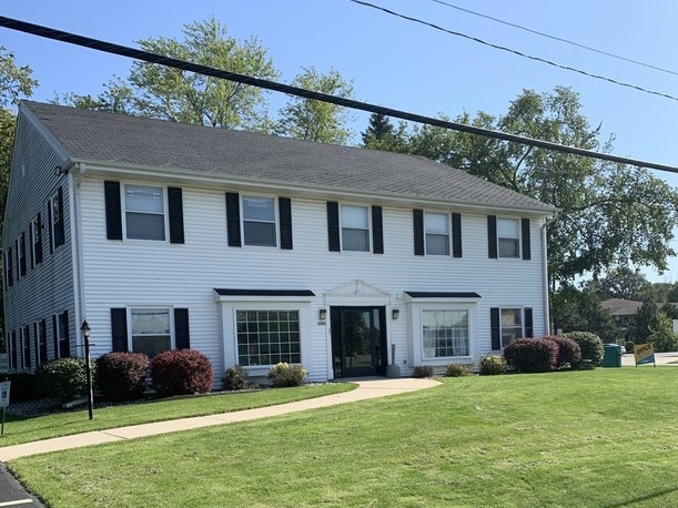
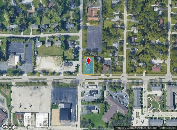
4680 W Bradley Rd, Milwaukee, WI 53223

Current Lease Availabilities
NEARBY LISTINGS FOR SALE OR LEASE
Property Detail
4680 W Bradley Rd
Milwaukee-Waukesha, WI
Noonan Heights Subd
066-0168-000
NOONAN HEIGHTS SUBD/ LOT 1 BLK 3
Commercialnec
Milwaukee
X
Wisconsin
55089C0265G
1
2022
0.35 AC
2024
Milwaukee NW
050104
Milwaukee/Madison
DEMOGRAPHICS near 4680 W Bradley Rd
1 Mile
3 Mile
5 Mile
2024 Total Population
8,691
58,957
192,183
2029 Population
8,444
57,809
189,936
Pop Growth 2024-2029
(2.84%)
(1.95%)
(1.17%)
Average Age
41
39
38
2024 Total Households
3,611
24,125
75,395
HH Growth 2024-2029
(3.05%)
(2.08%)
(1.24%)
Median Household Inc
$64,372
$59,437
$56,387
Avg Household Size
2.30
2.40
2.50
2024 Avg HH Vehicles
2.00
2.00
2.00
Median Home Value
$174,979
$188,169
$202,791
Median Year Built
1963
1967
1960
Nearby Places
Map Layers
Map Styles
 Street
 Aerial
- Restaurants
- Banks
- Shops
- Fitness
- Groceries
PUBLIC TRANSPORTATION
AIRPORT
General Mitchell International
DRIVE
WALK
Distance
General Mitchell International
31 min
18.5 mi
Freight Ports
Port Milwaukee
DRIVE
WALK
Distance
Port Milwaukee
24 min
14.3 mi
Nearby Properties
Address
Land Use
TOTAL SIZE
Lot Size
Zoning
Address
Land Use
TOTAL SIZE
Lot Size
Zoning
19.64 AC
Address
Land Use
TOTAL SIZE
Lot Size
Zoning
Address
Land Use
TOTAL SIZE
Lot Size
Zoning
Address
Land Use
TOTAL SIZE
Lot Size
Zoning
145,218 SF
10.23 AC
Address
Land Use
TOTAL SIZE
Lot Size
Zoning
72,824 SF
11.57 AC
Address
Land Use
TOTAL SIZE
Lot Size
Zoning
391,696 SF
36.33 AC
PD
Address
Land Use
TOTAL SIZE
Lot Size
Zoning
21.58 AC
RESIDENTIA
Address
Land Use
TOTAL SIZE
Lot Size
Zoning
Address
Land Use
TOTAL SIZE
Lot Size
Zoning
35.05 AC
Address
Land Use
TOTAL SIZE
Lot Size
Zoning
298,666 SF
5.09 AC
PD
Address
Land Use
TOTAL SIZE
Lot Size
Zoning
Address
Land Use
TOTAL SIZE
Lot Size
Zoning
104,365 SF
9.85 AC
PD
Address
Land Use
TOTAL SIZE
Lot Size
Zoning
4.70 AC
Address
Land Use
TOTAL SIZE
Lot Size
Zoning
12.70 AC
RESIDENTIA
Address
Land Use
TOTAL SIZE
Lot Size
Zoning
66.42 AC
IL1
Address
Land Use
TOTAL SIZE
Lot Size
Zoning
4.26 AC
Address
Land Use
TOTAL SIZE
Lot Size
Zoning
25.77 AC
Address
Land Use
TOTAL SIZE
Lot Size
Zoning
Address
Land Use
TOTAL SIZE
Lot Size
Zoning
Address
Land Use
TOTAL SIZE
Lot Size
Zoning
17.91 AC
RS5
Address
Land Use
TOTAL SIZE
Lot Size
Zoning
10.98 AC
Address
Land Use
TOTAL SIZE
Lot Size
Zoning
297,894 SF
19.67 AC
IL1
Address
Land Use
TOTAL SIZE
Lot Size
Zoning
333,971 SF
16.93 AC
IL1
Address
Land Use
TOTAL SIZE
Lot Size
Zoning
166,245 SF
55 AC
PD
Address
Land Use
TOTAL SIZE
Lot Size
Zoning
28.12 AC
RM1
Address
Land Use
TOTAL SIZE
Lot Size
Zoning
173,090 SF
15.83 AC
RB1
Address
Land Use
TOTAL SIZE
Lot Size
Zoning
Address
Land Use
TOTAL SIZE
Lot Size
Zoning
116,862 SF
14.39 AC
RM1
Address
Land Use
TOTAL SIZE
Lot Size
Zoning
23.38 AC
RS6
Address
Land Use
TOTAL SIZE
Lot Size
Zoning
13.08 AC
The World's #1 Commercial Real Estate Marketplace
Connect with us
© 2026 CoStar Group
The information above has been obtained from sources believed reliable. While we do not doubt its accuracy we have not verified it and make no guarantee, warranty or representation about it. It is your responsibility to independently confirm its accuracy and completeness. Any projections, opinions, assumptions, or estimates used are for example only and do not represent the current or future performance of the property. The value of this transaction to you depends on tax and other factors which should be evaluated by your tax, financial, and legal advisors. You and your advisors should conduct a careful, independent investigation of the property to determine to your satisfaction the suitability of the property for your needs.