Property Record
46839 Maple Leaf Pl, Sterling, VA 20164
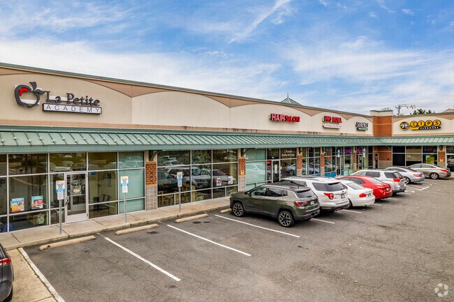

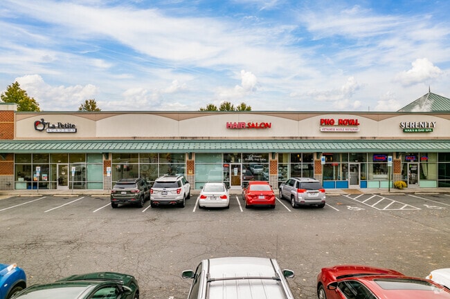
Property Detail
46839 Maple Leaf Pl
013-17-2668
WESTERLEY PARCEL E 1986--411 201211090088672P ST DED
Regionalshoppingcenterormallwithanchorstore
Loudoun
CCNC
Virginia
B and X Area of moderate flood hazard, usually the area between the limits of the 100-year and 500-year floods.
e
2025
2.42 AC
2025
Route 28 Corridor North
611205
Washington, DC
19,446 SF
Washington-Arlington-Alexandria, DC-VA-MD-WV
NEARBY LISTINGS FOR SALE OR LEASE
DEMOGRAPHICS near 46839 Maple Leaf Pl
1 mile
3 mile
5 mile
2025 Total Population
15,504
101,952
201,497
2030 Population
16,033
104,679
207,181
Pop Growth 2025-2030
+ 3.41%
+ 2.67%
+ 2.82%
Average Age
39
39
40
2025 Total Households
4,775
33,278
73,893
HH Growth 2025-2030
+ 3.46%
+ 2.73%
+ 3.02%
Median Household Inc
$139,733
$156,969
$145,582
Avg Household Size
3.10
3.00
2.70
2025 Avg HH Vehicles
2.00
2.00
2.00
Median Home Value
$651,945
$691,778
$694,734
Median Year Built
1986
1988
1991
Nearby Places
Map Layers
Map Styles
 Street
 Aerial
Transit
 Traffic
 Biking
Places
Listings with unknown addresses are not visible on the map
- Restaurants
- Banks
- Shops
- Fitness
- Groceries
PUBLIC TRANSPORTATION
AIRPORT
Washington Dulles International
Drive
Walk
Distance
Washington Dulles International
20 min
8.3 mi
Ronald Reagan Washington Ntl
Drive
Walk
Distance
Ronald Reagan Washington Ntl
42 min
26.5 mi
Freight Ports
Port of Baltimore
Drive
Walk
Distance
Port of Baltimore
81 min
58.4 mi
SALE & LEASE HISTORY
LISTING DATE
SALE/LEASE

Oct 05, 2020
For Lease
Nov 28, 2016
For Lease
May 08, 2025
For Lease
Jan 05, 2026
For Lease
Feb 11, 2022
For Lease
Nearby Properties
Address
Land Use
TOTAL SIZE
Lot Size
Zoning
Address
Land Use
TOTAL SIZE
Lot Size
Zoning
650,346 SF
PDMUB
Address
Land Use
TOTAL SIZE
Lot Size
Zoning
147,260 SF
33.04 AC
PDIP
Address
Land Use
TOTAL SIZE
Lot Size
Zoning
154,125 SF
9.68 AC
PDIP
Address
Land Use
TOTAL SIZE
Lot Size
Zoning
169,092 SF
PDMUB
Address
Land Use
TOTAL SIZE
Lot Size
Zoning
219,514 SF
14.34 AC
PDIP
Address
Land Use
TOTAL SIZE
Lot Size
Zoning
426,710 SF
19.50 AC
PDIP
Address
Land Use
TOTAL SIZE
Lot Size
Zoning
383,257 SF
33.05 AC
PDH4
Address
Land Use
TOTAL SIZE
Lot Size
Zoning
364,146 SF
38.05 AC
CCSC
Address
Land Use
TOTAL SIZE
Lot Size
Zoning
498,598 SF
21.89 AC
R16
Address
Land Use
TOTAL SIZE
Lot Size
Zoning
316,325 SF
18.08 AC
R16
Address
Land Use
TOTAL SIZE
Lot Size
Zoning
296,380 SF
24.36 AC
PDIP
Address
Land Use
TOTAL SIZE
Lot Size
Zoning
404,709 SF
18.57 AC
R24
Address
Land Use
TOTAL SIZE
Lot Size
Zoning
408,760 SF
87.24 AC
R1
Address
Land Use
TOTAL SIZE
Lot Size
Zoning
680,252 SF
19.23 AC
R16
Address
Land Use
TOTAL SIZE
Lot Size
Zoning
258,716 SF
10.62 AC
PDOP
Address
Land Use
TOTAL SIZE
Lot Size
Zoning
258,716 SF
13.65 AC
PDOP
Address
Land Use
TOTAL SIZE
Lot Size
Zoning
258,716 SF
12.54 AC
PDOP
Address
Land Use
TOTAL SIZE
Lot Size
Zoning
308,805 SF
34.45 AC
PDCCRC
Address
Land Use
TOTAL SIZE
Lot Size
Zoning
177,571 SF
16.23 AC
R16
Address
Land Use
TOTAL SIZE
Lot Size
Zoning
135,513 SF
8.49 AC
PDIP
Address
Land Use
TOTAL SIZE
Lot Size
Zoning
287,050 SF
11.05 AC
R24
Address
Land Use
TOTAL SIZE
Lot Size
Zoning
1,026,767 SF
71 AC
PDSC
Address
Land Use
TOTAL SIZE
Lot Size
Zoning
147,006 SF
PDTC
Address
Land Use
TOTAL SIZE
Lot Size
Zoning
110,535 SF
348.88 AC
R1
Address
Land Use
TOTAL SIZE
Lot Size
Zoning
251,859 SF
40 AC
R1
Address
Land Use
TOTAL SIZE
Lot Size
Zoning
31.82 AC
PDTC
Address
Land Use
TOTAL SIZE
Lot Size
Zoning
172,964 SF
8.02 AC
R24
Address
Land Use
TOTAL SIZE
Lot Size
Zoning
310,310 SF
40.67 AC
130
Address
Land Use
TOTAL SIZE
Lot Size
Zoning
204,867 SF
12.26 AC
PDIP
The World's #1 Commercial Real Estate Marketplace
Connect with us
© 2026 CoStar Group
The information above has been obtained from sources believed reliable. While we do not doubt its accuracy we have not verified it and make no guarantee, warranty or representation about it. It is your responsibility to independently confirm its accuracy and completeness. Any projections, opinions, assumptions, or estimates used are for example only and do not represent the current or future performance of the property. The value of this transaction to you depends on tax and other factors which should be evaluated by your tax, financial, and legal advisors. You and your advisors should conduct a careful, independent investigation of the property to determine to your satisfaction the suitability of the property for your needs.