Property Record
4685 Baseline Rd, Boulder, CO 80303
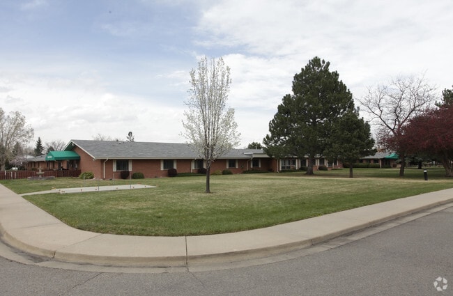

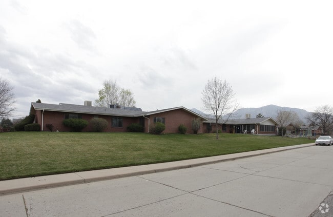

Property Detail
4685 Baseline Rd
Boulder, CO
OUTLOT C BLK 10 PARK EAST
1463333-18-001
Boulder
Multifamilydwelling
Colorado
B and X Area of moderate flood hazard, usually the area between the limits of the 100-year and 500-year floods.
c
2025
4.82 AC
2026
Boulder
012608
Denver
55,795 SF
NEARBY LISTINGS FOR SALE OR LEASE
-
-
View all Boulder listings for sale on LoopNet.com
DEMOGRAPHICS near 4685 Baseline Rd
1 mile
3 mile
5 mile
2025 Total Population
20,735
88,243
125,833
2030 Population
20,764
88,245
125,481
Pop Growth 2025-2030
+ 0.14%
0.00%
(0.28%)
Average Age
35
36
38
2025 Total Households
7,967
35,359
50,760
HH Growth 2025-2030
+ 0.20%
+ 0.07%
(0.25%)
Median Household Inc
$73,742
$69,479
$85,785
Avg Household Size
2.10
2.10
2.20
2025 Avg HH Vehicles
2.00
2.00
2.00
Median Home Value
$896,465
$977,383
$1,001,098
Median Year Built
1977
1976
1978
Nearby Places
Map Layers
Map Styles
 Street
 Aerial
Layers
 Traffic
 Biking
Places
Listings with unknown addresses are not visible on the map
- Restaurants
- Banks
- Shops
- Fitness
- Groceries
PUBLIC TRANSPORTATION
AIRPORT
Denver International
Drive
Walk
Distance
Denver International
49 min
41.5 mi
Nearby Properties
Address
Land Use
TOTAL SIZE
Lot Size
Zoning
Address
Land Use
TOTAL SIZE
Lot Size
Zoning
1,285,025 SF
17.46 AC
Address
Land Use
TOTAL SIZE
Lot Size
Zoning
30.08 AC
Address
Land Use
TOTAL SIZE
Lot Size
Zoning
14.66 AC
Address
Land Use
TOTAL SIZE
Lot Size
Zoning
941,000 SF
44 SF
Address
Land Use
TOTAL SIZE
Lot Size
Zoning
171.91 AC
Address
Land Use
TOTAL SIZE
Lot Size
Zoning
1,892,750 SF
200 AC
Address
Land Use
TOTAL SIZE
Lot Size
Zoning
155,000 SF
205.33 AC
Address
Land Use
TOTAL SIZE
Lot Size
Zoning
329,080 SF
16.41 AC
Address
Land Use
TOTAL SIZE
Lot Size
Zoning
244,999 SF
2.24 AC
Address
Land Use
TOTAL SIZE
Lot Size
Zoning
599,605 SF
4.46 AC
Address
Land Use
TOTAL SIZE
Lot Size
Zoning
842,665 SF
59.42 AC
Address
Land Use
TOTAL SIZE
Lot Size
Zoning
196,542 SF
1.41 AC
Address
Land Use
TOTAL SIZE
Lot Size
Zoning
191,430 SF
5.92 AC
Address
Land Use
TOTAL SIZE
Lot Size
Zoning
204,396 SF
1.41 AC
Address
Land Use
TOTAL SIZE
Lot Size
Zoning
520,605 SF
42.57 AC
C
Address
Land Use
TOTAL SIZE
Lot Size
Zoning
103,400 SF
21.82 AC
Address
Land Use
TOTAL SIZE
Lot Size
Zoning
518,974 SF
65.71 AC
Address
Land Use
TOTAL SIZE
Lot Size
Zoning
186.43 AC
RR
Address
Land Use
TOTAL SIZE
Lot Size
Zoning
294,015 SF
2.05 AC
Address
Land Use
TOTAL SIZE
Lot Size
Zoning
25.41 AC
GI
Address
Land Use
TOTAL SIZE
Lot Size
Zoning
63.88 AC
RR
Address
Land Use
TOTAL SIZE
Lot Size
Zoning
385,761 SF
19.07 AC
Address
Land Use
TOTAL SIZE
Lot Size
Zoning
234,968 SF
0.96 AC
Address
Land Use
TOTAL SIZE
Lot Size
Zoning
268.67 AC
Address
Land Use
TOTAL SIZE
Lot Size
Zoning
226,977 SF
Address
Land Use
TOTAL SIZE
Lot Size
Zoning
48.98 AC
A
Address
Land Use
TOTAL SIZE
Lot Size
Zoning
161,616 SF
8 AC
Address
Land Use
TOTAL SIZE
Lot Size
Zoning
69.99 AC
ER
Address
Land Use
TOTAL SIZE
Lot Size
Zoning
117,540 SF
Address
Land Use
TOTAL SIZE
Lot Size
Zoning
161,761 SF
4.79 AC
The World's #1 Commercial Real Estate Marketplace
Connect with us
© 2026 CoStar Group
The information above has been obtained from sources believed reliable. While we do not doubt its accuracy we have not verified it and make no guarantee, warranty or representation about it. It is your responsibility to independently confirm its accuracy and completeness. Any projections, opinions, assumptions, or estimates used are for example only and do not represent the current or future performance of the property. The value of this transaction to you depends on tax and other factors which should be evaluated by your tax, financial, and legal advisors. You and your advisors should conduct a careful, independent investigation of the property to determine to your satisfaction the suitability of the property for your needs.