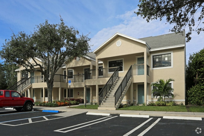
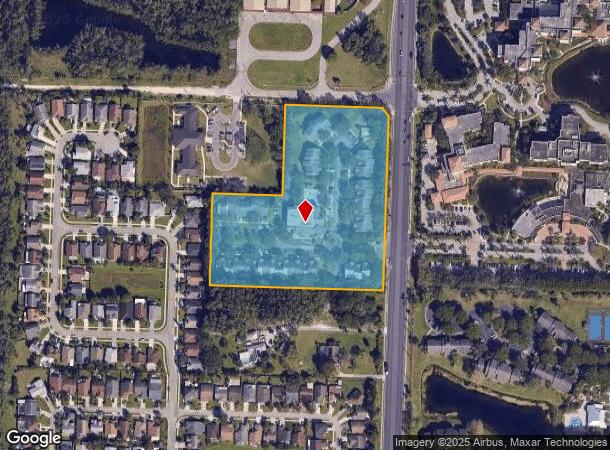
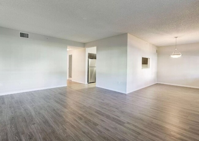
Property Record
4685 N Haverhill Rd, West Palm Beach, FL 33417
NEARBY LISTINGS FOR SALE OR LEASE
-
-
View all West Palm Beach listings for sale on LoopNet.com
Property Detail
4685 N Haverhill Rd
74-42-43-11-05-000-0000
Galilee
Multifamilydwelling
GALILEE ALL OF PLAT
X
Palm Beach
12099C0576F
Florida
2024
7.08 AC
2025
West Palm Beach
001907
South Florida
121,196 SF
West Palm Beach-Boca Raton-Delray Beach, FL
DEMOGRAPHICS near 4685 N Haverhill Rd
1 Mile
3 Mile
5 Mile
2024 Total Population
12,332
81,094
224,498
2029 Population
12,817
85,189
234,292
Pop Growth 2024-2029
+ 3.93%
+ 5.05%
+ 4.36%
Average Age
38
42
40
2024 Total Households
4,827
35,180
88,585
HH Growth 2024-2029
+ 3.11%
+ 4.64%
+ 3.97%
Median Household Inc
$66,309
$50,346
$52,898
Avg Household Size
2.40
2.20
2.40
2024 Avg HH Vehicles
1.00
1.00
1.00
Median Home Value
$234,916
$182,185
$250,451
Median Year Built
1999
1986
1986
Nearby Places
Map Layers
Map Styles
 Street
 Aerial
- Restaurants
- Banks
- Shops
- Fitness
- Groceries
PUBLIC TRANSPORTATION
COMMUTER RAIL
Mangonia Park (Tri-County Commuter - South Florida Regional Transportation Authority (Tri-Rail))
DRIVE
WALK
Distance
Mangonia Park (Tri-County Commuter - South Florida Regional Transportation Authority (Tri-Rail))
10 min
4.7 mi
West Palm Beach (Tri-County Commuter - South Florida Regional Transportation Authority (Tri-Rail))
DRIVE
WALK
Distance
West Palm Beach (Tri-County Commuter - South Florida Regional Transportation Authority (Tri-Rail))
13 min
8.0 mi
AIRPORT
Palm Beach International
DRIVE
WALK
Distance
Palm Beach International
15 min
6.5 mi
Freight Ports
Port of Palm Beach
DRIVE
WALK
Distance
Port of Palm Beach
13 min
6.5 mi
SALE & LEASE HISTORY
LISTING DATE
SALE/LEASE

Sep 24, 2016
For Sale
Apr 06, 2017
For Sale
Nearby Properties
Address
Land Use
TOTAL SIZE
Lot Size
Zoning
Address
Land Use
TOTAL SIZE
Lot Size
Zoning
1,778,741 SF
69.19 AC
CF
Address
Land Use
TOTAL SIZE
Lot Size
Zoning
492,288 SF
58.55 AC
CPD
Address
Land Use
TOTAL SIZE
Lot Size
Zoning
770,163 SF
571.53 AC
CS
Address
Land Use
TOTAL SIZE
Lot Size
Zoning
303,776 SF
27.63 AC
CPD
Address
Land Use
TOTAL SIZE
Lot Size
Zoning
586,386 SF
19.67 AC
RPD
Address
Land Use
TOTAL SIZE
Lot Size
Zoning
546,847 SF
19.50 AC
RPD
Address
Land Use
TOTAL SIZE
Lot Size
Zoning
411,080 SF
7.59 AC
CPD
Address
Land Use
TOTAL SIZE
Lot Size
Zoning
292,706 SF
30.75 AC
RPD
Address
Land Use
TOTAL SIZE
Lot Size
Zoning
347,853 SF
46.24 AC
PIPD
Address
Land Use
TOTAL SIZE
Lot Size
Zoning
224,212 SF
141.33 AC
CSPD
Address
Land Use
TOTAL SIZE
Lot Size
Zoning
406,623 SF
47.23 AC
MF14
Address
Land Use
TOTAL SIZE
Lot Size
Zoning
371,177 SF
17.38 AC
RPD
Address
Land Use
TOTAL SIZE
Lot Size
Zoning
328,512 SF
15.27 AC
PUD
Address
Land Use
TOTAL SIZE
Lot Size
Zoning
232,751 SF
12.67 AC
RPD
Address
Land Use
TOTAL SIZE
Lot Size
Zoning
302,217 SF
18.17 AC
RPD
Address
Land Use
TOTAL SIZE
Lot Size
Zoning
366,446 SF
67.91 AC
CPD
Address
Land Use
TOTAL SIZE
Lot Size
Zoning
307,554 SF
6.10 AC
CSPD
Address
Land Use
TOTAL SIZE
Lot Size
Zoning
247,028 SF
14.30 AC
RS
Address
Land Use
TOTAL SIZE
Lot Size
Zoning
177,585 SF
9.90 AC
CPD
Address
Land Use
TOTAL SIZE
Lot Size
Zoning
219,117 SF
4.15 AC
CPD
Address
Land Use
TOTAL SIZE
Lot Size
Zoning
172,493 SF
20.46 AC
CPD
Address
Land Use
TOTAL SIZE
Lot Size
Zoning
347,973 SF
17.87 AC
RM
Address
Land Use
TOTAL SIZE
Lot Size
Zoning
416,165 SF
42.48 AC
CSPD
Address
Land Use
TOTAL SIZE
Lot Size
Zoning
248,196 SF
8.74 AC
RPD
Address
Land Use
TOTAL SIZE
Lot Size
Zoning
270,686 SF
56.14 AC
IG
Address
Land Use
TOTAL SIZE
Lot Size
Zoning
299,161 SF
16.85 AC
CSPD
Address
Land Use
TOTAL SIZE
Lot Size
Zoning
323,628 SF
48.15 AC
IG
Address
Land Use
TOTAL SIZE
Lot Size
Zoning
236,554 SF
14.37 AC
IG
Address
Land Use
TOTAL SIZE
Lot Size
Zoning
262,228 SF
21.44 AC
CG
Address
Land Use
TOTAL SIZE
Lot Size
Zoning
118,728 SF
13.94 AC
MUPD
The World's #1 Commercial Real Estate Marketplace
Connect with us
© 2025 CoStar Group
The information above has been obtained from sources believed reliable. While we do not doubt its accuracy we have not verified it and make no guarantee, warranty or representation about it. It is your responsibility to independently confirm its accuracy and completeness. Any projections, opinions, assumptions, or estimates used are for example only and do not represent the current or future performance of the property. The value of this transaction to you depends on tax and other factors which should be evaluated by your tax, financial, and legal advisors. You and your advisors should conduct a careful, independent investigation of the property to determine to your satisfaction the suitability of the property for your needs.