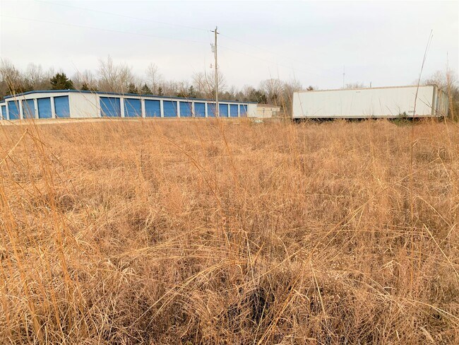
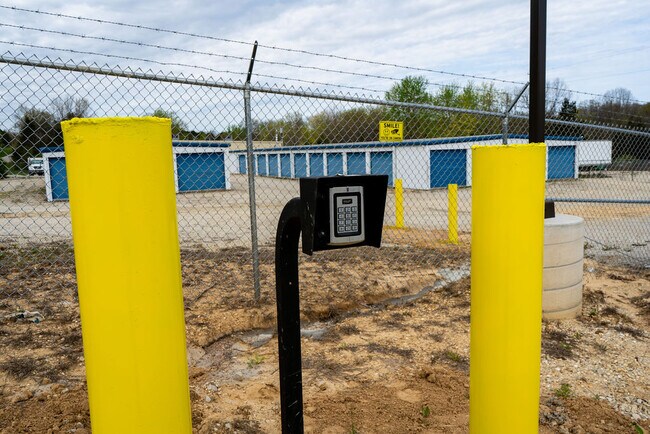
Property Record
4687 Highway 50, Leslie, MO 63056

Current Lease Availabilities
NEARBY LISTINGS FOR SALE OR LEASE
-
-
View all Leslie listings for lease on LoopNet.com
Property Detail
4687 Highway 50
24-1-020-2-000-010300
MINI STORAGE SITEPT LOT 2 NW N OF HWY 50
Realpropertynec
Franklin
X
Missouri
29071C0265D
2
2025
4 AC
2025
Franklin County
800501
St. Louis
3,000 SF
St. Louis, MO-IL
DEMOGRAPHICS near 4687 Highway 50
1 mile
3 mile
5 mile
2024 Total Population
341
1,298
3,207
2029 Population
355
1,353
3,340
Pop Growth 2024-2029
+ 4.11%
+ 4.24%
+ 4.15%
Average Age
44
44
43
2024 Total Households
135
523
1,279
HH Growth 2024-2029
+ 4.44%
+ 4.21%
+ 4.14%
Median Household Inc
$59,374
$72,053
$72,790
Avg Household Size
2.50
2.40
2.40
2024 Avg HH Vehicles
2.00
2.00
2.00
Median Home Value
$196,666
$224,516
$234,171
Median Year Built
1979
1984
1983
Nearby Places
Map Layers
Map Styles
 Street
 Aerial
Transit
 Traffic
 Biking
Places
Listings with unknown addresses are not visible on the map
- Restaurants
- Banks
- Shops
- Fitness
- Groceries
Nearby Properties
Address
Land Use
TOTAL SIZE
Lot Size
Zoning
Address
Land Use
TOTAL SIZE
Lot Size
Zoning
2,480 SF
28 AC
ANU
Address
Land Use
TOTAL SIZE
Lot Size
Zoning
10,270 SF
1 AC
CD
Address
Land Use
TOTAL SIZE
Lot Size
Zoning
560 SF
4.10 AC
CD
Address
Land Use
TOTAL SIZE
Lot Size
Zoning
720 SF
7.30 AC
CD
Address
Land Use
TOTAL SIZE
Lot Size
Zoning
5,600 SF
22.70 AC
CD
Address
Land Use
TOTAL SIZE
Lot Size
Zoning
0.90 AC
Address
Land Use
TOTAL SIZE
Lot Size
Zoning
3,500 SF
3.20 AC
CD
Address
Land Use
TOTAL SIZE
Lot Size
Zoning
6,344 SF
5.10 AC
ANU
Address
Land Use
TOTAL SIZE
Lot Size
Zoning
3,900 SF
0.60 AC
ANU
Address
Land Use
TOTAL SIZE
Lot Size
Zoning
6,477 SF
14.60 AC
ANU
Address
Land Use
TOTAL SIZE
Lot Size
Zoning
3,317 SF
40 AC
ANU
Address
Land Use
TOTAL SIZE
Lot Size
Zoning
6,060 SF
1 AC
Address
Land Use
TOTAL SIZE
Lot Size
Zoning
2,654 SF
51 AC
CD
Address
Land Use
TOTAL SIZE
Lot Size
Zoning
4,210 SF
290 AC
CD
Address
Land Use
TOTAL SIZE
Lot Size
Zoning
3,109 SF
23.70 AC
ANU
Address
Land Use
TOTAL SIZE
Lot Size
Zoning
1,008 SF
0.40 AC
Address
Land Use
TOTAL SIZE
Lot Size
Zoning
8,068 SF
0.30 AC
CD
Address
Land Use
TOTAL SIZE
Lot Size
Zoning
4,067 SF
10 AC
ANU
Address
Land Use
TOTAL SIZE
Lot Size
Zoning
14 AC
CD
Address
Land Use
TOTAL SIZE
Lot Size
Zoning
1,978 SF
53.70 AC
ANU
Address
Land Use
TOTAL SIZE
Lot Size
Zoning
1.54 AC
Address
Land Use
TOTAL SIZE
Lot Size
Zoning
3,322 SF
30 AC
ANU
Address
Land Use
TOTAL SIZE
Lot Size
Zoning
3,371 SF
14.80 AC
ANU
Address
Land Use
TOTAL SIZE
Lot Size
Zoning
2,762 SF
28.80 AC
ANU
Address
Land Use
TOTAL SIZE
Lot Size
Zoning
2,341 SF
14.80 AC
ANU
Address
Land Use
TOTAL SIZE
Lot Size
Zoning
2,488 SF
0.80 AC
CD
Address
Land Use
TOTAL SIZE
Lot Size
Zoning
2,572 SF
10.40 AC
CD
Address
Land Use
TOTAL SIZE
Lot Size
Zoning
2,464 SF
51 AC
CD
Address
Land Use
TOTAL SIZE
Lot Size
Zoning
0.10 AC
Address
Land Use
TOTAL SIZE
Lot Size
Zoning
3,431 SF
20 AC
The World's #1 Commercial Real Estate Marketplace
Connect with us
© 2026 CoStar Group
The information above has been obtained from sources believed reliable. While we do not doubt its accuracy we have not verified it and make no guarantee, warranty or representation about it. It is your responsibility to independently confirm its accuracy and completeness. Any projections, opinions, assumptions, or estimates used are for example only and do not represent the current or future performance of the property. The value of this transaction to you depends on tax and other factors which should be evaluated by your tax, financial, and legal advisors. You and your advisors should conduct a careful, independent investigation of the property to determine to your satisfaction the suitability of the property for your needs.