Property Record
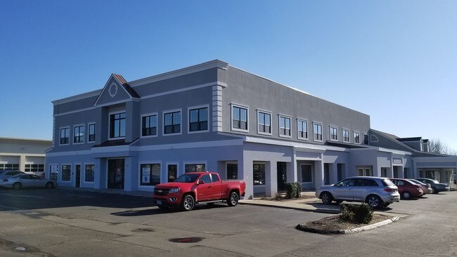
469 W Main St, Branford, CT 06405


Property Detail
469 W Main St
BRAN-000007B-B000008-000003-000001
South Central Ct
Commercialnec
Connecticut
B and X Area of moderate flood hazard, usually the area between the limits of the 100-year and 500-year floods.
1
2025
1.83 AC
2025
Branford
184200
Westchester/So Connecticut
15,183 SF
New Haven, CT
NEARBY LISTINGS FOR SALE OR LEASE
DEMOGRAPHICS near 469 W Main St
1 mile
3 mile
5 mile
2025 Total Population
5,523
64,078
145,668
2030 Population
5,702
65,138
147,236
Pop Growth 2025-2030
+ 3.24%
+ 1.65%
+ 1.08%
Average Age
44
44
40
2025 Total Households
2,515
28,331
60,866
HH Growth 2025-2030
+ 3.26%
+ 1.95%
+ 1.41%
Median Household Inc
$81,058
$72,231
$70,054
Avg Household Size
2.20
2.20
2.20
2025 Avg HH Vehicles
2.00
2.00
1.00
Median Home Value
$314,516
$307,065
$324,148
Median Year Built
1979
1968
1963
Nearby Places
Map Layers
Map Styles
 Street
 Aerial
Layers
 Traffic
 Biking
Places
Listings with unknown addresses are not visible on the map
- Restaurants
- Banks
- Shops
- Fitness
- Groceries
PUBLIC TRANSPORTATION
COMMUTER RAIL
Branford (Shore Line East - Shore Line East)
Drive
Walk
Distance
Branford (Shore Line East - Shore Line East)
5 min
2.1 mi
New Haven-State Street Station (New Haven Line - Metro-North Commuter Railroad Company (Metro-North))
Drive
Walk
Distance
New Haven-State Street Station (New Haven Line - Metro-North Commuter Railroad Company (Metro-North))
9 min
4.8 mi
AIRPORT
Tweed/New Haven
Drive
Walk
Distance
Tweed/New Haven
7 min
2.6 mi
SALE & LEASE HISTORY
LISTING DATE
SALE/LEASE

Jan 23, 2017
For Lease
Nearby Properties
Address
Land Use
TOTAL SIZE
Lot Size
Zoning
Address
Land Use
TOTAL SIZE
Lot Size
Zoning
227,335 SF
38.50 AC
Address
Land Use
TOTAL SIZE
Lot Size
Zoning
117,066 SF
71.34 AC
IH
Address
Land Use
TOTAL SIZE
Lot Size
Zoning
8,655 SF
107.61 AC
AIRPOR
Address
Land Use
TOTAL SIZE
Lot Size
Zoning
85,679 SF
14.23 AC
RM1
Address
Land Use
TOTAL SIZE
Lot Size
Zoning
197.78 AC
LI-3
Address
Land Use
TOTAL SIZE
Lot Size
Zoning
132,592 SF
4.61 AC
PDD 23
Address
Land Use
TOTAL SIZE
Lot Size
Zoning
5,946 SF
0.09 AC
RM1
Address
Land Use
TOTAL SIZE
Lot Size
Zoning
7.72 AC
RA-1
Address
Land Use
TOTAL SIZE
Lot Size
Zoning
306,943 SF
1.92 AC
PDD 23
Address
Land Use
TOTAL SIZE
Lot Size
Zoning
1,932 SF
64.06 AC
PARK
Address
Land Use
TOTAL SIZE
Lot Size
Zoning
16.50 AC
Address
Land Use
TOTAL SIZE
Lot Size
Zoning
5.50 AC
Address
Land Use
TOTAL SIZE
Lot Size
Zoning
249,513 SF
6.57 AC
PDD 23
Address
Land Use
TOTAL SIZE
Lot Size
Zoning
35 AC
RA-1
Address
Land Use
TOTAL SIZE
Lot Size
Zoning
44,676 SF
7 AC
Address
Land Use
TOTAL SIZE
Lot Size
Zoning
276,776 SF
4.98 AC
PDD 23
Address
Land Use
TOTAL SIZE
Lot Size
Zoning
2,299 SF
14.94 AC
RA-1
Address
Land Use
TOTAL SIZE
Lot Size
Zoning
96,449 SF
1.67 AC
RS2
Address
Land Use
TOTAL SIZE
Lot Size
Zoning
48,726 SF
9.46 AC
Address
Land Use
TOTAL SIZE
Lot Size
Zoning
19.26 AC
R-2
Address
Land Use
TOTAL SIZE
Lot Size
Zoning
9.34 AC
CA-1
Address
Land Use
TOTAL SIZE
Lot Size
Zoning
105,998 SF
13.68 AC
PDD
Address
Land Use
TOTAL SIZE
Lot Size
Zoning
10,892 SF
5.05 AC
Address
Land Use
TOTAL SIZE
Lot Size
Zoning
2,816 SF
PDD 11
Address
Land Use
TOTAL SIZE
Lot Size
Zoning
5,596 SF
37.74 AC
IH/RM1
Address
Land Use
TOTAL SIZE
Lot Size
Zoning
19.50 AC
Address
Land Use
TOTAL SIZE
Lot Size
Zoning
99,965 SF
9.11 AC
PEFD
Address
Land Use
TOTAL SIZE
Lot Size
Zoning
34,341 SF
5.65 AC
Address
Land Use
TOTAL SIZE
Lot Size
Zoning
109,119 SF
CA-1
Address
Land Use
TOTAL SIZE
Lot Size
Zoning
14,508 SF
14 AC
The World's #1 Commercial Real Estate Marketplace
Connect with us
© 2026 CoStar Group
The information above has been obtained from sources believed reliable. While we do not doubt its accuracy we have not verified it and make no guarantee, warranty or representation about it. It is your responsibility to independently confirm its accuracy and completeness. Any projections, opinions, assumptions, or estimates used are for example only and do not represent the current or future performance of the property. The value of this transaction to you depends on tax and other factors which should be evaluated by your tax, financial, and legal advisors. You and your advisors should conduct a careful, independent investigation of the property to determine to your satisfaction the suitability of the property for your needs.