Property Record
47 Jeanne Dr, Newburgh, NY 12550
NEARBY LISTINGS FOR SALE OR LEASE
Property Detail
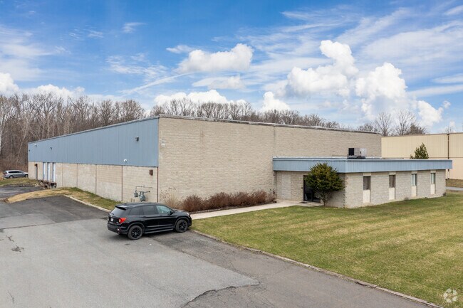
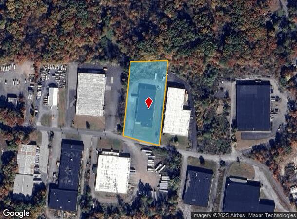
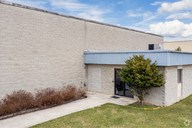
47 Jeanne Dr
New York-Jersey City-White Plains, NY-NJ
Jegamont Rlty Corp
334600-034-000-0002-067.100-0000
LT 1 JEGAMONT RLTY CORP SUB MAP 9014
Officebuilding
Orange
X
New York
36111C0900F
67.10
2024
2.50 AC
2024
Orange County
010300
Northern New Jersey
21,560 SF
DEMOGRAPHICS near 47 Jeanne Dr
1 Mile
3 Mile
5 Mile
2024 Total Population
2,548
31,116
82,230
2029 Population
2,623
31,683
83,519
Pop Growth 2024-2029
+ 2.94%
+ 1.82%
+ 1.57%
Average Age
41
41
39
2024 Total Households
873
11,193
29,972
HH Growth 2024-2029
+ 2.86%
+ 1.86%
+ 1.64%
Median Household Inc
$100,248
$95,893
$82,884
Avg Household Size
2.80
2.70
2.60
2024 Avg HH Vehicles
2.00
2.00
2.00
Median Home Value
$278,135
$290,655
$295,451
Median Year Built
1966
1968
1965
Nearby Places
- Restaurants
- Banks
- Shops
- Fitness
- Groceries
PUBLIC TRANSPORTATION
COMMUTER RAIL
Beacon Station (Hudson Line - Metro-North Commuter Railroad Company (Metro-North))
DRIVE
WALK
Distance
Beacon Station (Hudson Line - Metro-North Commuter Railroad Company (Metro-North))
15 min
7.9 mi
AIRPORT
New York Stewart International
DRIVE
WALK
Distance
New York Stewart International
15 min
7.0 mi
Freight Ports
Port Newark Container Terminal
DRIVE
WALK
Distance
Port Newark Container Terminal
93 min
69.6 mi
SALE & LEASE HISTORY
LISTING DATE
SALE/LEASE

Dec 05, 2017
For Lease
Nearby Properties
Address
Land Use
TOTAL SIZE
Lot Size
Zoning
Address
Land Use
TOTAL SIZE
Lot Size
Zoning
345,572 SF
43.80 AC
R-1
Address
Land Use
TOTAL SIZE
Lot Size
Zoning
927,041 SF
104.37 AC
Address
Land Use
TOTAL SIZE
Lot Size
Zoning
272,943 SF
17 AC
RL
Address
Land Use
TOTAL SIZE
Lot Size
Zoning
112,136 SF
2.70 AC
RM
Address
Land Use
TOTAL SIZE
Lot Size
Zoning
130,037 SF
128.80 AC
Address
Land Use
TOTAL SIZE
Lot Size
Zoning
82,344 SF
1.80 AC
RH
Address
Land Use
TOTAL SIZE
Lot Size
Zoning
213,521 SF
8 AC
RH
Address
Land Use
TOTAL SIZE
Lot Size
Zoning
71.72 AC
Address
Land Use
TOTAL SIZE
Lot Size
Zoning
44.50 AC
Address
Land Use
TOTAL SIZE
Lot Size
Zoning
505,577 SF
50.50 AC
Address
Land Use
TOTAL SIZE
Lot Size
Zoning
265,660 SF
24.20 AC
Address
Land Use
TOTAL SIZE
Lot Size
Zoning
Address
Land Use
TOTAL SIZE
Lot Size
Zoning
29,935 SF
31.60 AC
04
Address
Land Use
TOTAL SIZE
Lot Size
Zoning
67,448 SF
6.30 AC
RL
Address
Land Use
TOTAL SIZE
Lot Size
Zoning
71,379 SF
20.80 AC
Address
Land Use
TOTAL SIZE
Lot Size
Zoning
200,000 SF
13.80 AC
CD
Address
Land Use
TOTAL SIZE
Lot Size
Zoning
97,011 SF
19.70 AC
Address
Land Use
TOTAL SIZE
Lot Size
Zoning
115,361 SF
17.70 AC
IND
Address
Land Use
TOTAL SIZE
Lot Size
Zoning
73,585 SF
5.60 AC
04
Address
Land Use
TOTAL SIZE
Lot Size
Zoning
30,801 SF
2.40 AC
IND
Address
Land Use
TOTAL SIZE
Lot Size
Zoning
69,748 SF
13.85 AC
RH
Address
Land Use
TOTAL SIZE
Lot Size
Zoning
215,219 SF
14.57 AC
Address
Land Use
TOTAL SIZE
Lot Size
Zoning
Address
Land Use
TOTAL SIZE
Lot Size
Zoning
22,088 SF
5.02 AC
IND
Address
Land Use
TOTAL SIZE
Lot Size
Zoning
49.60 AC
IND
Address
Land Use
TOTAL SIZE
Lot Size
Zoning
921,380 SF
9.90 AC
Address
Land Use
TOTAL SIZE
Lot Size
Zoning
Address
Land Use
TOTAL SIZE
Lot Size
Zoning
137,765 SF
14 AC
Address
Land Use
TOTAL SIZE
Lot Size
Zoning
Address
Land Use
TOTAL SIZE
Lot Size
Zoning
62,458 SF
7.20 AC
The World's #1 Commercial Real Estate Marketplace
Connect with us
© 2025 CoStar Group
The information above has been obtained from sources believed reliable. While we do not doubt its accuracy we have not verified it and make no guarantee, warranty or representation about it. It is your responsibility to independently confirm its accuracy and completeness. Any projections, opinions, assumptions, or estimates used are for example only and do not represent the current or future performance of the property. The value of this transaction to you depends on tax and other factors which should be evaluated by your tax, financial, and legal advisors. You and your advisors should conduct a careful, independent investigation of the property to determine to your satisfaction the suitability of the property for your needs.