Property Record
47 Mine Brook Rd, Bernardsville, NJ 07924
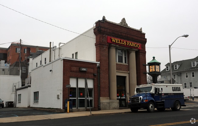


Property Detail
47 Mine Brook Rd
03-00077-0000-00013
Somerset
Officebuilding
New Jersey
D-CO
13
AE The base floodplain where base flood elevations are provided. AE Zones are now used on new format FIRMs instead of A1-A30 Zones.
0.43 AC
2024
Route 78 East
2025
Northern New Jersey
052701
Lakewood-New Brunswick, NJ
10,378 SF
NEARBY LISTINGS FOR SALE OR LEASE
DEMOGRAPHICS near 47 Mine Brook Rd
1 mile
3 mile
5 mile
2025 Total Population
6,711
20,470
50,315
2030 Population
6,924
21,221
51,865
Pop Growth 2025-2030
+ 3.17%
+ 3.67%
+ 3.08%
Average Age
41
42
43
2025 Total Households
2,321
7,075
18,256
HH Growth 2025-2030
+ 3.36%
+ 3.86%
+ 3.26%
Median Household Inc
$208,731
$215,274
$191,607
Avg Household Size
2.90
2.80
2.70
2025 Avg HH Vehicles
2.00
2.00
2.00
Median Home Value
$780,637
$887,068
$828,845
Median Year Built
1962
1967
1978
Nearby Places
Map Layers
Map Styles
 Street
 Aerial
Layers
 Traffic
 Biking
Places
Listings with unknown addresses are not visible on the map
- Restaurants
- Banks
- Shops
- Fitness
- Groceries
PUBLIC TRANSPORTATION
TRANSIT/SUBWAY
Bernardsville (Morris & Essex Gladstone Branch - NJ Transit Commuter Rail (NJ Transit))
Drive
Walk
Distance
Bernardsville (Morris & Essex Gladstone Branch - NJ Transit Commuter Rail (NJ Transit))
1 min
2 min
0.1 mi
COMMUTER RAIL
Bernardsville (Morris & Essex Gladstone Branch - NJ Transit Commuter Rail (NJ Transit))
Drive
Walk
Distance
Bernardsville (Morris & Essex Gladstone Branch - NJ Transit Commuter Rail (NJ Transit))
1 min
3 min
0.1 mi
Basking Ridge (Morris & Essex Gladstone Branch - NJ Transit Commuter Rail (NJ Transit))
Drive
Walk
Distance
Basking Ridge (Morris & Essex Gladstone Branch - NJ Transit Commuter Rail (NJ Transit))
4 min
1.7 mi
AIRPORT
Newark Liberty International
Drive
Walk
Distance
Newark Liberty International
39 min
30.0 mi
Trenton Mercer
Drive
Walk
Distance
Trenton Mercer
70 min
40.4 mi
Freight Ports
Maher Terminal
Drive
Walk
Distance
Maher Terminal
43 min
30.6 mi
SALE & LEASE HISTORY
LISTING DATE
SALE/LEASE

Dec 26, 2024
For Sale
Apr 25, 2025
For Sale
Apr 04, 2017
For Lease
Nearby Properties
Address
Land Use
TOTAL SIZE
Lot Size
Zoning
Address
Land Use
TOTAL SIZE
Lot Size
Zoning
133.08 AC
E1
Address
Land Use
TOTAL SIZE
Lot Size
Zoning
290,000 SF
51.96 AC
E4
Address
Land Use
TOTAL SIZE
Lot Size
Zoning
839.97 AC
P1
Address
Land Use
TOTAL SIZE
Lot Size
Zoning
34.78 AC
P3
Address
Land Use
TOTAL SIZE
Lot Size
Zoning
21,500 SF
9.66 AC
E4
Address
Land Use
TOTAL SIZE
Lot Size
Zoning
103,547 SF
15.70 AC
Address
Land Use
TOTAL SIZE
Lot Size
Zoning
96,631 SF
13.69 AC
OB
Address
Land Use
TOTAL SIZE
Lot Size
Zoning
8.67 AC
DCOR
Address
Land Use
TOTAL SIZE
Lot Size
Zoning
211,662 SF
33.83 AC
E5
Address
Land Use
TOTAL SIZE
Lot Size
Zoning
100,860 SF
14.06 AC
OB
Address
Land Use
TOTAL SIZE
Lot Size
Zoning
2,381 SF
34.92 AC
E1
Address
Land Use
TOTAL SIZE
Lot Size
Zoning
2,976 SF
19.80 AC
SH2
Address
Land Use
TOTAL SIZE
Lot Size
Zoning
16,496 SF
157.52 AC
R110
Address
Land Use
TOTAL SIZE
Lot Size
Zoning
26.04 AC
DCOR
Address
Land Use
TOTAL SIZE
Lot Size
Zoning
141.24 AC
Address
Land Use
TOTAL SIZE
Lot Size
Zoning
2,133 SF
34.33 AC
P3
Address
Land Use
TOTAL SIZE
Lot Size
Zoning
3,230 SF
14.43 AC
E3
Address
Land Use
TOTAL SIZE
Lot Size
Zoning
97.51 AC
PL
Address
Land Use
TOTAL SIZE
Lot Size
Zoning
41,385 SF
65.51 AC
R4
Address
Land Use
TOTAL SIZE
Lot Size
Zoning
87.32 AC
RR
Address
Land Use
TOTAL SIZE
Lot Size
Zoning
6.92 AC
B2
Address
Land Use
TOTAL SIZE
Lot Size
Zoning
34,806 SF
6.28 AC
SH1
Address
Land Use
TOTAL SIZE
Lot Size
Zoning
2,141 SF
111 AC
R1
Address
Land Use
TOTAL SIZE
Lot Size
Zoning
28,381 SF
90.71 AC
5-AC
Address
Land Use
TOTAL SIZE
Lot Size
Zoning
35,436 SF
18.30 AC
R6
Address
Land Use
TOTAL SIZE
Lot Size
Zoning
22,833 SF
7 AC
R110
Address
Land Use
TOTAL SIZE
Lot Size
Zoning
185.18 AC
P1
Address
Land Use
TOTAL SIZE
Lot Size
Zoning
9,540 SF
9.39 AC
E5
Address
Land Use
TOTAL SIZE
Lot Size
Zoning
15,207 SF
5.50 AC
R110
Address
Land Use
TOTAL SIZE
Lot Size
Zoning
18,867 SF
3.90 AC
R1
The World's #1 Commercial Real Estate Marketplace
Connect with us
© 2026 CoStar Group
The information above has been obtained from sources believed reliable. While we do not doubt its accuracy we have not verified it and make no guarantee, warranty or representation about it. It is your responsibility to independently confirm its accuracy and completeness. Any projections, opinions, assumptions, or estimates used are for example only and do not represent the current or future performance of the property. The value of this transaction to you depends on tax and other factors which should be evaluated by your tax, financial, and legal advisors. You and your advisors should conduct a careful, independent investigation of the property to determine to your satisfaction the suitability of the property for your needs.