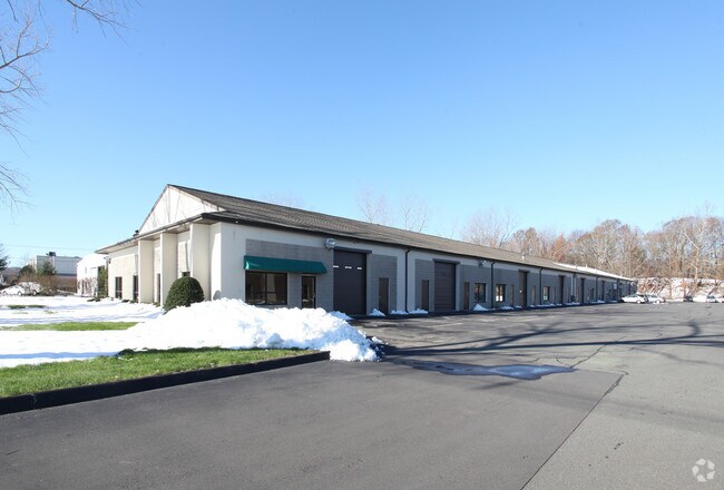
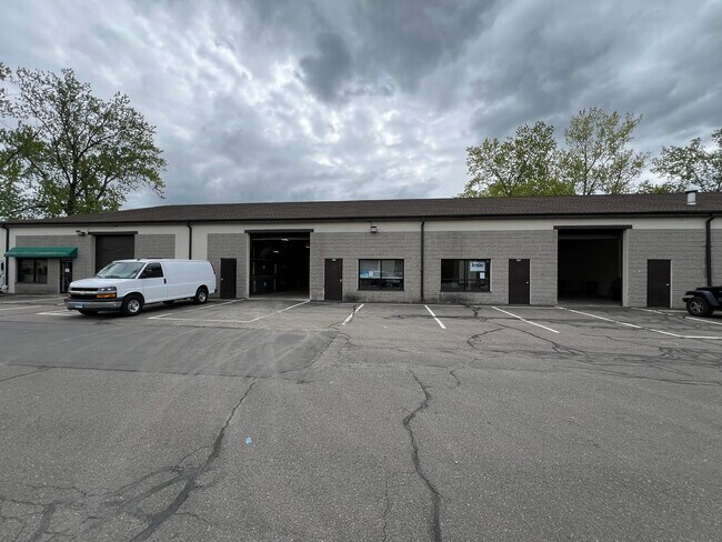
Property Record
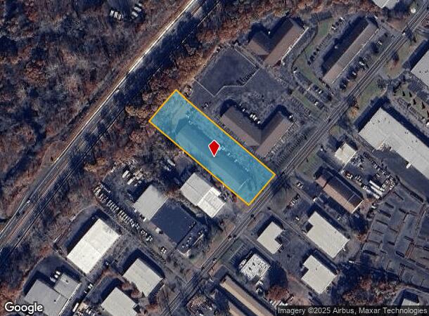
47 N Plains Industrial Rd, Wallingford, CT 06492

NEARBY LISTINGS FOR SALE OR LEASE
Property Detail
47 N Plains Industrial Rd
WALL-000050-000000-000013
New Haven
Warehouse
Connecticut
X
13
09009C0302J
2.11 AC
2025
Wallingford
2025
Westchester/So Connecticut
175400
New Haven-Milford, CT
26,025 SF
DEMOGRAPHICS near 47 N Plains Industrial Rd
1 Mile
3 Mile
5 Mile
2024 Total Population
2,566
47,446
116,475
2029 Population
2,552
47,188
116,101
Pop Growth 2024-2029
(0.55%)
(0.54%)
(0.32%)
Average Age
43
43
42
2024 Total Households
1,156
19,360
46,080
HH Growth 2024-2029
(0.61%)
(0.65%)
(0.39%)
Median Household Inc
$82,079
$84,757
$78,500
Avg Household Size
2.20
2.30
2.40
2024 Avg HH Vehicles
2.00
2.00
2.00
Median Home Value
$260,571
$259,219
$263,321
Median Year Built
1963
1968
1964
Nearby Places
Map Layers
Map Styles
 Street
 Aerial
- Restaurants
- Banks
- Shops
- Fitness
- Groceries
PUBLIC TRANSPORTATION
COMMUTER RAIL
DRIVE
WALK
Distance
5 min
2.2 mi
DRIVE
WALK
Distance
5 min
2.5 mi
AIRPORT
Tweed/New Haven
DRIVE
WALK
Distance
Tweed/New Haven
30 min
18.1 mi
Bradley International
DRIVE
WALK
Distance
Bradley International
62 min
40.7 mi
Freight Ports
Port of New Haven
DRIVE
WALK
Distance
Port of New Haven
26 min
15.8 mi
SALE & LEASE HISTORY
LISTING DATE
SALE/LEASE

Sep 25, 2016
For Lease
May 14, 2024
For Lease
Mar 15, 2019
For Lease
Nearby Properties
Address
Land Use
TOTAL SIZE
Lot Size
Zoning
Address
Land Use
TOTAL SIZE
Lot Size
Zoning
63,356 SF
154.26 AC
RM40
Address
Land Use
TOTAL SIZE
Lot Size
Zoning
41.91 AC
RU40
Address
Land Use
TOTAL SIZE
Lot Size
Zoning
32.85 AC
RU40
Address
Land Use
TOTAL SIZE
Lot Size
Zoning
276,631 SF
27.60 AC
R-1
Address
Land Use
TOTAL SIZE
Lot Size
Zoning
105,252 SF
9.13 AC
I40
Address
Land Use
TOTAL SIZE
Lot Size
Zoning
85.08 AC
I40
Address
Land Use
TOTAL SIZE
Lot Size
Zoning
44.46 AC
R18
Address
Land Use
TOTAL SIZE
Lot Size
Zoning
329,296 SF
35.55 AC
IX
Address
Land Use
TOTAL SIZE
Lot Size
Zoning
291,405 SF
104.81 AC
WI
Address
Land Use
TOTAL SIZE
Lot Size
Zoning
119,598 SF
18.43 AC
RF40
Address
Land Use
TOTAL SIZE
Lot Size
Zoning
23,920 SF
137.43 AC
R18
Address
Land Use
TOTAL SIZE
Lot Size
Zoning
11.02 AC
S-R
Address
Land Use
TOTAL SIZE
Lot Size
Zoning
172,027 SF
18.04 AC
RF40
Address
Land Use
TOTAL SIZE
Lot Size
Zoning
72,256 SF
R18
Address
Land Use
TOTAL SIZE
Lot Size
Zoning
13.42 AC
RM6
Address
Land Use
TOTAL SIZE
Lot Size
Zoning
3,952 SF
21.76 AC
R-1
Address
Land Use
TOTAL SIZE
Lot Size
Zoning
26.45 AC
RF40
Address
Land Use
TOTAL SIZE
Lot Size
Zoning
153,180 SF
3.07 AC
TODH
Address
Land Use
TOTAL SIZE
Lot Size
Zoning
187,914 SF
16.13 AC
IX
Address
Land Use
TOTAL SIZE
Lot Size
Zoning
1.67 AC
TODP
Address
Land Use
TOTAL SIZE
Lot Size
Zoning
38,735 SF
Address
Land Use
TOTAL SIZE
Lot Size
Zoning
123,730 SF
40.31 AC
R18
Address
Land Use
TOTAL SIZE
Lot Size
Zoning
203,692 SF
21.22 AC
IX
Address
Land Use
TOTAL SIZE
Lot Size
Zoning
22,284 SF
128.20 AC
RU40
Address
Land Use
TOTAL SIZE
Lot Size
Zoning
18.70 AC
RF40
Address
Land Use
TOTAL SIZE
Lot Size
Zoning
12 AC
RU40
Address
Land Use
TOTAL SIZE
Lot Size
Zoning
8,984 SF
22.75 AC
RM11
Address
Land Use
TOTAL SIZE
Lot Size
Zoning
9.75 AC
RF40
Address
Land Use
TOTAL SIZE
Lot Size
Zoning
598.20 AC
R-R
Address
Land Use
TOTAL SIZE
Lot Size
Zoning
12.36 AC
I40
The World's #1 Commercial Real Estate Marketplace
Connect with us
© 2025 CoStar Group
The information above has been obtained from sources believed reliable. While we do not doubt its accuracy we have not verified it and make no guarantee, warranty or representation about it. It is your responsibility to independently confirm its accuracy and completeness. Any projections, opinions, assumptions, or estimates used are for example only and do not represent the current or future performance of the property. The value of this transaction to you depends on tax and other factors which should be evaluated by your tax, financial, and legal advisors. You and your advisors should conduct a careful, independent investigation of the property to determine to your satisfaction the suitability of the property for your needs.