Property Record
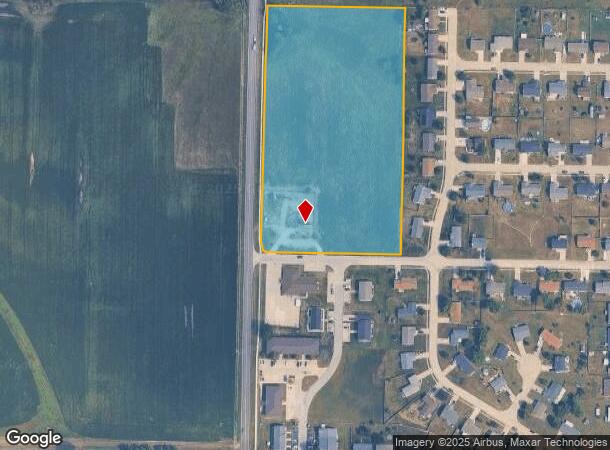
47 N State Highway U Dr, Warrenton, MO 63383


This Property Is For Sale
NEARBY LISTINGS FOR SALE OR LEASE
Property Detail
47 N State Highway U Dr
05-09.0-1-00-006.000.000
LAND & BUILDING PT SE 1/4 NE 1/4
Warehouse
Warren
X
Missouri
29219C0132D
7.42 AC
2024
Warren County
2024
St. Louis
820106
St. Louis, MO-IL
1,350 SF
DEMOGRAPHICS near 47 N State Highway U Dr
1 Mile
3 Mile
5 Mile
2024 Total Population
2,085
8,500
17,689
2029 Population
2,488
10,252
21,253
Pop Growth 2024-2029
+ 19.33%
+ 20.61%
+ 20.15%
Average Age
35
39
40
2024 Total Households
717
3,267
6,737
HH Growth 2024-2029
+ 18.97%
+ 20.29%
+ 19.76%
Median Household Inc
$67,557
$51,058
$62,423
Avg Household Size
2.80
2.60
2.60
2024 Avg HH Vehicles
2.00
2.00
2.00
Median Home Value
$163,985
$179,761
$180,245
Median Year Built
2003
2000
1999
Nearby Places
Map Layers
Map Styles
 Street
 Aerial
- Restaurants
- Banks
- Shops
- Fitness
- Groceries
Nearby Properties
Address
Land Use
TOTAL SIZE
Lot Size
Zoning
Address
Land Use
TOTAL SIZE
Lot Size
Zoning
16,575 SF
3.70 AC
Address
Land Use
TOTAL SIZE
Lot Size
Zoning
251,900 SF
35.75 AC
Address
Land Use
TOTAL SIZE
Lot Size
Zoning
22,696 SF
4.48 AC
Address
Land Use
TOTAL SIZE
Lot Size
Zoning
157,734 SF
14.80 AC
Address
Land Use
TOTAL SIZE
Lot Size
Zoning
9,828 SF
18.16 AC
Address
Land Use
TOTAL SIZE
Lot Size
Zoning
4,320 SF
11.34 AC
Address
Land Use
TOTAL SIZE
Lot Size
Zoning
2,880 SF
17.91 AC
Address
Land Use
TOTAL SIZE
Lot Size
Zoning
39,125 SF
5.19 AC
Address
Land Use
TOTAL SIZE
Lot Size
Zoning
35,919 SF
1.87 AC
Address
Land Use
TOTAL SIZE
Lot Size
Zoning
37,722 SF
6.22 AC
Address
Land Use
TOTAL SIZE
Lot Size
Zoning
113,525 SF
24.82 AC
Address
Land Use
TOTAL SIZE
Lot Size
Zoning
28,500 SF
9.45 AC
Address
Land Use
TOTAL SIZE
Lot Size
Zoning
10,530 SF
6 AC
Address
Land Use
TOTAL SIZE
Lot Size
Zoning
18,240 SF
0.91 AC
Address
Land Use
TOTAL SIZE
Lot Size
Zoning
2,880 SF
4.61 AC
Address
Land Use
TOTAL SIZE
Lot Size
Zoning
7,033 SF
1.56 AC
Address
Land Use
TOTAL SIZE
Lot Size
Zoning
3,458 SF
2.45 AC
Address
Land Use
TOTAL SIZE
Lot Size
Zoning
3.28 AC
Address
Land Use
TOTAL SIZE
Lot Size
Zoning
4,464 SF
2.79 AC
Address
Land Use
TOTAL SIZE
Lot Size
Zoning
29,662 SF
2.22 AC
Address
Land Use
TOTAL SIZE
Lot Size
Zoning
14,987 SF
1.57 AC
Address
Land Use
TOTAL SIZE
Lot Size
Zoning
400 SF
3.54 AC
Address
Land Use
TOTAL SIZE
Lot Size
Zoning
29,558 SF
3.57 AC
Address
Land Use
TOTAL SIZE
Lot Size
Zoning
16,200 SF
2.38 AC
Address
Land Use
TOTAL SIZE
Lot Size
Zoning
60,000 SF
3.33 AC
Address
Land Use
TOTAL SIZE
Lot Size
Zoning
7,284 SF
2.53 AC
Address
Land Use
TOTAL SIZE
Lot Size
Zoning
13,200 SF
5.16 AC
Address
Land Use
TOTAL SIZE
Lot Size
Zoning
5,928 SF
0.64 AC
Address
Land Use
TOTAL SIZE
Lot Size
Zoning
5,032 SF
2.91 AC
Address
Land Use
TOTAL SIZE
Lot Size
Zoning
25,860 SF
5 AC
The World's #1 Commercial Real Estate Marketplace
Connect with us
© 2026 CoStar Group
The information above has been obtained from sources believed reliable. While we do not doubt its accuracy we have not verified it and make no guarantee, warranty or representation about it. It is your responsibility to independently confirm its accuracy and completeness. Any projections, opinions, assumptions, or estimates used are for example only and do not represent the current or future performance of the property. The value of this transaction to you depends on tax and other factors which should be evaluated by your tax, financial, and legal advisors. You and your advisors should conduct a careful, independent investigation of the property to determine to your satisfaction the suitability of the property for your needs.