Property Record
47 Rockingham Rd, Windham, NH 03087


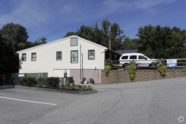
Property Detail
47 Rockingham Rd
WNDM-000013-D000000-000090
ROCKINGHAM
Departmentstore
New Hampshire
CDA
90
C and X Area of minimal flood hazard, usually depicted on FIRMs as above the 500-year flood level.
3.10 AC
2025
Rockingham
2025
Boston
106101
Boston-Cambridge-Newton, MA-NH
3,420 SF
NEARBY LISTINGS FOR SALE OR LEASE
DEMOGRAPHICS near 47 Rockingham Rd
1 mile
3 mile
5 mile
2025 Total Population
1,522
23,264
59,764
2030 Population
1,546
23,683
60,501
Pop Growth 2025-2030
+ 1.58%
+ 1.80%
+ 1.23%
Average Age
42
44
44
2025 Total Households
511
8,611
22,379
HH Growth 2025-2030
+ 1.57%
+ 1.79%
+ 1.25%
Median Household Inc
$168,258
$130,777
$126,917
Avg Household Size
2.90
2.60
2.60
2025 Avg HH Vehicles
2.00
2.00
2.00
Median Home Value
$742,553
$609,409
$565,987
Median Year Built
1994
1981
1982
Nearby Places
Map Layers
Map Styles
 Street
 Aerial
Layers
 Traffic
 Biking
Places
Listings with unknown addresses are not visible on the map
- Restaurants
- Banks
- Shops
- Fitness
- Groceries
PUBLIC TRANSPORTATION
AIRPORT
Manchester Boston Regional
Drive
Walk
Distance
Manchester Boston Regional
31 min
17.6 mi
General Edward Lawrence Logan International
Drive
Walk
Distance
General Edward Lawrence Logan International
51 min
37.8 mi
Portsmouth International at Pease
Drive
Walk
Distance
Portsmouth International at Pease
60 min
40.3 mi
Freight Ports
Port of Boston
Drive
Walk
Distance
Port of Boston
52 min
37.5 mi
Nearby Properties
Address
Land Use
TOTAL SIZE
Lot Size
Zoning
Address
Land Use
TOTAL SIZE
Lot Size
Zoning
Address
Land Use
TOTAL SIZE
Lot Size
Zoning
137,886 SF
26.65 AC
CIC
Address
Land Use
TOTAL SIZE
Lot Size
Zoning
75.16 AC
CIB
Address
Land Use
TOTAL SIZE
Lot Size
Zoning
72.18 AC
CIB
Address
Land Use
TOTAL SIZE
Lot Size
Zoning
7.99 AC
CIB
Address
Land Use
TOTAL SIZE
Lot Size
Zoning
215,338 SF
66.52 AC
CIB
Address
Land Use
TOTAL SIZE
Lot Size
Zoning
13,158 SF
52.40 AC
VCD
Address
Land Use
TOTAL SIZE
Lot Size
Zoning
71,854 SF
26 AC
RD
Address
Land Use
TOTAL SIZE
Lot Size
Zoning
21,433 SF
7.54 AC
LID
Address
Land Use
TOTAL SIZE
Lot Size
Zoning
113,388 SF
16.28 AC
CIB
Address
Land Use
TOTAL SIZE
Lot Size
Zoning
21.88 AC
CIC
Address
Land Use
TOTAL SIZE
Lot Size
Zoning
63,628 SF
34.21 AC
CDA
Address
Land Use
TOTAL SIZE
Lot Size
Zoning
Address
Land Use
TOTAL SIZE
Lot Size
Zoning
58,449 SF
41.20 AC
RD
Address
Land Use
TOTAL SIZE
Lot Size
Zoning
155,040 SF
16.36 AC
IND
Address
Land Use
TOTAL SIZE
Lot Size
Zoning
59,626 SF
7.40 AC
VCD
Address
Land Use
TOTAL SIZE
Lot Size
Zoning
20,784 SF
15 AC
PBT
Address
Land Use
TOTAL SIZE
Lot Size
Zoning
55,980 SF
2.08 AC
TCD
Address
Land Use
TOTAL SIZE
Lot Size
Zoning
46,991 SF
5.68 AC
CIB
Address
Land Use
TOTAL SIZE
Lot Size
Zoning
46,389 SF
8.06 AC
B1
Address
Land Use
TOTAL SIZE
Lot Size
Zoning
3.90 AC
CA
Address
Land Use
TOTAL SIZE
Lot Size
Zoning
72,868 SF
6.58 AC
IND
Address
Land Use
TOTAL SIZE
Lot Size
Zoning
68,175 SF
6.54 AC
CIC
Address
Land Use
TOTAL SIZE
Lot Size
Zoning
13,673 SF
11.76 AC
CDA
Address
Land Use
TOTAL SIZE
Lot Size
Zoning
64,896 SF
11.68 AC
IND
Address
Land Use
TOTAL SIZE
Lot Size
Zoning
11,412 SF
4.21 AC
CDA
Address
Land Use
TOTAL SIZE
Lot Size
Zoning
99,833 SF
15.26 AC
IND
Address
Land Use
TOTAL SIZE
Lot Size
Zoning
8.24 AC
CIB
Address
Land Use
TOTAL SIZE
Lot Size
Zoning
3,556 SF
7.45 AC
RD
Address
Land Use
TOTAL SIZE
Lot Size
Zoning
56,632 SF
14.20 AC
RUR
The World's #1 Commercial Real Estate Marketplace
Connect with us
© 2026 CoStar Group
The information above has been obtained from sources believed reliable. While we do not doubt its accuracy we have not verified it and make no guarantee, warranty or representation about it. It is your responsibility to independently confirm its accuracy and completeness. Any projections, opinions, assumptions, or estimates used are for example only and do not represent the current or future performance of the property. The value of this transaction to you depends on tax and other factors which should be evaluated by your tax, financial, and legal advisors. You and your advisors should conduct a careful, independent investigation of the property to determine to your satisfaction the suitability of the property for your needs.